Maps of Nova Scotia
Various Regions and Cities in and around Maine including Canadian Maritime Provinces.
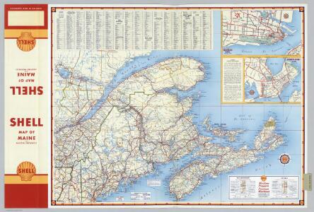
Shell Oil Company
Shell Maritime Provinces.
1 : 2090880 Shell Oil Company
129. Maine, Nova Scotia, New Brunswick, Quebec.
1 : 3000000 Touring club italiano
Map, showing the commercial position of Portland
Map, showing the commercial position of Portland ... and its connection by lines of steamboat and railway with Europe, the British Provinces and the United States. Drawn and engraved for the State of Maine Newspaper. A.C. Morton, Engineer. (Map, showing the Plan for shortening the Transit between New York and London.) J.B. Cummings.
Nova Scotia, Cape Britain.
1 : 1900000 Jefferys, Thomas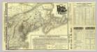
Map Boston & Maine Railroad.
1 : 2192000 Boston and Maine Railroad
Map Boston & Maine Railroad.
1 : 2471040 Boston and Maine Railroad
Lower Canada.
1 : 2200000 Arrowsmith, John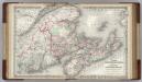
Canada. New Brunswick, Nova Scotia and Prince Edward island.
1 : 1500000 Colton, G.W.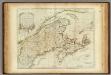
A New Map of Nova Scotia, and Cape Breton Island.
1 : 1900000 Jefferys, Thomas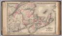
New Brunswick, Nova Scotia, Prince Edward Island, and Cape Breton Inland.
1 : 1500000 Colton, G.W.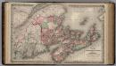
Dominion of Canada. Provinces of New Brunswick & Nova Scotia and Prince Edward Island.
1 : 1550000 Colton, G.W.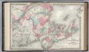
New Brunswick, Nova Scotia. Prince Edward Island. and Cape Breton Inland.
1 : 1500000 Colton, G.W.
Canada, New Brunswick, Nova Scotia, &c., East Sheet.
1 : 2370000 Black, Adam & Charles
Lower Canada ... and a large portion of the United States.
1 : 2154240 Arrowsmith, John
New Map of Nova Scotia, New Brunswick and Cape Breton.
1 : 4200000 Morse, Jedidiah
The district of Main : from the latest surveys
1 : 2900000 Carleton, Osgood, 1742-1816
The district of Main : from the latest surveys
1 : 2800000 Carleton, Osgood, 1742-1816 by Isaiah Thomas and Ebenezer T. Andrews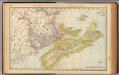
New Brunswick, Nova Scotia, and Prince Edward Island.
1 : 1730000 Rand McNally and Company
A map of the district of Maine : drawn from the latest surveys and other best authorities
1 : 1170000 Carleton, Osgood, 1742-1816 Thomas & Andrews
County map of Nova Scotia, New Brunswick, Cape Breton Id., and Pr. Edward's Id.
1 : 3000000 Mitchell, Samuel Augustus Jr.
State Of Maine With The Province Of New Brunswick.
1 : 570240 Greenleaf, Moses, 1777-1834
Maine
1 : 1020000 Sotzmann, D. F Bey Carl Ernst Bohn
Nova Scotia, New Brunswick, Pr. Edward's Id.
1 : 2900000 Mitchell, Samuel Augustus
Nova Scotia, New Brunswick, Pr. Edward's Id.
1 : 2900000 Mitchell, Samuel Augustus
Nova Scotia, New Brunswick, Pr. Edward's Id.
1 : 2900000 Mitchell, Samuel Augustus Jr.
Nova Scotia, New Brunswick, Pr. Edward's Id.
1 : 2900000 Mitchell, Samuel Augustus
Nova Scotia, New Brunswick, P.E.I.
1 : 3000000 Mitchell, Samuel Augustus
County Map Of Nova Scotia New Brunswick Cape Breton Id. And Pr. Edward's Id.
1 : 2950000 Mitchell, Samuel Augustus