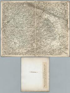
Maps of Hövelhof

332. Gutersloh.
1 : 100000 Reichsamt fur Landesaufnahme
Composite: 332. Gutersloh.
1 : 100000 Reichsamt fur Landesaufnahme
Meßtischblatt 2293 : Senne, 1897
1 : 250000 Senne. - Aufn. 1895. - 1:25000. - [Berlin]: Reichsamt für Landesaufnahme, 1897. - 1 Kt.
Meßtischblatt 2292 : Verl, 1932
1 : 250000 Verl. - Aufn. 1895, hrsg. 1897, bericht. 1912, einz. Nachtr. 1932. - 1:25000. - [Berlin]: Reichsamt für Landesaufnahme, 1932. - 1 Kt.
Meßtischblatt 2292 : Verl, 1897
1 : 250000 Verl. - Aufn. 1895. - 1:25000. - [Berlin]: Reichsamt für Landesaufnahme, 1897. - 1 Kt.
Meßtischblatt 2220 : Lage, 1937
1 : 250000 Lage. - Hrsg. 1912, einz. Nachtr. 1921, gedr. [19]37. - 1:25000. - [Berlin]: Reichsamt für Landesaufnahme, 1937. - 1 Kt.
Meßtischblatt 2219, neue Nr. 4017 : Brackwede, 1937
1 : 250000 Brackwede. - Hrsg. 1897, bericht. 1912, einz. Nachtr. 1932. - 1:25000. - [Berlin]: Reichsamt für Landesaufnahme, 1937. - 1 Kt.
Meßtischblatt 4116 : Rietberg, 1939
1 : 250000 Rietberg. - Hrsg. 1897, bericht. 1912, einz. Nachtr. 1932. - 1:25000. - [Berlin]: Reichsamt für Landesaufnahme, 1939. - 1 Kt.
Meßtischblatt 2291 : Rietberg, 1932
1 : 250000 Rietberg. - Hrsg. 1897, bericht. 1912, einz. Nachtr. 1932. - 1:25000. - [Berlin]: Reichsamt für Landesaufnahme, 1932. - 1 Kt.
Meßtischblatt 2291 : Rietberg, 1897
1 : 250000 Rietberg. - Aufn. 1895. - 1:25000. - [Berlin]: Reichsamt für Landesaufnahme, 1897. - 1 Kt.
Meßtischblatt 4016 : Gütersloh, 1948
1 : 250000 Gütersloh. - Aufn. 1895, hrsg. 1899, bericht. 1912, letzte Nachtr. 1941. - 1:25000. - [Berlin]: Reichsamt für Landesaufnahme, 1948. - 1 Kt.
Meßtischblatt 2367 : Paderborn, 1936
1 : 250000 Paderborn. - Hrsg. 1896, bericht. 1922, einz. Nachtr. 1936. - 1:25000. - [Berlin]: Reichsamt für Landesaufnahme, 1936. - 1 Kt.
Meßtischblatt 2367 : Paderborn, 1913
1 : 250000 Paderborn. - Aufn. 1894, hrsg. 1896, Aufl.-dr. 1913. - 1:25000. - [Berlin]: Reichsamt für Landesaufnahme, 1913. - 1 Kt.
Meßtischblatt 2367 : Paderborn, 1907
1 : 250000 Paderborn. - Aufn. 1894, hrsg. 1896, einz. Nachtr. 1907. - 1:25000. - [Berlin]: Reichsamt für Landesaufnahme, 1907. - 1 Kt.
Meßtischblatt 2367 : Paderborn, 1896
1 : 250000 Paderborn. - Aufn. 1894. - 1:25000. - [Berlin]: Reichsamt für Landesaufnahme, 1896. - 1 Kt.
Meßtischblatt 2366 : Delbrück, 1932
1 : 250000 Delbrück. - Hrsg. 1897, bericht. 1912, einz. Nachtr. 1932. - 1:25000. - [Berlin]: Reichsamt für Landesaufnahme, 1932. - 1 Kt.
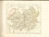
98. Detmold, uit: Topographische Uebersichtskarte des Deutschen Reiches / herausgegeben v. d. Kartogr. Abt. d. Königl. Preuß. Landesaufnahme
1 : 200000 titelvariant: Topogr. Übersichtskarte des Deutschen Reiches; Annotatie: Titel boven bladen ook: Topogr. Übersichtskarte des Deutschen Reiches; Annotatie geografische gegevens: Op elk blad twee maatstokken: 10 Kilometer = 5,5 cm; 1 geogr. Meile = 3,6 cm; Legenda onder op elk blad Königlich Preußische Landesaufnahme. Kartographische Abtheilung [S.l : Königlich Preußische Landesaufnahme, Kartographische Abtheilung]
Tableau Topographique Qui comprend la Partie Septentrionale du Landgraviat de Hesse Cassel et de la Principauté de Waldeck, l'Eveché de Paderborn, Partie du Comté de Grubenhague et les Frontieres de ces Etats]
1 : 130000 Mollova mapová sbírka Julien, Roch-Joseph Julien, Roch Joseph
Meßtischblatt 4216 : Mastholte, 1945
1 : 250000 Mastholte. - Ausgabe Nr. 2, Stand 1937/38, gedr. 1945. - 1:25000. - [Berlin]: Reichsamt für Landesaufnahme, 1945. - 1 Kt.
Episcopatvs Paderbornensis descriptio nova
1 : 230000 Mollova mapová sbírka Gigas, Johann Michael Schenk, Peter I
Paderbornensis Episcopatus Descriptio Nova
1 : 220000 Mollova mapová sbírka Gigas, Johann Michael Blaeu, Willem Jansz.
Paderbornensis Episcopatus Descriptio Nova
1 : 220000 Mollova mapová sbírka Gigas, Johann Michael
Paderbornensis Episcopatus Descriptio Nova
1 : 220000 Mollova mapová sbírka Gigas, Johann Michael
PADERBORNENSIS | Episcopatus | DESCRIPTIO NOVA
Ioanne Gigante Ludense D. Med. et Math. auth. Amstelodami Judocus Hondius excudit
Episcopatvs Paderborn nec non Abbatiae Corvei Territorium seculare
1 : 190000 Mollova mapová sbírka Gigas, Johann Michael Homann, Johann Baptista - dědici
Paderbornensis Episcopatus Descriptio Nova [Karte], in: Le théâtre du monde, ou, Nouvel atlas contenant les chartes et descriptions de tous les païs de la terre, Bd. 1, S. 169.
1 Karte aus Atlas Blaeu, Willem Janszoon und Blaeu, Joan Blaeu, Willem Janszoon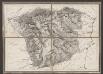
Episcopatus Paderbornensis descriptio nova [Karte], in: Gerardi Mercatoris et I. Hondii Newer Atlas, oder, Grosses Weltbuch, Bd. 1, S. 167.
1 Karte aus Atlas Mercator, Gerhard und Hondius, Jodocus Jansson, Jan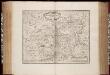
Episcopatus Paderbornensis descriptio nova / Iohanne Gigante Ludense ; [Henricus Hondius]
1 : 225000 Annotatie: Het eerst verschenen in: Novus Atlas ... Ersten Theils, Ander Stück. - Amstelodami : apud Ioannem Ianssonium, 1644; 1e staat: Amstelodami : Henricus Hondius, [1630]; Origineel is Blad 75 in atlas factice Gigas, Joannes (1580-1650); Hondius, Henricus Amstelodami : Joannes Janssonius excudit