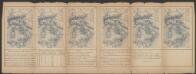
Maps of Samtgemeinde Schüttorf

Composite: 281. Bentheim.
1 : 100000 Reichsamt fur Landesaufnahme
281. Bentheim.
1 : 100000 Reichsamt fur Landesaufnahme
29 Denekamp, uit: Topographische en militaire kaart van het Koningrijk der Nederlanden / vervaardigd door de officieren van den Generale Staf ; en gegraveerd op het Topographisch Bureau, van het Ministerie van Oorlog
1 : 50000 titelvariant: TMK; Annotatie: Met bladwijzer op schaal 1:600.000. - 1915; Met Verklaring van de topographische en militaire kaart van het Koninkrijk der Nederlanden. - 1910; Bd. 1: titelblad, bladwijzer, verklaring, bladen 1 t/m 32; Bd. 2: bladen 33 t/m 62 Generale Staf, Nederland; Ministerie van Oorlog. Topographisch Bureau ['s-Gravenhage : Ministerie van Oorlog]
[Kaart], uit: Wandelkaart voor Oldenzaal en De Lutte / W.H. Dingeldein
1 : 25000 titelvariant: Wandel-, rijwiel- en autokaart van Oldenzaal, De Lutte en omstreken; Annotatie: Omslagtitel: Wandel-, rijwiel- en autokaart van Oldenzaal, De Lutte en omstreken Dingeldein, W. H. [Oldenzaal : Vereeniging tot Bevordering van het Vreemdelingenverkeer voor Oldenzaal en Omstreken]
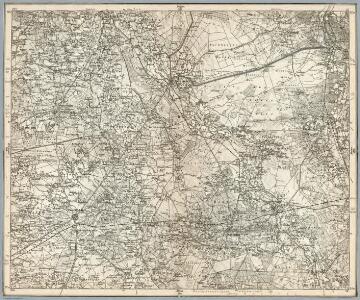
Meßtischblatt 1938 : Bentheim, 1908
1 : 250000 Bentheim. - Aufn. 1895, hrsg. 1897, einz. Nachtr. 1908. - 1:25000. - [Berlin]: Reichsamt für Landesaufnahme, 1908. - 1 Kt.
Meßtischblatt 1870 : Nordhorn, 1897
1 : 250000 Nordhorn. - Aufn. 1895. - 1:25000. - [Berlin]: Reichsamt für Landesaufnahme, 1897. - 1 Kt.
Meßtischblatt 1939 : Schüttorf, 1925
1 : 250000 Schüttorf. - Aufn. 1895, Nachtr. 1925. - 1:25000. - [Berlin]: Reichsamt für Landesaufnahme, 1925. - 1 Kt.
Meßtischblatt 1871 : Lohne, 1897
1 : 250000 Lohne. - Aufn. 1895. - 1:25000. - [Berlin]: Reichsamt für Landesaufnahme, 1897. - 1 Kt.
Meßtischblatt 1869 : Neuenhaus, 1897
1 : 250000 Neuenhaus. - Aufn. 1895. - 1:25000. - [Berlin]: Reichsamt für Landesaufnahme, 1897. - 1 Kt.
OLDENZALIA | Vt erat cum caperetur et munitiones ejus de | struentur ab Ordinibus Belgicæ Foederatæ | Anno 1626
[Amsterdam : Joan Blaeu]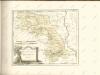

Germany 25.000, Gronau
Sheet 3708 from the map series: Germany 1 : 25,000. AMS M 841. (GSGS. 4414). [Washington, D.C.] : Army Map Service
Germany 1:25,000, Gronau
Germany 1:25,000 , Series GSGS 4414. Great Britain. War Office. [London] : War Office
Meßtischblatt 2005 : Gronau in Westfalen, 1925
1 : 250000 Gronau in Westfalen. - Aufn. 1895, einz. Nachtr. 1925. - 1:25000. - [Berlin]: Reichsamt für Landesaufnahme, 1925. - 1 Kt.
Meßtischblatt 2005 : Gronau in Westfalen, 1897
1 : 250000 Gronau in Westfalen. - Aufn. 1895. - 1:25000. - [Berlin]: Reichsamt für Landesaufnahme, 1897. - 1 Kt.
Germany 1:25,000, Ochtrup
Germany 1:25,000 , Series GSGS 4414. Great Britain. War Office. [London] : War Office
Meßtischblatt 2006 : Ochtrup, 1934
1 : 250000 Ochtrup. - Hrsg. 1897, einz. Nachtr. 1925, gedr. [19]34. - 1:25000. - [Berlin]: Reichsamt für Landesaufnahme, 1934. - 1 Kt.
Meßtischblatt 2006 : Ochtrup, 1897
1 : 250000 Ochtrup. - Aufn. 1895. - 1:25000. - [Berlin]: Reichsamt für Landesaufnahme, 1897. - 1 Kt.
Germany 1:25,000, Enschede
Germany 1:25,000 , Series GSGS 4414. Great Britain. War Office. [London] : War Office
Meßtischblatt 3707 : Glanerbrücke, 1949
1 : 250000 Glanerbrücke. - Aufn. 1895, hrsg. 1896, bericht. 1939. - 1:25000. - [Berlin]: Reichsamt für Landesaufnahme, 1949. - 1 Kt.
Meßtischblatt 2004 : Glanerbrücke, 1896
1 : 250000 Glanerbrücke. - Aufn. 1895. - 1:25000. - [Berlin]: Reichsamt für Landesaufnahme, 1896. - 1 Kt.
83. Bentheim, uit: Topographische Uebersichtskarte des Deutschen Reiches / herausgegeben v. d. Kartogr. Abt. d. Königl. Preuß. Landesaufnahme
1 : 200000 titelvariant: Topogr. Übersichtskarte des Deutschen Reiches; Annotatie: Titel boven bladen ook: Topogr. Übersichtskarte des Deutschen Reiches; Annotatie geografische gegevens: Op elk blad twee maatstokken: 10 Kilometer = 5,5 cm; 1 geogr. Meile = 3,6 cm; Legenda onder op elk blad Königlich Preußische Landesaufnahme. Kartographische Abtheilung [S.l : Königlich Preußische Landesaufnahme, Kartographische Abtheilung]

COMITATVS | BENTHEIM, | et | STEINFVRT.
Auctore | Ioanne Westenberg | M. Doct. et Math. Guljelm. Blaeu excudebat
Comitatvs Bentheim, et Steinfvrt
1 : 160000 Mollova mapová sbírka Westenberg, Joann Schenk, Peter I
Comitatus Bentheimensis
1 : 160000 Mollova mapová sbírka Westenberg, Joann Schenk, Peter I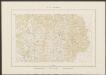
Comitatus Bentheim, et Steinfurt. [Karte], in: Theatrum orbis terrarum, sive, Atlas novus, Bd. 1, S. 212.
1 Karte aus Atlas Blaeu, Joan Blaeu, Willem Janszoon
Comitatus Bentheim, et Steinfurt. [Karte], in: Novus Atlas, das ist, Weltbeschreibung, Bd. 1, S. 132.
1 Karte aus Atlas Blaeu, Joan Blaeu, Willem Janszoon
Comitatus Bentheim, et Steinfurt. [Karte], in: Novus atlas absolutissimus, Bd. 2, S. 121.
1 Karte aus Atlas Janssonius Offizin