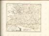
Maps of powiat chodzieski

251. Wongrowitz.
1 : 100000 Reichsamt fur Landesaufnahme
Composite: 251. Wongrowitz.
1 : 100000 Reichsamt fur Landesaufnahme
Meßtischblatt 1645 : Zelitz, 1890
1 : 250000 Zelitz. - Aufn. 1888. - 1:25000. - [Berlin]: Reichsamt für Landesaufnahme, 1890. - 1 Kt.
Meßtischblatt 3167 : Budsin, 1936
1 : 250000 Budsin. - Letzte Nachtr. 1934/35. - 1:25000. - [Berlin]: Reichsamt für Landesaufnahme, 1936. - 1 Kt.
Meßtischblatt 3169 : Wongrowitz, 1911
1 : 250000 Wongrowitz. - Aufn. 1888, hrsg. 1890, bericht. 1911. - 1:25000. - [Berlin]: Reichsamt für Landesaufnahme, 1911. - 1 Kt.
Meßtischblatt 3068 : Margonin, 1940
1 : 250000 Margonin. - Ausg. m. dt. Namen, Ausg. 1940 m. vorläuf. Namen. - 1:25000. - [Berlin]: Reichsamt für Landesaufnahme, 1940. - 1 Kt.
Meßtischblatt 1574 : Margonin, 1889
1 : 250000 Margonin. - Aufn. 1888. - 1:25000. - [Berlin]: Reichsamt für Landesaufnahme, 1889. - 1 Kt.
Meßtischblatt 3067 : Kolmar in Posen, 1940
1 : 250000 Kolmar in Posen. - Ausg. m. dt. Namen, Ausg. 1940 m. vorläuf. Namen. - 1:25000. - [Berlin]: Reichsamt für Landesaufnahme, 1940. - 1 Kt.
Meßtischblatt 3069 : Gollantsch, 1940
1 : 250000 Gollantsch. - Ausg. m. dt. Namen, Ausg. 1940 m. vorläuf. Namen. - 1:25000. - [Berlin]: Reichsamt für Landesaufnahme, 1940. - 1 Kt.
Meßtischblatt 3269 : Mietschisko, 1936
1 : 250000 Mietschisko. - Aufn. 1888, hrsg. 1890, bericht. 1911, letzte Nachtr. 1933. - 1:25000. - [Berlin]: Reichsamt für Landesaufnahme, 1936. - 1 Kt.
Meßtischblatt 3268 : Rogasen, 1936
1 : 250000 Rogasen. - Aufn. 1888, letzte Nachtr. 1933/35. - 1:25000. - [Berlin]: Reichsamt für Landesaufnahme, 1936. - 1 Kt.
Meßtischblatt 3267 : Bülowsthal, 1936
1 : 250000 Bülowsthal. - Aufn. 1888, letzte Nachtr. 1933/35. - 1:25000. - [Berlin]: Reichsamt für Landesaufnahme, 1936. - 1 Kt.
80. Czarnikan, uit: Topographische Uebersichtskarte des Deutschen Reiches / herausgegeben v. d. Kartogr. Abt. d. Königl. Preuß. Landesaufnahme
1 : 200000 titelvariant: Topogr. Übersichtskarte des Deutschen Reiches; Annotatie: Titel boven bladen ook: Topogr. Übersichtskarte des Deutschen Reiches; Annotatie geografische gegevens: Op elk blad twee maatstokken: 10 Kilometer = 5,5 cm; 1 geogr. Meile = 3,6 cm; Legenda onder op elk blad Königlich Preußische Landesaufnahme. Kartographische Abtheilung [S.l : Königlich Preußische Landesaufnahme, Kartographische Abtheilung]
Meßtischblatt 1647 : Stempuchowo, 1889
1 : 250000 Stempuchowo. - Aufn. 1888. - 1:25000. - [Berlin]: Reichsamt für Landesaufnahme, 1889. - 1 Kt.
Meßtischblatt 3070 : Exin, 1936
1 : 250000 Exin. - Aufn. 1888, hrsg. 1889, letzte Nachtr. 1934/35. - 1:25000. - [Berlin]: Reichsamt für Landesaufnahme, 1936. - 1 Kt.
Meßtischblatt 3270 : Janowitz, 1936
1 : 250000 Janowitz. - Aufn. 1888, letzte Nachtr. 1934/35. - 1:25000. - [Berlin]: Reichsamt für Landesaufnahme, 1936. - 1 Kt.
Composite: 252. Exin.
1 : 100000 Reichsamt fur Landesaufnahme
250. Czarnikau.
1 : 100000 Reichsamt fur Landesaufnahme
252. Exin.
1 : 100000 Reichsamt fur Landesaufnahme
Composite: 250. Czarnikau.
1 : 100000 Reichsamt fur Landesaufnahme
223. Wirsitz.
1 : 100000 Reichsamt fur Landesaufnahme
Composite: 276. Rogasen.
1 : 100000 Reichsamt fur Landesaufnahme
Meßtischblatt 3166 : Schrotthaus, 1936
1 : 250000 Schrotthaus. - Aufn. 1890, letzte Nachtr. 1934/35. - 1:25000. - [Berlin]: Reichsamt für Landesaufnahme, 1936. - 1 Kt.
Meßtischblatt 1572 : Gembitz, 1892
1 : 250000 Gembitz. - Aufn. 1890. - 1:25000. - [Berlin]: Reichsamt für Landesaufnahme, 1892. - 1 Kt.
Meßtischblatt 2967 : Morzewo, 1940
1 : 250000 Morzewo. - Aufn. 1876, hrsg. 1878. - 1:25000. - [Berlin]: Reichsamt für Landesaufnahme, 1940. - 1 Kt.
Meßtischblatt 2968 : Samotschin, 1940
1 : 250000 Samotschin. - Aufn. 1876, hrsg. 1878, letzte Nachtr. 1936. - 1:25000. - [Berlin]: Reichsamt für Landesaufnahme, 1940. - 1 Kt.
Meßtischblatt 1502 : Jaktorowo, 1913
1 : 250000 Jaktorowo. - Aufn. 1876, hrsg. 1878, Auflagedr. 1913. - 1:25000. - [Berlin]: Reichsamt für Landesaufnahme, 1913. - 1 Kt.
Meßtischblatt 1713 : Polajewo, 1892
1 : 250000 Polajewo. - Aufn. 1890. - 1:25000. - [Berlin]: Reichsamt für Landesaufnahme, 1892. - 1 Kt.
Meßtischblatt 2970 : Gromaden, 1940
1 : 250000 Gromaden. - Aufn. 1876, hrsg. 1878, letzte Nachtr. 1935. - 1:25000. - [Berlin]: Reichsamt für Landesaufnahme, 1940. - 1 Kt.