Maps of gmina Szydłowo

222. Schneidermuhl.
1 : 100000 Reichsamt fur Landesaufnahme
Composite: 222. Schneidermuhl.
1 : 100000 Reichsamt fur Landesaufnahme
Meßtischblatt 2965 : Radolin, 1940
1 : 250000 Radolin. - Aufn. 1935, hrsg. 1938. - 1:25000. - [Berlin]: Reichsamt für Landesaufnahme, 1940. - 1 Kt.
Meßtischblatt 1497 : Schönlanke, 1878
1 : 250000 Schönlanke. - Aufn. 1876. - 1:25000. - [Berlin]: Reichsamt für Landesaufnahme, 1878. - 1 Kt.
Meßtischblatt Usch
1 : 250000 Usch. - Aufn. 1876/1935, letzte Nachtr. 1935/36. - 1:25000. - [Berlin]: Reichsamt für Landesaufnahme, 1938. - 1 Kt.
Meßtischblatt 2865 : Gr. Wittenberg, 1940
1 : 250000 Gr. Wittenberg. - Aufn. 1935, vorläuf. Ausg. 1940. - 1:25000. - [Berlin]: Reichsamt für Landesaufnahme, 1940. - 1 Kt.
Meßtischblatt 2864 : Arnsfelde, 1944
1 : 250000 Arnsfelde. - Aufn. 1935. - 1:25000. - [Berlin]: Reichsamt für Landesaufnahme, 1944. - 1 Kt.
Meßtischblatt 2866 : Schneidemühl, 1940
1 : 250000 Schneidemühl. - Aufn. 1935, hrsg. 1940. - 1:25000. - [Berlin]: Reichsamt für Landesaufnahme, 1940. - 1 Kt.
Meßtischblatt 2764 : Deutsch Krone, 1937
1 : 250000 Deutsch Krone. - Aufn. 1928/34. - 1:25000. - [Berlin]: Reichsamt für Landesaufnahme, 1937. - 1 Kt.
Meßtischblatt 2765 : Breitenstein, 1878
1 : 250000 Breitenstein. - Aufn. 1876. - 1:25000. - [Berlin]: Reichsamt für Landesaufnahme, 1878. - 1 Kt.
Meßtischblatt 2766 : Lebehnke, 1938
1 : 250000 Lebehnke. - Aufn. 1935. - 1:25000. - [Berlin]: Reichsamt für Landesaufnahme, 1938. - 1 Kt.
Meßtischblatt 2867 : Schmilau, 1936
1 : 250000 Schmilau. - Aufn. 1935, letzte Nachtr. 1936. - 1:25000. - [Berlin]: Reichsamt für Landesaufnahme, 1936. - 1 Kt.
Meßtischblatt 2967 : Morzewo, 1940
1 : 250000 Morzewo. - Aufn. 1876, hrsg. 1878. - 1:25000. - [Berlin]: Reichsamt für Landesaufnahme, 1940. - 1 Kt.
Meßtischblatt 2767 : Krojanke, 1938
1 : 250000 Krojanke. - Aufn. 1928, letzte Nachtr. 1934, redakt. Änd. 1938. - 1:25000. - [Berlin]: Reichsamt für Landesaufnahme, 1938. - 1 Kt.
Der Arenswaldische Creis
1 : 290000 Sotzmann, Daniel Friedrich
Kreuz 49, uit: Special-Karte von Mittel-Europa / nach amtlichen Quellen bearbeitet von W. Liebenow
1 : 300000 titelvariant: W. Liebenow's Mittel-Europa; Annotatie: Titel boven de bladen: W. Liebenow's Mittel-Europa Johannes Wilhelm Liebenow 1822-1897 Frankfurt a. M. : Ludwig Ravenstein
Tempelburg 37, uit: Special-Karte von Mittel-Europa / nach amtlichen Quellen bearbeitet von W. Liebenow
1 : 300000 titelvariant: W. Liebenow's Mittel-Europa; Annotatie: Titel boven de bladen: W. Liebenow's Mittel-Europa Johannes Wilhelm Liebenow 1822-1897 Frankfurt a. M. : Ludwig Ravenstein
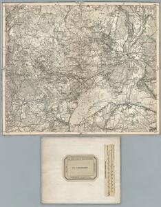
191. Deutsch-Krone. (Germany)
1 : 100000 Reichsamt fur Landesaufnahme
Composite: 191. Deutsch-Krone. (Germany)
1 : 100000 Reichsamt fur Landesaufnahme
Composite: 250. Czarnikau.
1 : 100000 Reichsamt fur Landesaufnahme
223. Wirsitz.
1 : 100000 Reichsamt fur Landesaufnahme
Meßtischblatt 2963 : Kl. Drensen, 1940
1 : 250000 Kl. Drensen. - Aufn. 1934. - 1:25000. - [Berlin]: Reichsamt für Landesaufnahme, 1940. - 1 Kt.
Meßtischblatt 2863 : Ruschendorf, 1937
1 : 250000 Ruschendorf. - Aufgen. 1933. - 1:25000. - [Berlin]: Reichsamt für Landesaufnahme, 1937. - 1 Kt.
Meßtischblatt 2763 : Marzdorf, 1878
1 : 250000 Marzdorf. - Aufn. 1876. - 1:25000. - [Berlin]: Reichsamt für Landesaufnahme, 1878. - 1 Kt.
221. Schloppe. (Germany)
1 : 100000 Reichsamt fur Landesaufnahme
Meßtischblatt 1572 : Gembitz, 1892
1 : 250000 Gembitz. - Aufn. 1890. - 1:25000. - [Berlin]: Reichsamt für Landesaufnahme, 1892. - 1 Kt.
Meßtischblatt 1571 : Czarnikau, 1891
1 : 250000 Czarnikau. - Aufn. 1890. - 1:25000. - [Berlin]: Reichsamt für Landesaufnahme, 1891. - 1 Kt.
Meßtischblatt 1570 : Stieglitz, 1892
1 : 250000 Stieglitz. - Aufn. 1890. - 1:25000. - [Berlin]: Reichsamt für Landesaufnahme, 1892. - 1 Kt.