Maps of powiat sztumski

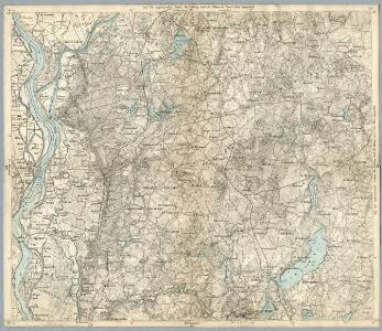
Composite: 131. Stuhm. (Germany)
1 : 100000 Reichsamt fur Landesaufnahme
131. Stuhm. (Germany)
1 : 100000 Reichsamt fur Landesaufnahme
Meßtischblatt 797 : Pestlin, 1910
1 : 250000 Pestlin. - Aufn. 1904/08, hrsg. 1910. - 1:25000. - [Berlin]: Reichsamt für Landesaufnahme, 1910. - 1 Kt.
Meßtischblatt 796 : Rehhof, 1929
1 : 250000 Rehhof. - Hrsg. 1906, bericht. 1909, einz. Nachtr. 1929. - 1:25000. - [Berlin]: Reichsamt für Landesaufnahme, 1929. - 1 Kt.
Meßtischblatt 798 : Gr. Rohdau, 1910
1 : 250000 Gr. Rohdau. - Aufn. 1908. - 1:25000. - [Berlin]: Reichsamt für Landesaufnahme, 1910. - 1 Kt.
Meßtischblatt 2080 : Stuhm, 1938
1 : 250000 Stuhm. - Hrsg. 1906, einz. Nachtr. 1928, redakt. Änd. 193. - 1:25000. - [Berlin]: Reichsamt für Landesaufnahme, 1938. - 1 Kt.
Meßtischblatt Wernersdorf
1 : 250000 Wernersdorf. - Hrsg. 1906, bericht. 1928. - 1:25000. - [Berlin]: Reichsamt für Landesaufnahme, 1928. - 1 Kt.
Meßtischblatt 2081 : Gr. Waplitz, 1929
1 : 250000 Gr. Waplitz. - Hrsg. 1906, einz. Nachtr. 1929. - 1:25000. - [Berlin]: Reichsamt für Landesaufnahme, 1929. - 1 Kt.
Meßtischblatt 892 : Riesenburg, 1910
1 : 250000 Riesenburg. - Aufn. 1908. - 1:25000. - [Berlin]: Reichsamt für Landesaufnahme, 1910. - 1 Kt.
Meßtischblatt 891 : Gr. Krebs, 1910
1 : 250000 Gr. Krebs. - Aufn. 1908. - 1:25000. - [Berlin]: Reichsamt für Landesaufnahme, 1910. - 1 Kt.
Meßtischblatt 890 : Marienwerder, 1928
1 : 250000 Marienwerder. - Hrsg. 1906, einz. Nachtr. 1928. - 1:25000. - [Berlin]: Reichsamt für Landesaufnahme, 1928. - 1 Kt.
49. Marienwerder, uit: Topographische Uebersichtskarte des Deutschen Reiches / herausgegeben v. d. Kartogr. Abt. d. Königl. Preuß. Landesaufnahme
1 : 200000 titelvariant: Topogr. Übersichtskarte des Deutschen Reiches; Annotatie: Titel boven bladen ook: Topogr. Übersichtskarte des Deutschen Reiches; Annotatie geografische gegevens: Op elk blad twee maatstokken: 10 Kilometer = 5,5 cm; 1 geogr. Meile = 3,6 cm; Legenda onder op elk blad Königlich Preußische Landesaufnahme. Kartographische Abtheilung [S.l : Königlich Preußische Landesaufnahme, Kartographische Abtheilung]
Elbing 27, uit: Special-Karte von Mittel-Europa / nach amtlichen Quellen bearbeitet von W. Liebenow
1 : 300000 titelvariant: W. Liebenow's Mittel-Europa; Annotatie: Titel boven de bladen: W. Liebenow's Mittel-Europa Johannes Wilhelm Liebenow 1822-1897 Frankfurt a. M. : Ludwig Ravenstein
TRACTVVM BORVSSIÆ, | circa Gedanum et Elbingam, | ab incolis WERDER appellati; cum | adiuncta NERINGIA, nova et | elaboratissima delineatio
Authore Olao Ioannis Gotho. [Amsterdam : Joan Blaeu]
Tractuum Borussiae, circa Gedanum et Elbingam, ab incolis Werder appellati, cum adiuncta Neringia, nova et elaboratissima delineatio [Karte], in: Novus atlas absolutissimus, Bd. 1, S. 110.
1 Karte aus Atlas Janssonius Offizin
Karte von Danzig, Elbing, und Marienburg oder erstes Blat von Westpreussen
1 : 137000 Elbląg (Polsko) Endersch, Johann Friedrich Amon, Anton F.A. Schraembl
Karte von Danzig, Elbing, und Marienburg oder erstes Blat von Westpreussen
1 : 137000 Elbląg (Polsko) Endersch, Johann Friedrich Amon, Anton F.A. Schraembl
Karte von Danzig, Elbing, und Marienburg oder erstes Blat von Westpreussen
1 : 137000 Elbląg (Polsko) Endersch, Johann Friedrich Amon, Anton F.A. Schraembl
Karte von Danzig, Elbing, und Marienburg oder erstes Blat von Westpreussen
1 : 137000 Elbląg (Polsko) Endersch, Johann Friedrich Amon, Anton F.A. Schraembl
Gdańsk
Polen Danzig Gdansk Grenze Wierzbicki, B.
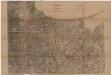
100. Marienburg. (Germany)
1 : 100000 Reichsamt fur Landesaufnahme
Meßtischblatt 795 : Mewe, 1913
1 : 250000 Mewe. - Aufn. 1904/08, hrsg. 1910. - 1:25000. - [Berlin]: Reichsamt für Landesaufnahme, 1913. - 1 Kt.
Meßtischblatt 2078 : Pelplin, 1940
1 : 250000 Pelplin. - Aufn. 1904/08, hrsg. 1910, letzte Nachtr. 1929. - 1:25000. - [Berlin]: Reichsamt für Landesaufnahme, 1940. - 1 Kt.

Svobodné město Gdansk (Danzig)
1 : 300000 Gdaňsk-oblast (Polsko) Jordán, V. O. Girgal
Regni Borussiae Episcopatus Warmiensis Palatinatus Mariaeburgensis et Culmensis cum Territorio Dantiscano et Ichnographia Urbis Regiomontis].
Mollova mapová sbírka
Sect. 10: Bromberg, uit: Geologische Karte des Deutschen Reichs in 27 Blaettern / [von] Richard Lepsius ; Red. von C. Vogel
1 : 500000 Annotatie: Blad 18 ontbreekt; Een aantal bladen op linnen; Een aantal bladen gereviseerd 1913-1914; Annotatie geografische gegevens: Met schaalstokken o.a. in kilometers; Legenda Carl Vogel 1828-1897 Gotha : Justus Perthes