Maps of Lubeck

114. Lubeck. (Germany)
1 : 100000 Reichsamt fur Landesaufnahme
Composite: 114. Lubeck. (Germany)
1 : 100000 Reichsamt fur Landesaufnahme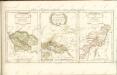

Meßtischblatt 2130 : Lübeck, 1941
1 : 250000 Lübeck. - Hrsg. 1879, bericht. 1920. - 1:25000. - [Berlin]: Reichsamt für Landesaufnahme, 1941. - 1 Kt.
Meßtischblatt 747 : Lübeck, 1920
1 : 250000 Lübeck. - Aufn. 1877, bericht. 1920. - 1:25000. - [Berlin]: Reichsamt für Landesaufnahme, 1920. - 1 Kt.
Meßtischblatt 747 : Lübeck, 1914
1 : 250000 Lübeck. - Aufn. 1877, hrsg. 1879, Aufldr. 1914. - 1:25000. - [Berlin]: Reichsamt für Landesaufnahme, 1914. - 1 Kt.
Meßtischblatt 746 : Hamberge, 1879
1 : 250000 Hamberge. - Aufn. 1877. - 1:25000. - [Berlin]: Reichsamt für Landesaufnahme, 1879. - 1 Kt.
Meßtischblatt 745 : Oldeslohe, 1905
1 : 250000 Oldeslohe. - Aufn. 1877, hrsg. 1879, einz. Nachtr. 1898, gedr. [19]05. - 1:25000. - [Berlin]: Reichsamt für Landesaufnahme, 1905. - 1 Kt.
Meßtischblatt 661 : Schwartau, 1900
1 : 250000 Schwartau. - Aufn. 1877, hrsg. 1879, einz. Nachtr. 1900. - 1:25000. - [Berlin]: Reichsamt für Landesaufnahme, 1900. - 1 Kt.
Meßtischblatt 660 : Curau, 1879
1 : 250000 Curau. - Aufn. 1877. - 1:25000. - [Berlin]: Reichsamt für Landesaufnahme, 1879. - 1 Kt.
Meßtischblatt 659 : Warder, 1879
1 : 250000 Warder. - Aufn. 1877. - 1:25000. - [Berlin]: Reichsamt für Landesaufnahme, 1879. - 1 Kt.
Meßtischblatt 841, neue Nr. 2230 : Ratzeburg, 1937
1 : 250000 Ratzeburg. - Hrsg. 1881, einz. Nachtr. 1908, gedr. [19]37. - 1:25000. - [Berlin]: Reichsamt für Landesaufnahme, 1937. - 1 Kt.
Meßtischblatt 841 : Ratzeburg, 1908
1 : 250000 Ratzeburg. - Aufn. 1877/79, hrsg. 1881, einzelne Nachtr. 1908. - 1:25000. - [Berlin]: Reichsamt für Landesaufnahme, 1908. - 1 Kt.
Meßtischblatt 840 : Crummesse, 1898
1 : 250000 Crummesse. - Aufn. 1877/79, hrsg. 1881, einz. Nachtr. 1898. - 1:25000. - [Berlin]: Reichsamt für Landesaufnahme, 1898. - 1 Kt.
Meßtischblatt 839 : Eichede, 1898
1 : 250000 Eichede. - Aufn. 1877/79, hrsg. 1881, einz. Nachtr. 1898. - 1:25000. - [Berlin]: Reichsamt für Landesaufnahme, 1898. - 1 Kt.
Grund-Riß der Kayserlichen und des Heil. Röm. Reichs Freyen Stadt Lübeck
1 : 5400 Mollova mapová sbírka Seutter, Matthäus Seutter, Matthäus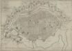
Plan der Stadt Lübeck: neu berichtigt und herausge
Saltzenberg, J. F.
Stralsund
Stralsund (Německo)
Stralsund
Stralsund (Německo)
Stralsund
Stralsund (Německo)
Stralsund
Stralsund (Německo)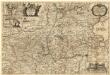
Landtcarte Uom Süderntheil des Wagerland's
1 : 130000 Mollova mapová sbírka Mejer, Johannes Rothgiesser, Andreas Lorenzen
PARS MERIDIONALIS | WAGRIÆ, | cum partes | STORMARIÆ | in qua Episcopatus Lubencensis, | Plona Principatus, et Præfectura | Segebergensis
Andres Lorensen | Rothgiesser Hus. | sculps. [Amsterdam : Joan Blaeu]
41. Lübeck, uit: Topographische Uebersichtskarte des Deutschen Reiches / herausgegeben v. d. Kartogr. Abt. d. Königl. Preuß. Landesaufnahme
1 : 200000 titelvariant: Topogr. Übersichtskarte des Deutschen Reiches; Annotatie: Titel boven bladen ook: Topogr. Übersichtskarte des Deutschen Reiches; Annotatie geografische gegevens: Op elk blad twee maatstokken: 10 Kilometer = 5,5 cm; 1 geogr. Meile = 3,6 cm; Legenda onder op elk blad Königlich Preußische Landesaufnahme. Kartographische Abtheilung [S.l : Königlich Preußische Landesaufnahme, Kartographische Abtheilung]
Ostsee
1 : 50000 Lübeck (Německo : oblast) Reichs-Marine-Amt
Composite: 147. Ratzeburg. (Germany)
1 : 100000 Reichsamt fur Landesaufnahme
Meßtischblatt 744 : Leezen, 1896
1 : 250000 Leezen. - Aufn. 1878, hrsg. 1880, einz. Nachtr. 1896. - 1:25000. - [Berlin]: Reichsamt für Landesaufnahme, 1896. - 1 Kt.
Meßtischblatt 658 : Bad Segeberg, 1925
1 : 250000 Bad Segeberg. - Aufn. 1878, einz. Nachtr. 1925. - 1:25000. - [Berlin]: Reichsamt für Landesaufnahme, 1925. - 1 Kt.
Meßtischblatt 838 : Bargteheide, 1910
1 : 250000 Bargteheide. - Aufn. 1878, hrsg. 1880, einz. Nachtr. 1910. - 1:25000. - [Berlin]: Reichsamt für Landesaufnahme, 1910. - 1 Kt.


