Maps of Łeba

25. Leba. (Germany)
1 : 100000 Reichsamt fur Landesaufnahme
Composite: 25. Leba. (Germany)
1 : 100000 Reichsamt fur Landesaufnahme
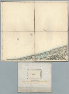
Meßtischblatt 172 : Leba, 1928
1 : 250000 Leba. - Hrsg. 1891, bericht. 1911, einz. Nachtr. 1928. - 1:25000. - [Berlin]: Reichsamt für Landesaufnahme, 1928. - 1 Kt.
Meßtischblatt 171 : Leba- See, 1891
1 : 250000 Leba- See. - Aufn. 1889. - 1:25000. - [Berlin]: Reichsamt für Landesaufnahme, 1891. - 1 Kt.
Meßtischblatt 1172/1272 : Sassin, 1939
1 : 250000 Sassin. - Aufn. 1889, hrsg. 1890, bericht. 1939. - 1:25000. - [Berlin]: Reichsamt für Landesaufnahme, 1939. - 1 Kt.
Hela 16, uit: Special-Karte von Mittel-Europa / nach amtlichen Quellen bearbeitet von W. Liebenow
1 : 300000 titelvariant: W. Liebenow's Mittel-Europa; Annotatie: Titel boven de bladen: W. Liebenow's Mittel-Europa Johannes Wilhelm Liebenow 1822-1897 Frankfurt a. M. : Ludwig Ravenstein

15. Lauenburg i. Pom., uit: Topographische Uebersichtskarte des Deutschen Reiches / herausgegeben v. d. Kartogr. Abt. d. Königl. Preuß. Landesaufnahme
1 : 200000 titelvariant: Topogr. Übersichtskarte des Deutschen Reiches; Annotatie: Titel boven bladen ook: Topogr. Übersichtskarte des Deutschen Reiches; Annotatie geografische gegevens: Op elk blad twee maatstokken: 10 Kilometer = 5,5 cm; 1 geogr. Meile = 3,6 cm; Legenda onder op elk blad Königlich Preußische Landesaufnahme. Kartographische Abtheilung [S.l : Königlich Preußische Landesaufnahme, Kartographische Abtheilung]
Meßtischblatt 1269 : Scholpin, 1943
1 : 250000 Scholpin. - Aufn. 1889/1939, hrsg. 1891, bericht. 1939. - 1:25000. - [Berlin]: Reichsamt für Landesaufnahme, 1943. - 1 Kt.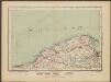
Danzig
1 : 600000 Opitz, Carl Solbrig
Sect. 4: Danzig, uit: Geologische Karte des Deutschen Reichs in 27 Blaettern / [von] Richard Lepsius ; Red. von C. Vogel
1 : 500000 Annotatie: Blad 18 ontbreekt; Een aantal bladen op linnen; Een aantal bladen gereviseerd 1913-1914; Annotatie geografische gegevens: Met schaalstokken o.a. in kilometers; Legenda Carl Vogel 1828-1897 Gotha : Justus Perthes

West Preussen.
1 : 940000 Flemming, Carl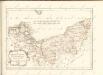


Provinz Pommern
1 : 938000 Pomořansko (Německo a Polsko) Handtke, Friedrich C. Fleming
POMERANIÆ | DVCATVS TABVLA
Auctore | Eilhardo Lubino. S. Rogiers sculpsit [Amsterdam : Joan Blaeu]
Pommern.
1 : 940000 Flemming, Carl
Preusische Provinz Pommern
1 : 620000 Pomořansko (Německo a Polsko) Kiepert, Heinrich Gräf, A. Geographisches Institut
Provinz Pommern
1 : 1650000 Pommern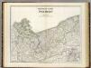
Pommern.
1 : 600000 Kiepert, Heinrich, 1818-1899
Pommern.
1 : 1250000 Andree, Richard

Die Preussische Provinz Pommern, bestehend aus den Regierungs-Bezirken: Stettin, Cöslin & Stralsund
1 : 1850000 Pommern
Regni Borussiae Episcopatus Warmiensis Palatinatus Mariaeburgensis et Culmensis cum Territorio Dantiscano et Ichnographia Urbis Regiomontis].
Mollova mapová sbírka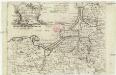
Das Königreich Preussen
1 : 1850000 Prusko Východní Kilian, Georg Christoph Georg Christoph Kilian
Le Royaume de Prusse
1 : 730000 Mollova mapová sbírka Le Rouge, Georges-Louis Le Rouge, Georges-Louis
Prussia [Karte], in: Gerardi Mercatoris Atlas, sive, Cosmographicae meditationes de fabrica mundi et fabricati figura, S. 152.
1 Karte aus Atlas Mercator, Gerhard Montanus, Petrus
Borussiæ regnum sub fortissimo tutamine et justissimo regimine serenissimi ac potentissimi principis Friderici Wilhelmi lætissimis incrementis efflorescens cum adjacentib. regionibus mappa geographica
1 Karte : Kupferdruck ; 48 x 56 cm Seutter Matthäus Seutter