Maps of Outaouais
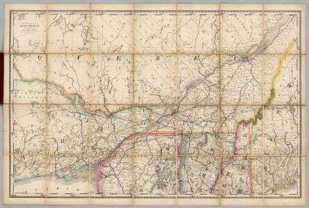
(Quebec, New England) Railroad Map of the United States.
1 : 506880 Rand McNally and Company
Map of Oswego Co.
from New topographical atlas of Oswego County, New York : from actual surveys especially for this atlas.
Partie des Etats-Unis. Amer. Sep. 43.
1 : 1641836 Vandermaelen, Philippe, 1795-1869
The provinces of New York, and New Jersey : with part of Pensilvania, and the governments of Trois Rivieres, and Montreal / drawn by Capt. Holland ; engraved by Thomas Jefferys, geographer to His Majesty.
from Parts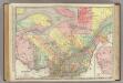
Quebec.
1 : 1204000 Rand McNally and Company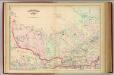
Quebec, part.
1 : 1267200 Asher & Adams
Canada 2.
1 : 1774080 Letts, Son & Co.
Quebec.
1 : 1280000 Asher & Adams
Lower Canada, N.S., N.B.
1 : 1800000 Meyer, Joseph, 1796-1856
Lower-Canada, N.B., N.Y., Vt., Maine.
1 : 1770000 Society for the Diffusion of Useful Knowledge (Great Britain)
(Canada, Louisiane et Terres Angloises. Southeast section) Le Fleuve Saint-Laurent.
1 : 910000 Anville, Jean Baptiste Bourguignon d, 1697-1782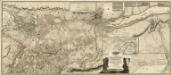
Composite: Lower Canada
1 : 174240 Faden, William, 1750?-1836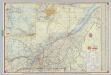
Shell Highway Map of Quebec.
1 : 950400 Shell Oil Company
East Part of Canada.
1 : 1440000 Greenleaf, Jeremiah
Lower Canada.
1 : 1440000 Greenleaf, Jeremiah
Lower Canada.
1 : 1520640 Burr, David H., 1803-1875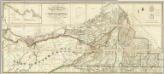
Map of the District Of Montreal, Lower Canada.
1 : 174240 Wyld, James, 1812-1887
The provinces of New York, and New Jersey : with part of Pensilvania, and the governments of Trois Rivieres, and Montreal / drawn by Capt. Holland ; engraved by Thomas Jefferys, geographer to His Majesty.
from Parts
Quebec.
1 : 2000000 Mitchell, Samuel Augustus
Quebec.
1 : 2000000 Mitchell, Samuel Augustus
Quebec.
1 : 2000000 Mitchell, Samuel Augustus Jr.
Original Thirteen Colonies.
1 : 2000000 Mitchell, Samuel Augustus Jr.
Quebec.
1 : 2000000 Mitchell, Samuel Augustus
Quebec.
1 : 2000000 Mitchell, Samuel Augustus
[Neueste Karte von Lower Canada]
Grosser Hand-Atlas über alle Theile der Erde in 170 Karten Meyer, J. Verlag des Bibliographischen Instituts
Canada East Formerly Lower Canada.
1 : 1770000 Mitchell, Samuel Augustus
Canada East.
1 : 1500000 Morse, Sidney E. (Sidney Edwards), 1794-1871
Canada East.
1 : 1770000 Tanner, Henry S.
Lower Canada.
1 : 1770000 Tanner, Henry S.