Maps of United States

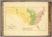
Grassland Divisions. Land in Crops, 1919. Atlas of American Agriculture.
Zon, Rafael
Mileage chart U.S.
Rand McNally and Company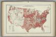
Areas of Soil Surveys. Atlas of American Agriculture.
1 : 8000000 Marbut, Curtis F.
Various Regions and Cities in Washington.
Shell Oil Company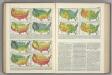
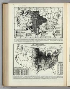
Temperature Thresholds by Date. Range of Temperatures. Atlas of American Agriculture.
Kincer, Joseph Burton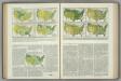
(Hail, Fog, Thunderstorms, Clear, Cloudy). Relative Humidity. Atlas of American Agriculture.
Kincer, Joseph Burton
Various Regions and Cities in Oregon.
Shell Oil Company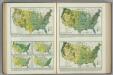
Average Precipitation. Atlas of American Agriculture.
1 : 17000000 Kincer, Joseph Burton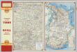
Central Ozarks.
1 : 823680 Shell Oil Company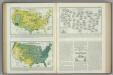
Warm Season Precipitation. Atlas of American Agriculture.
1 : 17000000 Kincer, Joseph Burton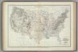
Location of Meteorological Stations. Atlas of American Agriculture.
1 : 8000000 Kincer, Joseph Burton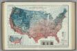
Average Number of Days without Killing Frost. Atlas of American Agriculture.
1 : 8000000 Marschner, F.J.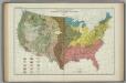
Great Soil Groups. Atlas of American Agriculture.
1 : 8000000 Marschner, Francis J.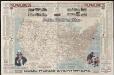
National highways map of the United States showing one hundred fifty thousand miles of national highways proposed by the National Highways Association
1 : 3800000 Mulford, John C. National Highways Association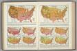
Monthly Temperature Maps: September. October. Atlas of American Agriculture.
Kincer, Joseph Burton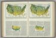
Annual Snowfall. Atlas of American Agriculture.
1 : 17000000 Kincer, Joseph Burton
Annual March of Significant Temperatures at Selected Stations. Atlas of American Agriculture.
1 : 8000000 Kincer, Joseph Burton
Various Regions and Cities in New Mexico.
Shell Oil Company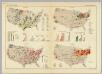
United States of America. Pergamon World Atlas.
Polish Army Topography Service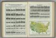
Annual Precipitation. Atlas of American Agriculture.
Kincer, Joseph Burton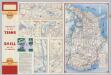
Various Regions and Cities in Alabama.
Shell Oil Company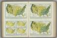
Monthly (February, March, April) Precipitation. Atlas of American Agriculture.
1 : 17000000 Kincer, Joseph Burton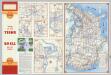
Various Regions and Cities in Iowa.
Shell Oil Company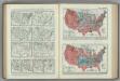
Frost Occurrences. Atlas of American Agriculture.
Reed, William Gardner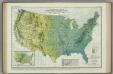
Average Summer Precipitation, in Inches. Atlas of American Agriculture.
1 : 8000000 Kincer, Joseph Burton
Various Regions and Cities in Oklahoma.
Shell Oil Company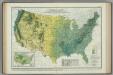
Spring Precipitation. Atlas of American Agriculture.
1 : 8000000 Marschner, Francis, J.
Monthly Temperature Maps: July. August. Atlas of American Agriculture.
Kincer, Joseph Burton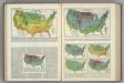
Winter Temperatures. Atlas of American Agriculture.
Kincer, Joseph Burton