Maps of Scandinavia

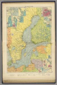
Baltic Sea.
1 : 5000000 Philip, George
General Karte von König[reich] Schweden und Norwegen : nebst Daenemark, nach den neuesten und zuverlässigsten Hülfsmitteln
1 : 3000000 Augsburg : Walch
Die Ost See
1 : 500000 Baltské moře-oblast Flemming, Carl C. Flemming
Die Ost See
1 : 5000000 Baltské moře-oblast Flemming, Carl C. Flemming
Nordeuropa 2003
Nordeuropa Kunz, Andreas ; Treiling, Thomas
Suede, Norvege, et Danemark.
1 : 5300000 Montemont, A.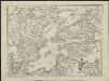
Kriegscarte zwischen Schweden und Rusland
nach den besten Carten gezeichnet von I.C. Iaeger Frankf. a/m : im Verlag der Jägerishen Landcarten Handlung
Carte des couronnes du nord comprenant la Suede, le Danemarc, la Norvege la Prusse etc
1 : 2600000 Dánsko Büsching, Anton Friedrich Jean Frederic Frauenholz
Sweden.
1 : 6500000 Bowen, Emanuel
Composite: Schweden, Norwegen.
1 : 4500000 Flemming, Carl
57. Scandanavia, Political. The World Atlas.
1 : 5000000 USSR (Union of Soviet Socialist Republics).
Baltic Sea.
1 : 3400000 Faden, William, 1750?-1836

Scandinavia.
1 : 3350000 Pinkerton, John, 1758-1826
Charta öfver Sverige
1 : 6500000 utg. en 1789 af Fredr. Akrel förbättrad af Dan. Djurberg Stockholm : [s.n.]
Schweden und Norwegen
Allgemeiner Atlas [Walch, Johannes] im Verlag bei Johannes Walch
(La Suede, la Finlande)
1 : 21000000 Bruyset, Jean-Marie; Schneider, J. H.
Les royaumes de Suéde, de Danemark et de Norwege
1 : 6420000 Dánsko Bonne, Rigobert André
Svea ock Göta Riken med Finland ock Norland
1 : 1680000 Finsko Biurman, G.
Švedy a Norvegy
Švédsko Schmidt, Eduard Berra, Marco
Ice Chart, Baltic Sea, March.
U.S. Navy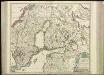
[69][69] Regni Sueciae ..., uit: Atlas sive Descriptio terrarum orbis
Annotatie: Gedigitaliseerde versie. Amsterdam. Heiloo : Picturae (vervaardiger), 2015. tiff-bestand. Gedigitaliseerd: 07-01-2015; Origineel: Universiteitsbibliotheek Vrije Universiteit (XL.05127.-) ; Netherlands; Titelpagina ontbreekt Wit, Frederik de Amsterdam : Frederick de Wit
Ice Chart, Baltic Sea, June.
U.S. Navy
Carte du Royaume de Suede,Norwege et Danemarck.
1 : 4800000 Vivien de St Martin, L.
Ice Chart, Baltic Sea, February.
U.S. Navy
Ice Chart, Baltic Sea, November.
U.S. Navy
Ice Chart, Baltic Sea, April.
U.S. Navy
Sweden, Norway.
1 : 2217600 Stanford, Edward
Ice Chart, Baltic Sea, October.
U.S. Navy