Maps of District de Morges
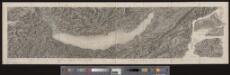
147 Nozeroy, Les Rousses.
1 : 86400 Cassini family; Cassini, Cesar-Francois, 1714-1784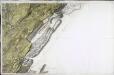
[Nozeroy - les Rousses]
1 Blatt : 59 x 90 cm s.n.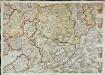
Inclitae Bernatum urbis, cum omni ditionis suae agro et provinciis delineatio chorographica, 11/12
2 Blätter : Adelbert Saueracher
Lausanne
1 : 100000 [s.n.]
Carte de la Suisse romande, 3
1 Blatt : s.n.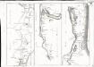
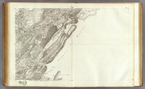
Carte topographique de la grande route de Berne à Genève, Blatt 10-12
3 Blätter : 35 x 48 cm Ochs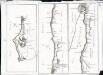
Carte topographique de la grande route de Berne à Genève, Blatt 13-15
3 Blätter : 35 x 49 cm Ochs
Plan de Lausanne et de sa banlieue
1 : 8000 1 Plan Etabl. topogr. de Wurster, Randegger & Co. F. Payot, Lausanne
[Kaart + gids, p. 4], uit: Plan de Lausanne
1 : 8000 Annotatie: Verso: toeristische informatie; In omslag: straatnamenregister; Annotatie geografische gegevens: Inzet: Panorama du Signal Lausanne : Simplon
Carte de Lausanne et ses environs
1 : 16300 [s.n.]
Plan de la ville de Lausanne et de sa banlieue
1 : 8000 1 Plan Etabl. topogr. de Wurster, Randegger & Co. D. Lebet, éditeur, [Erscheinungsort nicht ermittelbar]
Plan de la ville de Lausanne et de sa banlieue
1 : 5000 Furrer, H. Lebet, D. Lith. H. Furrer
[Le desséchement de la Plaine de l'Orbe]
1 : 50000 Gonin, Louis Imprimerie Georges Bridel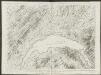
Plus grande partie de la Suisse romande ou canton du Léman
1 : 108000 Weiss, Johann Heinrich ; Guérin, Christophe ; Meyer, Johann Rudolf J. R. Meyer
Atlas Suisse
1 : 120000 16 Karten levé et dessiné par J.H. Weiss [et Joachim Eugen Müller] aux frais de J.R. Meyer à Aarau dans les années 1786 à 1802 ; gravée [sic] par [Christophe] Guérin, [Matthias Gottfried] Eichler et [Johann Jakob] Scheurmann [Johann Rudolf Meyer], Aarau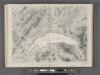
Plus grande partie de la Suisse Romande ou République Lémanique.
From Atlas Suisse. Levé et dessiné par J. H. Weiss aux fraix de J. R. Meyer á Aarau dans les années 1786 á 1802. Gravée par Guerin, Eichler, et Scheurmann.
Carte de la Suisse avec les plans des cheflieux des 22 cantons
1 : 200000 1 Karte auf 8 Bl. dessinée et publié par Henri Keller ; Lithogr. von J. Schweizer = Charte der Schweiz mit den Grundrissen der Hauptorte der 22 Cantone Keller, Zürich
[Malerisches Relief der Schweizer- und angränzenden Alpen]
1 : 135000 11 Vogelschaukarten Nach der Natur aufgenommen und gezeichnet von F.W. Delkeskamp ; gestochen v. Knopfmacher u. J.Ph. Dauch [Friedrich Wilhelm Delkeskamp], [Frankfurt am Main]
Carte du canton de Vaud
1 : 200000 Reber, ... ; Zwahlen, J. Barbey
canton de Vaud
1 : 390000 Keller, Heinrich ; Scheuermann, Johann Jakob Orell Fussli & Comp.
Le Canton de Vaud - Canton Waadt

Pontarlier, Yverdon
1 : 100000 1 Karte par Aug. Jaccard [Wurster & Randegger], [Winterthur]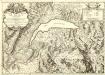
Carte du Lac de Geneve et des Pays Circonvoisins
1 : 150000 Mollova mapová sbírka Chopy, Antoine Daudet, Jean-Louis Chopy, Antoine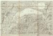
Carte du Lac de Geneve et de ses environs
1 : 320000 Ženeva (Švýcarsko : kanton)
Topographische Karte der Schweiz
1 : 100000 25 Karten vermessen und hrsg. auf Befehl der Eidgenössischen Behörden ; aufgenommen unter der Aufsicht des Generals G.H. Dufour Eidg. Topographisches Bureau, [Genève], [später: Bern]
Lacus Lemanni Locorumque Circumiacentium Accuratissima Descriptio. [Karte], in: Theatrum orbis terrarum, sive, Atlas novus, Bd. 2, S. 160.
1 Karte aus Atlas Blaeu, Joan Blaeu, Willem Janszoon
Lacus Lemanni Locorumque Circumiacentium Accuratissima Descriptio. [Karte], in: Novus atlas absolutissimus, Bd. 4, S. 236.
1 Karte aus Atlas Janssonius Offizin
Lacus Lemanni Locorumque Circumiacentium Accuratissima Descriptio. [Karte], in: Novus Atlas, das ist, Weltbeschreibung, Bd. 2, S. 82.
1 Karte aus Atlas Blaeu, Joan Blaeu, Willem Janszoon