Maps of United States
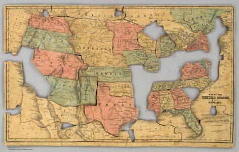
Map of the United States and Canada.
1 : 11404800 Merriam, Moore & Co.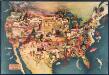
Paul Sample's America: Its Soil
This bird's-eye-view map shows scenes of land use and farming superimposed on a map of the United States. Agricultural scenes of farming, livestock, and crops are depicted. Sample, Paul Associatedd American Artists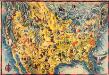
The Covarrubias America: a decorative map of the United States of America
This pictorial bird's-eye-view map shows the United States of America with parts of Canada and Mexico. Landscape, trade, industry, points of interest, people, and animals are depicted. Covarrubias, Miguel Edward Stern & Co.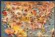
Bohrod's America, its history
This map shows scenes from America's history with names of historical events superimposed on a map of the United States. Bohrod, Aaron Associated American Artists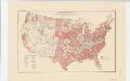
Areas covered by the soil survey, completed to January 1934
1 : 7900000 Includes numbered list of reconnaissance surveys. "Atlas of American Agriculture, Soils, Plate 1." United States. Bureau of Chemistry and Soils. [Washington, D.C.?] : The Bureau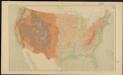
United States relief map
1 : 7000000 Geological Survey (U.S.) Geological Survey (U.S.)
Road map United States.
1 : 7500000 Rand McNally and Company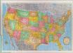
United States.
1 : 5000000 Rand McNally and Company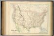
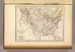
United States.
1 : 9504000 Fullarton, A. & Co.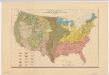
Distribution of the great soil groups (soil provinces)
1 : 8000000 Relief shown by spot heights. Appears in Washington: U.S. Dept. of Agriculture. Atlas of American agriculture, 1936. Soils, plate 2. Marbut, Curtis Fletcher, 1863-1935. Washington, D.C. : Bureau of Chemistry and Soils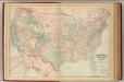
United States, territories.
1 : 8000000 Asher & Adams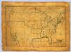
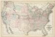
United States.
1 : 7700000 Symonds, Maria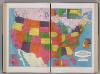
United States.
1 : 8183000 Hammond, C.S.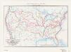
Map of the conterminous United States showing routes of the principal explorers from 1501 to 1844, whose work had an important bearing on the settlement of the country and the fixing of its successive boundaries
1 : 8500000 "Taken from Bulletin 1212, Plate 1." Original title: United States map showing routes of principal explorers and early roads and highways. Bond, Frank, 1856-1940 United States. General Land Office.; Geological Survey (U.S.); Reston, Virginia : U.S. Geological Survey
United States.
1 : 8750000 Mitchell, Samuel Augustus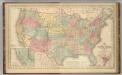
United States.
1 : 8750000 Mitchell, Samuel Augustus
Hammond's comprehensive map of the United States with portions of Canada and Mexico
1 : 5000000 C.S. Hammond & Company C.S. Hammond & Company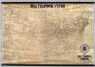
Lines Of The Bell Telephone Companies. United States And Canada.
1 : 2471040 American Telephone and Telegraph Company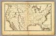
United States.
1 : 14300000 Weeks, Lydia S.
United States of America: corrected & improved from the best authorities / engraved by H. Anderson.
from Whole H. Anderson.,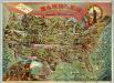
Rambles Through Our Country.
1 : 6842880 American Publishing Company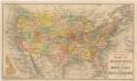
Routen der Missouri - Pacific, sowie der Wabash St. Louis und Pacific Eisenbahnen
Walling and Grey's map of the United States and territories
Etats-Unis d'Amerique, 1835.
1 : 16200000 Malte-Brun, Conrad, 1775-1826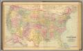
United States.
1 : 7603200 O.W. Gray & Son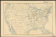
United States
1 : 11875000 Geological Survey (U.S.) Geological Survey (U.S.)
Colton's plans of U.S. harbors, showing the positions & vicinities of the most important fortifications on the sea-board and in the interior

H.H. Lloyd & Co's campaign military charts showing places of interest

Lloyd's military maps: showing the principal places of interest