Maps of Patagonia

South America 6.
1 : 6969600 Letts, Son & Co.
Patagonia, S. Shetlands, S. Orkneys.
1 : 6700000 Society for the Diffusion of Useful Knowledge (Great Britain)
Südlichster Theil von America enthaltend Patagonia, Feuerland & Falklands Gruppe
Grosser Hand-Atlas über alle Theile der Erde in 170 Karten Meyer, J. Verlag des Bibliographischen Instituts
Chili et Argentine, Flle. Nord.
1 : 6000000 Vivien St Martin, L.
Sud-America III.
1 : 13000000 Berghaus, Heinrich; Flemming, Carl; Handtke, Friedrich H.; Sohr, Karl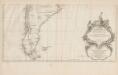
Amerique Meridionale [c]
1 : 6300000 Hoja del inferior del más importante y detallado mapa francés sobre Suramérica de mediados del siglo XVIII, elaborado por Jean Baptiste Bourguignon D’Anville, una de las autoridades cartográficas más trascendentales e influyentes de su tiempo. Esta parte del mapa muestra la región de las pampas y de la Patagonia, al extremo sur de América, en las actuales Chile y Argentina. El mapa enfatiza, con sus espacios en blanco, el carácter desconocido y salvaje de estas regiones, según los europeos. D’Anville registra las tensiones entre españoles e ingleses por las Islas Malvinas o Falkland. De particular interés resulta el cartucho decorativo, en la parte inferior del mapa: allí aparece una escena alegórica del dominio católico del subcontinente. Anville, Jean Baptiste Bourguignon d' (1697-1782) Delahaye, Guillaume-Nicolas (1727-1802)
Patagonia. South Orkney. Falkland Islands. South Georgia Island.
1 : 8000000 Colton, G.W.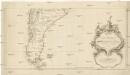
Karte von Süd-America
Jižní Amerika Anville, Jean-Baptiste Bourguinon d' Alberti, Ignaz F.A. Schraembl
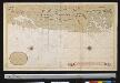
Paskaarte van't zuÿdelÿckste deel van America
1 Karte : Kupferdruck ; 43 x 53 cm Doncker bÿ Hendrick Doncker boeckverkoper en graad-boog-maker inde Nieuwe-brug-steeg
Tractus australior Americæ meridionalis a Rio de la Plata per fretum Magellanicum ad Toraltum
1 Karte : Kupferdruck ; 48 x 54 cm Renard Louis Renard
Patagonia. South Orkney or Powell's Group. Falkland Islands. South Georgia Island.
Colton, G.W.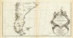
Amerique Meridionale. (Southern section)
1 : 6300000 Anville, Jean Baptiste Bourguignon d, 1697-1782
[147][150] Tractus Australior Americae Meridionalis ..., uit: Atlas sive Descriptio terrarum orbis
Annotatie: Gedigitaliseerde versie. Amsterdam. Heiloo : Picturae (vervaardiger), 2015. tiff-bestand. Gedigitaliseerd: 07-01-2015; Origineel: Universiteitsbibliotheek Vrije Universiteit (XL.05127.-) ; Netherlands; Titelpagina ontbreekt Wit, Frederik de Amsterdam : Frederick de Wit
Patagonie, Terre de Feu, Malouines.
1 : 3750000 Martin de Moussy, V. (Victor), 1810-1869
Esquisse de la Patagonie (République Argentine)
1 : 6000000 Paris : Erhard et fils
Patagonia. South Orkney or Powell's Group. Falkland Islands. South Georgia Island.
1 : 7750000 Colton, G.W.
Patagonia. South Orkney or Powell's Group. Falkland Islands. South Georgia Island.
1 : 7600000 Colton, G.W.
Amerique Merid., cotes.
1 : 5500000 Spain. Marina
Patagonia, Feuerland, Falklands, Antarctische Continent.
1 : 7700000 Radefeld, Carl Christian Franz, 1788-1874
Carte de la Patagonie et des Archipels de la Terre de Feu des Malounies et des Còtes Occidentales
1 : 2000000 Description géographique et statistique de la Confédération Argentine Martin de Moussy, Victor Librairie de Firmin Didot frères, fils et Cie
Patagonia ... South Orkney ... Falkland Islands ... South Georgia Island.
1 : 8236800 Colton, G.W.
A new map of the southern parts of America taken from manuscript maps made in the country and a survey of the eastern coast maode by the order of the King of Spain
1 : 3168000
S. extremity of America.
1 : 4500000 Cook, James, 1728-1779
Composite: (Mapa de la Republica de Chile 9-15)
1 : 11000000 Pissis, Aime, 1812-1889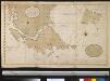
Verbeeterde caert van de uijthoek van Zuijd America waer in vervat sijn de onlangs ondekte eijlanden, door de scheepen van St. Malo, zedert den jaaren 1700, welker west sijde nog onbekent is, de doortogt, die hier met de naam van St. Barbara genaemt word is, onlangs den 25 Maij 1713 ontdeckt door een schip t welk dien naam hadt
Chile Gerard van Keulen
Tabula Magellanica, quâ Tierrae del fuego [...] [Karte], in: Novus Atlas, das ist, Weltbeschreibung, Bd. 2, S. 349.
1 Karte aus Atlas Blaeu, Joan Blaeu, Willem Janszoon
[Terra del Fuego]
1 : 875000 [S.l. : s.n.]
Tabula Magellanica, quâ Tierrae del fuego [...] [Karte], in: Theatrum orbis terrarum, sive, Atlas novus, Bd. 2, S. 359.
1 Karte aus Atlas Blaeu, Joan Blaeu, Willem Janszoon
Tabula Magellanica, quâ Tierrae del Fuego [...] [Karte], in: Le théâtre du monde, ou, Nouvel atlas contenant les chartes et descriptions de tous les païs de la terre, Bd. 2, S. 344.
1 Karte aus Atlas Blaeu, Willem Janszoon und Blaeu, Joan Blaeu, Willem Janszoon