Maps of United States
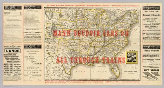
Queen & Crescent Route.
1 : 6500000 Cincinnati, New Orleans & Texas Pacific Railway Company
United States.
1 : 12500000 Tallis, J. & F.
Louisville and Nashville Railroad.
1 : 5001200 Louisville and Nashville Railroad Company
The United States of North America / engd. by Jno. Johnstone, Edinb.
from Whole John Johnstone, Edinb.,
United States of America.
1 : 11404800 Galveston, Houston, & Henderson Railroad
United States of America / by H.S. Tanner, 1837; engraved by H.S. Tanner, assisted by E.B. Dawson, W. Allen & J. Knight.
from Whole Henry S. Tanner; E. B. Dawson; W. Allen; J. Knight,
Eagle Map of the United States.
1 : 7603200 Moore, I.W.
United States of America / compiled from the latest & best authorities by John Melish; engraved by Saml. Harrison.
from Charts and maps John Melish; Saml. Harrison,
Map of the United States: drawn from the most approved surveys / engraved by G.W. Merchant, Albany.
from Whole G. W. Merchant,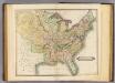
United States.
1 : 8700000 Lizars, Daniel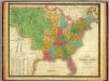
Map of the United States.
1 : 7000000 Mitchell, Samuel Augustus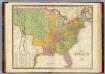
Map of The United States.
1 : 6950000 Finley, Anthony
United States of North America.
1 : 7603200 Maclure, William
Turn and learn, U.S.
1 : 25000000 Chartomap Co.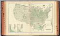
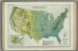
99. Wheat per sq. mile.
1 : 8900000 Gannett, Henry, 1846-1914; Hewes, Fletcher W.; United States. Census Office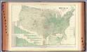
96. Farm land by counties.
1 : 8900000 Gannett, Henry, 1846-1914; Hewes, Fletcher W.; United States. Census Office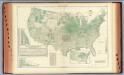
98. Corn per acre planted.
1 : 8900000 Gannett, Henry, 1846-1914; Hewes, Fletcher W.; United States. Census Office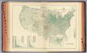
101. Oats per sq. mile.
1 : 8900000 Gannett, Henry, 1846-1914; Hewes, Fletcher W.; United States. Census Office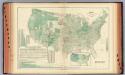
100. Wheat per acre sown.
1 : 8900000 Gannett, Henry, 1846-1914; Hewes, Fletcher W.; United States. Census Office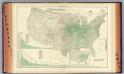
97. Corn per sq. mile.
1 : 8900000 Gannett, Henry, 1846-1914; Hewes, Fletcher W.; United States. Census Office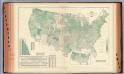
102. Oats per acre sown.
1 : 8900000 Gannett, Henry, 1846-1914; Hewes, Fletcher W.; United States. Census Office
United States.
1 : 7153000 Finley, Anthony
Vereinigte Staaten von Nord-America
1 : 33640000 Spojené státy americké Hoffmann, Wilh. bei Wilh. Hoffmann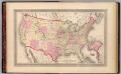
Map of the United States.
1 : 9800000 H.W. Burgett and Company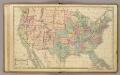
United States.
1 : 9700000 Cornell, S. S. (Sarah S.)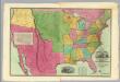
Map Of The United States Of America.
1 : 4118400 Willard, A.
Map of the United States of America.
from Whole s.n.: [Philadelphia?],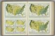
Monthly (February, March, April) Precipitation. Atlas of American Agriculture.
1 : 17000000 Kincer, Joseph Burton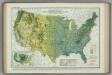
Average Warm Season Precipitation in Inches. Atlas of American Agriculture.
1 : 8000000 Kincer, Joseph Burton