Maps of British Columbia

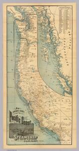
Pacific Coast Steamship Company.
1 : 3000000 Pacific Coast Steamship Co.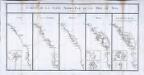
Carte de la coste nord-est de la mer du Sud
5 Karten auf einem Blatt : Kupferdruck ; je 38 x 17 cm, Bildgrösse 44 x 87 cm La Borde; Cook; Lapérouse; Dixon; Mears s.n.
Cote N.O. de l'Amerique.
1 : 6600000 La Perouse, Jean-Francois de Galaup, comte de, 1741-1788
Facsimile: Western Coast of America (portion).
1 : 5600000 Alaskan Boundary Tribunal
Oregon-Gebiet.
1 : 5650000 Flemming, Carl
Oregon, Upper California.
1 : 10000000 Mitchell, Samuel Augustus
Facsimile: Part of Map of British North America. Arrowsmith.
1 : 9750000 Arrowsmith, John
Oregon Territory.
1 : 7200000 Greenleaf, Jeremiah
Oregon Territory.
1 : 7603200 Greenleaf, Jeremiah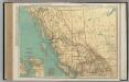
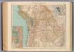
British Columbia.
1 : 2851000 Rand McNally and Company
British Columbia.
1 : 2408000 Rand McNally and Company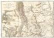
Map of the Oregon districts and the adjacent country
Kanada Wyld, James James Wyld
Facsimile: Map of the Province of British Columbia.
1 : 4539000 Mohun, Edward
Oregon Territory.
1 : 6969600 Burr, David H., 1803-1875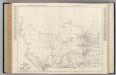
Alberta. British Columbia.
Rand McNally and Company
U.S. West of Mississippi R. 1.
1 : 2000000 Freyhold, Edward; Warren, Gouverneur Kemble, 1830-1882; United States. Army. Corps of Engineers
Sectional map indicating main automobile roads between Canada and United States
1 : 2534400 Kanada západní National Development Bureau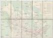
Limits of forest trees
1 : 12500000 Kanada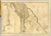
Map of the Oregon Territory.
1 : 3041280 Wilkes, Charles, 1798-1877
Chart of the North West Coast of America.
1 : 3040000 La Perouse, Jean-Francois de Galaup, comte de, 1741-1788
Cote, N.O. de l'Amerique. 3.
1 : 3100000 La Perouse, Jean-Francois de Galaup, comte de, 1741-1788
British Columbia
1 : 2450000
British North America. Sheet III. Pacific Coast.
1 : 2407680 Fullarton, A. & Co.
Philip’s Map of British Columbia and Vancouver Island
Philip's Map of British Columbia and Vancouver Island.
Oregon, Upper California & New Mexico.
1 : 6600000 Tanner, Henry S.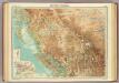
British Columbia.
1 : 2500000 John Bartholomew and Son
Bancroft's Map Of The Pacific States.
1 : 1520640 Knight, W.H.
Map of Oregon, Washington and part of Idaho.
from New general atlas.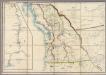
Map of the Oregon Territory
Wyld, James, 1812-1887