Maps of Piedmont
Schonberg's Map of North Carolina and South Carolina.
1 : 1900000 Schonberg & Co.
Carte des Provines Meridionales des Etats-Unis.
1 : 2400000 Marshall, John
Map showing route of marches of the army of Genl. W.T. Sherman, from Atlanta, Ga. to Goldsboro, N.C. : to accompany the report of operations from Savannah, Ga. to Goldsboro, N.C
1 : 1950000 United States. Army. Corps of Engineers Lith. of P.S. Duval & Son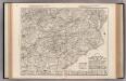
Auto Trail Map. Indiana, Ohio, Virginia, North Carolina, South Carolina, Georgia.
1 : 1893000 Rand McNally and Company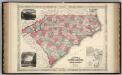
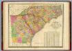
North And South Carolina.
1 : 1530000 Johnson, A.J.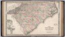
North Carolina and South Carolina.
1 : 1267000 Colton, G.W.
Virginiae partis australis, et Floridae partis orientalis, interjacentiumq[ue] regionum, nova descriptio.
from John H. Levine Collection Meurs, Jacob van; Montanus, Arnoldus,
Virginiae partis australis, et Floridae partis orientalis, interjacentiumq[ue] regionum nova descriptio.
from Parts J. and C. Blaeu: [Amsterdam]; Blaeu, Joan; Blaeu, Willem Janszoon,
Virginiae partis australis et Floridae partis orientalis interjacentimq[ue] regionum, nova descriptio.
from Charts and maps Ioannem Ianssonium?: [Amstelodami?]; Jansson, Jan,
Virginiae partis australis, et Floridae partis orientalis, interjacentiumq[ue] regionum nova descriptio.
from Parts J. and C. Blaeu: [Amsterdam]; Blaeu, Joan; Blaeu, Willem Janszoon,
Virginiae partis australis, et Floridae partis orientalis, interjacentiumq[ue] regionum nova descriptio.
from John H. Levine Collection J. and C. Blaeu: [Amsterdam]; Blaeu, Joan; Blaeu, Willem Janszoon,
Virginiae partis australis, et Floridae partis orientalis, interjacentiumq[ue] regionum nova descriptio.
from Charts and maps J. and C. Blaeu: [Amsterdam]; Blaeu, Joan; Blaeu, Willem Janszoon,
Virginiae partis australis, et Floridae partis orientalis, interjacentiumq[ue] regionum nova descriptio.
from Parts J. and C. Blaeu: [Amsterdam]; Blaeu, Joan; Blaeu, Willem Janszoon,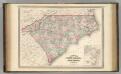
North Carolina and South Carolina.
1 : 1550000 Johnson, A.J.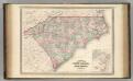
North Carolina and South Carolina.
1 : 1550000 Johnson, A.J.
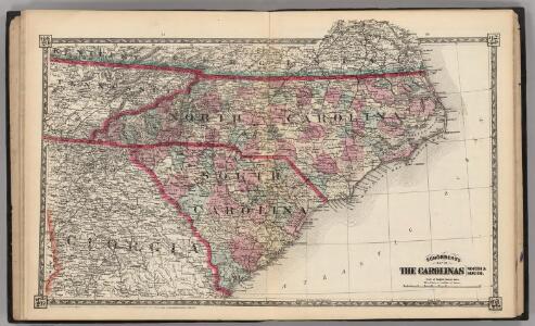
North Carolina, South Carolina, Georgia and eastern Tennessee
1 : 2000000 Charleston (Jižní Karolína) Bumstead, Albert H. National Geographic Society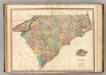
North & South Carolina.
1 : 1100000 Tanner, Henry S.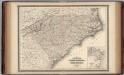
North Carolina and South Carolina.
1 : 1550000 Johnson, A.J.
North Carolina, South Carolina, Georgia and Eastern Tennessee

North Carolina. South Carolina.
1 : 2012000 Gray, Ormando Willis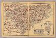
N. & S. Carolina.
1 : 1750000 Rand McNally and Company
Carte general de la Caroline: dresse sur les memoires le plus nouveaux
1 : 1300000 Published in N. Sanson's "Atlas Nouveau Contenant Toutes Les Parties du Monde", Paris, 1696, based on the 1685 Thornton-Morden-Lea map. Relief shown pictorially. Depths shown by soundings. Prime meridian: [Cadiz]. Includes inset [scale ca. 1:203,000] of the Ashley and Cooper Rivers, including Charles Town. Sanson, Nicolas, 1600-1667.;Mortier, Pierre. chez Pierre Mortier
North Carolina, South Carolina, Georgia and Eastern Tenessee

North Carolina, South Carolina, Georgia.
1 : 1788000 Finley, Anthony
North Carolina. South Carolina.
1 : 1431000 Hammond, C.S.
North & South Carolina.
1 : 2070000 Black, Adam & Charles

North Carolina and South Carolina.
1 : 1280000 Asher & Adams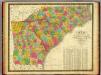
Map of North and South Carolina, and Georgia.
1 : 1800000 Mitchell, Samuel Augustus