Maps of United States

Map Of The United States.
1 : 13168000 U.S. War Department, Topographical Engineers
Westliches-Nordamerica
Neuer Handatlas über alle Theile der Erde Kiepert, Heinrich Verlag von Dietrich Reimer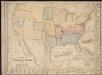
Military map of the United States & territories showing the location of the military posts, arsenals, Navy Yards, & ports of entry
Cuba. Various Regions and Cities in Florida.
Shell Oil Company
Maris Pacifici, America.
Schoner, Johann
Composite: Map of Louisiana and Mexico.
1 : 4300000 Tardieu, P.F.
Base-map of the United States
1 : 7000000 U.S. Coast and Geodetic Survey U.S. Coast and Geodetic Survey
North America, 1722.
1 : 25000000 Wells, Edward
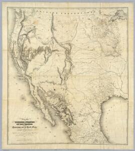
Map of the United States and their territories between the Mississippi and the Pacific Ocean; and part of Mexico
1 : 3200000 United States. Topographical Engineers. United States. Topographical Engineers.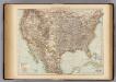
United States.
1 : 10000000 Andree, Richard; Times (London, England)
United States of America, 1900.
1 : 16000000 Schlitz Brewing Company
Map Of The Territory Of The United States From The Mississippi To The Pacific.
1 : 3000000 Warren, Gouverneur Kemble, 1830-1882
Map Of The Territory Of The United States From The Mississippi To The Pacific Ocean.
1 : 3000000 Warren, Gouverneur Kemble, 1830-1882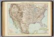
Vereinigte Staaten von Nordamerika.
1 : 10000000 Andree, Richard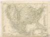
Vereinigte Staaten von Nord - America und Mexico
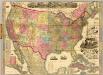
The American Republic and rail-road map of the United States.
1 : 4435200 Watson, Gaylord
Map Of The Territory Of The United States From The Mississippi To The Pacific Ocean.
1 : 3000000 Warren, Gouverneur Kemble, 1830-1882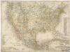
Vereinigte Staaten von Nord America - und Mexico

Reduced section, general map, North America, 1795.
1 : 18000000 Winterbotham, W.
Nouvelle Carte du Mexique, Du Texas.
1 : 4800000 Brue, Adrien Hubert, 1786-1832
Map of the United States of North America: with parts of the adjacent countries / by David H. Burr (late topographer to the Post Office), geographer to the House of Representatives of the U.S.
from Whole David H. Burr,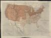
Map of the United States of North America, upper & lower Canada, New Brunswick, Nova Scotia & British Columbia, Mexico, Cuba, Jamaica, St. Domingo and the Bahama Islands
1 : 5800000
Map Atlantic Coast Line.
1 : 12503000 Atlantic Coast Line Railroad Company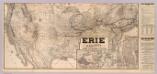
Erie Railway and connections.
1 : 8826000 New York, Lake Erie, and Western Railroad Company
Reduced section, map of North America, 1826.
1 : 18000000 Warren, Gouverneur Kemble, 1830-1882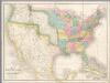
Map of the United States Of North America.
1 : 4118400 Burr, David H., 1803-1875
Map Of Mexico & California.
1 : 6000000 Hutawa, Julius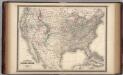
United States.
1 : 8800000 Johnson, A.J.
[Map of Spanish Louisiana and the American colonies]
from Whole