Maps of Jamaica
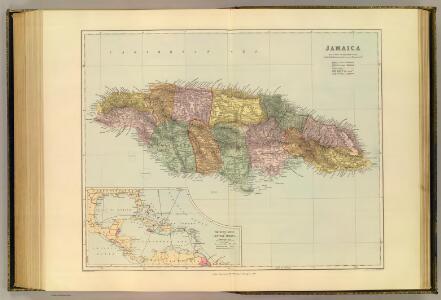
Jamaica.
1 : 418176 Stanford, Edward
Map Of Jamaica.
1 : 950400 Lea, I.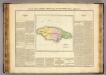
Jamaique.
1 : 940000 Buchon, J. A. C.; Carey, H. C.; Lea, I.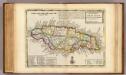
Island of Jamaica.
1 : 1100000 Moll, Herman, d. 1732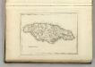
Jamaica.
1 : 813000 Melish, John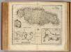
Jamaica.
1 : 785000 Bowen, Emanuel
Jamaica, Americae septentrionalis ampla insula, a Christophoro Columbo detecta, in suas gubernationes peraccurate distincta
1 : 500000 per Nicolaum Visser L. v. Anse schulp. Amst. Bat : nunc apud Pet: Schenk Jun.
Jamaica.
1 : 264000 Lucas, Fielding Jr.
Jamaica.
1 : 744000 Tallis, J. & F.
Jamaica - Leeward and Windward Islands.
1 : 3380000 Sharpe, J.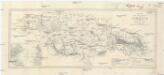
Map of the Island of Jamaica
1 : 519000 Atlantský oceán Edinburgh Geographical Institute
Jamaica, Americae septentrionalis ampla insula, a Christophoro Columbo detecta, in suas gubernationes peraccurate distincta
1 : 500000 per Nicolaum Visser L. v. Anse schulp. Amst. Bat. : [s.n.]
Jamaica.
1 : 1320000 Peterson, Augusts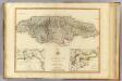
Jamaica.
1 : 500000 Robert Laurie & James Whittle
Carte de l'isle de la Jamaïque
1 : 860000
Carte de l'Isle de la Jamaique
1 : 1
Insula Iamaica : in suas parochias divisa et secundum exemplar primitivum Londinense excusa
1 : 1300000
The island of Jamaica, divided into its principal parishes, with the roads &c.
1 : 1075000
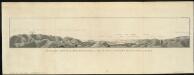
Map Of Jamaica According To A Survey Made In The Year 1670
This is a map of Jamaica in the year 1670. It is taken from the first volume of Edward Long's 'The History of Jamaica' which traces events on the island from the European occupation in 1655 to the late eighteenth century. On this map Jamaica is divided into parishes, with settlements, trees and dense vegetation marked and labelled. The depth of the harbours is also shown.
La Giammaica.
1 : 950000 Zatta, Antonio
Charte von Jamaica
1 : 950000 Jamajka Pluth, Fr.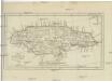
CHARTE von JAMAICA
1 : 950000 Jamajka Pluth, Fr.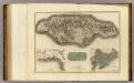
Jamaica.
1 : 500000 Thomson, John
Dominia Anglorum in praecipuis Insulis Americae ut sunt Insula S. Christophori, Antegoa, Iamaica, Barbados nec non Insulae Bermudes vel Sommers dictae
singulari mappa omnia exhibita et edita ab Homannianis Heredibus [Nürnberg] : [Homannische Erben]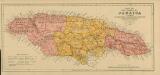
Map of the Island of Jamaica
Map of the Island of Jamaica, prepared for the Jamaica Handbook, under the direction of Thomas Harrison, Govt. Surveyor, by Colin Liddell, 1895. Scale of statute miles, 34[ = 130 mm] Kingston, Jamaica : Government Printing Office
Map of Jamaica.
1 : 411840 Arrowsmith, John
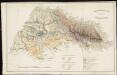
Geological map of part of Jamaica
1 : 1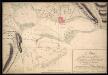
A Plan Of The Harbours And Towns Of Kingston And Port Royal In The Island Of Jamaica And Of Their Environs
Plan of the harbours and towns of Kingston and Port Royal in Jamaica as they were in 1815. The complete harbour consists of almost landlocked area approximately 10 miles long and 2 miles wide. The surveyor, Nathaniel Watts, has coloured settlements in pink, and has marked in fathoms the different depths of the harbour. In the late 17th century Port Royal had been a large, economically prosperous town and was the central trading post in the Caribbean. However it was largely destroyed by an earthquake in 1692, leading to the founding of Kingston the following year. Kingston (which took over from Spanish Town as the capital of the island in 1872) was more difficult for vessels to reach as it was further inland and had more shallow waters. It was built on land owned by Sir William Beeston, who sold it to the Council of Jamaica for £1,000. John Goffe was employed to survey the land and he was responsible for laying it out in its regular rectangularrectilinear patternrectangular formation. Watts, Nathanial. Cartographer.