Maps of United States

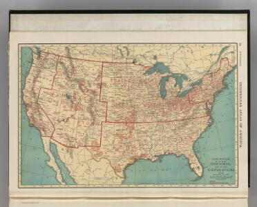
Industrial Map of the United States.
1 : 10138000 Rand McNally and Company
United States.
1 : 9900000 Rand McNally and Company
Walling and Grey's map of the United States and territories
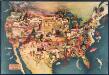
Paul Sample's America: Its Soil
This bird's-eye-view map shows scenes of land use and farming superimposed on a map of the United States. Agricultural scenes of farming, livestock, and crops are depicted. Sample, Paul Associatedd American Artists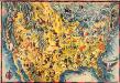
The Covarrubias America: a decorative map of the United States of America
This pictorial bird's-eye-view map shows the United States of America with parts of Canada and Mexico. Landscape, trade, industry, points of interest, people, and animals are depicted. Covarrubias, Miguel Edward Stern & Co.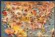
Bohrod's America, its history
This map shows scenes from America's history with names of historical events superimposed on a map of the United States. Bohrod, Aaron Associated American Artists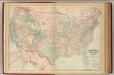
United States, territories.
1 : 8000000 Asher & Adams
Vereinigte Staaten von Nord Amerika
United States
1 : 2500000 Geological Survey (U.S.) Geological Survey (U.S.)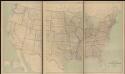
United States
1 : 2500000 Geological Survey (U.S.) Geological Survey (U.S.)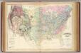
U.S. geological map.
1 : 6696600 Asher & Adams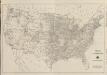
Composite: Black and White Mileage Map of the United States.
1 : 5132000 Rand McNally and Company
Gray's Botanical and Zoological Maps of the United States.
1 : 18000000 Gray, Ormando Willis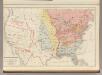
Discoveries and Settlements in Canada and the United States.
1 : 10000000 Rand McNally and Company
Botanical Divisions of the United States.
1 : 12400000 Porter, Thomas C.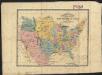
The United States : the relative position of the Oregon & Texas and California
1 : 19000000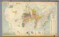
United States -- Pleistocene Eolian Deposits
1 : 2500000 The Geological Society of America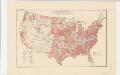
Areas covered by the soil survey, completed to January 1934
1 : 7900000 Includes numbered list of reconnaissance surveys. "Atlas of American Agriculture, Soils, Plate 1." United States. Bureau of Chemistry and Soils. [Washington, D.C.?] : The Bureau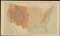
United States relief map
1 : 7000000 Geological Survey (U.S.) Geological Survey (U.S.)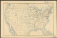
United States
1 : 11875000 Geological Survey (U.S.) Geological Survey (U.S.)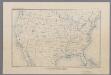
United States
1 : 16500000 [Washington, D.C. : U.S. Geological Survey]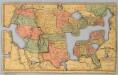
Map of the United States and Canada.
1 : 11404800 Merriam, Moore & Co.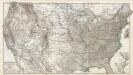
Composite: Vereinigten Staaten von Nord-Amerika in 6 Blattern.
1 : 3700000 Petermann, A.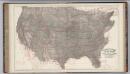
Climatological Map of the United States.
1 : 3740000 Blodget, Lorin
Vereinigte Staaten v. Nord-America.
1 : 11500000 Flemming, Carl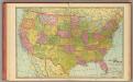
United States.
1 : 9400000 Cram, George Franklin
Zoological Divisions of the United States.
1 : 12400000 Cope, Edward D.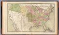
United States.
1 : 7920000 Goodrich, S.G.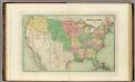
United States.
1 : 8236800 Bradford, Thomas G.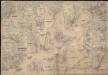
Colton's plans of U.S. harbors, showing the positions & vicinities of the most important fortifications on the sea-board and in the interior

H.H. Lloyd & Co's campaign military charts showing places of interest