Maps of Finger Lakes
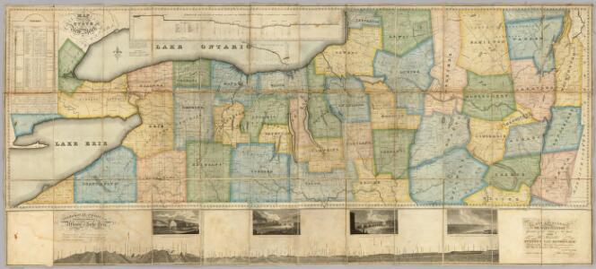
Map of the Western Part of the State Of New York.
1 : 330000 Vance, David H.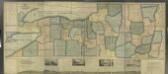
Map of the western part of the state of New York, 1823 / by D.H. Vance ; improved and enlarged to the east boundary of the state by J. Ogden Dey, 1824 ; engraved by Balch, Rawdon & Co.
from (A-Z)
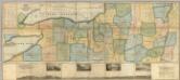
A new map and profile of the proposed canal from Lake Erie to Hudson River in the State of New York / contracted by direction of the Canal Commissioners from the maps of the engineers 1821.
from Erie Canal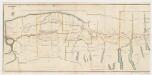
A new map and profile of the proposed canal from Lake Erie to Hudson River in the state of New York : Western sheet
1 : 253440 New York (State). Canal Commissioners W. A. Mercein, printer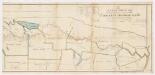
A new map and profile of the proposed canal from Lake Erie to Hudson River in the state of New York : Eastern sheet
1 : 253440 New York (State). Canal Commissioners W. A. Mercein, printer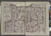
"Monroe, Livingston, Allegany, Wayne, Ontario, Steuben, Yates, Schuyler, Chemung, Seneca, Cayuga, Tompkins, Tioga, Onondaga, and Cortland Counties "
from New topographical atlas and gazetteer of New York, comprising a topographical view of the several counties of the state, ... including ... map of the United States and territories ... Compiled from the latest astronomical observations, official surveys and records of the United States and territories ...
Map of the state of New York.
from Whole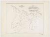
Map of the head waters of the rivers Susquehanna & Delaware embracing the early patents on the south side of the Mohawk River : from the original, drawn about the year 1790
1 : 260000 De Witt, Simeon, 1756-1834 Weed, Parsons & Co.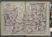
"Oneida, Madison, Otsego, Fulton, Montgomery, Schenectady, Albany, Schoharie, Warren, Saratoga, Washington, and Rensselaer Counties"
from New topographical atlas and gazetteer of New York, comprising a topographical view of the several counties of the state, ... including ... map of the United States and territories ... Compiled from the latest astronomical observations, official surveys and records of the United States and territories ...
New York.
1 : 614000 Hammond, C.S.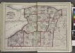
"Niagara, Erie, Chautauqua, Cattaraugus, Orleans, Genesee, Wyoming, Allegany, Monroe, and Livingston Counties"
from New topographical atlas and gazetteer of New York, comprising a topographical view of the several counties of the state, ... including ... map of the United States and territories ... Compiled from the latest astronomical observations, official surveys and records of the United States and territories ...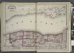
"Niagara, Orleans, Genesee, Monroe, and Wayne counties"
from New topographical atlas and gazetteer of New York, comprising a topographical view of the several counties of the state, ... including ... map of the United States and territories ... Compiled from the latest astronomical observations, official surveys and records of the United States and territories ...
Hamilton County.
from Atlas of New York.
Map of Morris's Purchase or West Geneseo in the state of New York : exhibiting part of the Lakes Erie and Ontario, the Straights of Niagara ...
1 : 336000 Ellicott, Joseph Holland Land Co.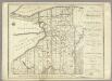
Map of Morris's Purchase or West Geneseo In the State of New York.
1 : 336000 Ellicott, Joseph & B.
"Onondaga, Cortland, Broome, Madison, and Chenango Counties"
from New topographical atlas and gazetteer of New York, comprising a topographical view of the several counties of the state, ... including ... map of the United States and territories ... Compiled from the latest astronomical observations, official surveys and records of the United States and territories ...
Map of the county of Cayuga / by David H. Burr ; engd. by Rawdon, Clark & Co., Albany, & Rawdon, Wright & Co., N.Y.
from An atlas of the state of New York : containing a map of the state and of the several counties / by David H. Burr.
Binghamton
1 : 250000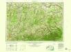
Binghamton
1 : 250000
Binghamton
1 : 250000
Binghamton
1 : 250000
Binghamton
1 : 250000
Elmira
1 : 250000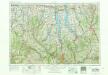
Elmira
1 : 250000
Elmira
1 : 250000
Elmira
1 : 250000
Elmira
1 : 250000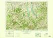
Elmira
1 : 250000
Elmira
1 : 250000
Elmira
1 : 250000