Maps of Abitibi-Témiscamingue

Quebec.
1 : 1280000 Asher & Adams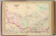
Quebec, part.
1 : 1267200 Asher & Adams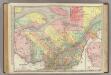
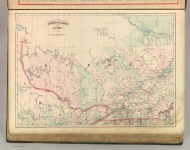
Quebec.
1 : 1204000 Rand McNally and Company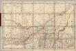
(Quebec, New England) Railroad Map of the United States.
1 : 506880 Rand McNally and Company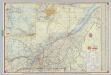
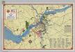
Shell Highway Map of Quebec.
1 : 950400 Shell Oil Company
Lower Canada.
1 : 1520640 Burr, David H., 1803-1875
East Part of Canada.
1 : 1440000 Greenleaf, Jeremiah
Lower Canada.
1 : 1440000 Greenleaf, Jeremiah
(Canada, Louisiane et Terres Angloises. Southeast section) Le Fleuve Saint-Laurent.
1 : 910000 Anville, Jean Baptiste Bourguignon d, 1697-1782
Canada East.
1 : 1500000 Morse, Sidney E. (Sidney Edwards), 1794-1871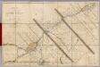
Seat of War in Lower Canada.
1 : 443520 Lay, Amos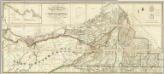
Map of the District Of Montreal, Lower Canada.
1 : 174240 Wyld, James, 1812-1887
Schonberg's Map of Canada East.
1 : 1939000 Schonberg & Co.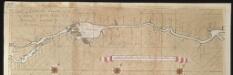
La riviere de Canada ou de St. Laurens de Quebec jusqu'à I. de Montreal aux Nord de l'Amérique
Canada Gerard van Keulen
Canada East (Lower).
1 : 1750000 Tanner, Henry S.
(This Topographical map of the Province of Lower Canada. Sheet) B-C.
1 : 174240 Faden, William, 1750?-1836
(This Topographical map of the Province of Lower Canada. Sheet) A.
1 : 174240 Faden, William, 1750?-1836
(This Topographical map of the Province of Lower Canada. Sheet) A-B.
1 : 174240 Faden, William, 1750?-1836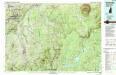
Sherbrooke
1 : 100000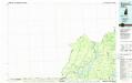
Sherbrooke
1 : 100000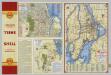
Downtown Montreal. Seeing Montreal. Shell Metropolitan District of Montreal.
Shell Oil Company
Montreal.
Rand McNally and Company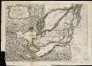
The Isles of Montreal as they have been survey'd by the French engineers
1 : 170000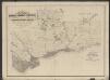
Plan shewing the distribution of the plumbago & phosphate of Lime Rocks : and the position of the most important mining locations in the townships of Buckingham, Portland and Templeton
1 : 88000 Vennor, Henry George 1840-1884 Montréal : The Burland-Desbarats Litho. Compy.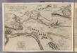
River St. Laurence.
1 : 34000 Jefferys, Thomas
Quebec and Adjacent Country ... during the Siege by General Wolfe in 1759.
1 : 29000 Melish, John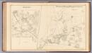
Pittsburg, Hubbard, Webster, Carlisle, Jefferson.
1 : 51000 D.H. Hurd & Co.
Shell Street Map of Montreal.
1 : 38016 Shell Oil Company
Plan of the military & naval operation under the command of the immortal Wolfe, & vice admiral Saunders, before Quebec
1 : 23700 Hawkins, Alfred, 1802?-1854 Jas. Wyld