Maps of Rocky Mountains

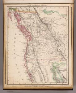
Oregon-Gebiet.
1 : 5650000 Flemming, Carl
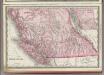
Oregon, Upper California.
1 : 10000000 Mitchell, Samuel Augustus
Sectional map indicating main automobile roads between Canada and United States
1 : 2534400 Kanada západní National Development Bureau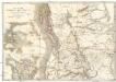
Map of the Oregon districts and the adjacent country
Kanada Wyld, James James Wyld
Oregon.
from The cerographic atlas of the United States. By Sidney E. Morse, A.M., and Samuel Breese, A.M.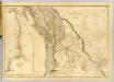
Map of the Oregon Territory.
1 : 3041280 Wilkes, Charles, 1798-1877
Pacific Coast Steamship Company.
1 : 3000000 Pacific Coast Steamship Co.
Oregon Territory.
1 : 6969600 Burr, David H., 1803-1875
Oregon Territory.
1 : 7200000 Greenleaf, Jeremiah
Oregon Territory.
1 : 7603200 Greenleaf, Jeremiah
Map of Oregon, Washington and part of Idaho.
from New general atlas.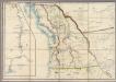
Map of the Oregon Territory
Wyld, James, 1812-1887
Bancroft's Map Of The Pacific States.
1 : 1520640 Knight, W.H.
Oregon, Upper California & New Mexico.
1 : 6600000 Tanner, Henry S.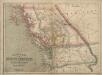
Philip’s Map of British Columbia and Vancouver Island
Philip's Map of British Columbia and Vancouver Island.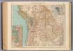
138-39. Wash., Ore., Ida.
1 : 3000000 Touring club italiano
U.S. West of Mississippi R. 1.
1 : 2000000 Freyhold, Edward; Warren, Gouverneur Kemble, 1830-1882; United States. Army. Corps of Engineers
Map of an exploring expedition to the Rocky Mountains in the year 1842 and to Oregon & north California in the years 1843-44 / by Brevet Capt. J.C. Frémont of the Corps of Topographical Engineers under the orders of Col. J.J. Abert, Chief of the Topog...
From Parts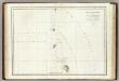
Cote, N.O. de l'Amerique. 3.
1 : 3100000 La Perouse, Jean-Francois de Galaup, comte de, 1741-1788
Chart of the North West Coast of America.
1 : 3040000 La Perouse, Jean-Francois de Galaup, comte de, 1741-1788
Washington, Mt. Rainier National Park : topography / R.B. Marshall, chief geographer ; T.G. Gerdine, geographer in charge ; topography by F.E. Matthes ... [et al.] ; engraved by U.S.G.S.
1 : 62500 Annotatie geografische gegevens: Opname: 1910-1911, 1913 Marshall, R. B.; Gerdine, T. G.; Matthes, François E.; United States Geological Survey [Washington, D.C. : U.S. Geological Survey]
[Die Vereinigten Staaten von Amerika in 6 Blättern, Blatt 1]
Adolf Stieler's Handatlas über alle Theile der Erde und über das Weltgebäude Stieler, Adolf Justus Perthes
Vereinigte Staaten Von Nord-Amerika In 6 Blattern, Bl. 1.
1 : 3700000 Petermann, A.
[Die Vereinigten Staaten von Nord-Amerika, Blatt 1]
Handatlas über alle Theile der Erde und über das Weltgebäude Stieler, Adolf Justus Perthes
Bancroft's Map Of Oregon, Washington, Idaho, Montana And British Columbia.
1 : 1520640 Bancroft, H.H.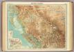
British Columbia.
1 : 2500000 John Bartholomew and Son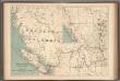
No.13, Telegraphs : British Columbia, Yukon and Alberta
1 : 2217600 Canada. Department of Interior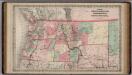
Oregon and Washington Territory.
1 : 3000000 Colton, G.W.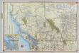
Shell British Columbia - Alberta.
1 : 2471040 Shell Oil Company