Maps of Nordrhein-Westfalen

Westphalen.
1 : 720000 Flemming, Carl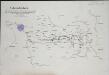
Übersichts-Karte der Operationen der allirten und französischen Armee von Eröffnung des Sommerfeldzuges bis zur Schlacht bei Vellinghausen oder vom Anfang Juni bis 15t Juli 1761
1 : 600000
Estat et Seigneurie de l'Eves.ché de Lyege
1 : 240000 Mollova mapová sbírka Sanson, Guillaume Jaillot, Alexis Hubert
Le cercle de Westphalie
1 : 740000 Vestfálsko (Německo) Jaillot, Alexis-Hubert I. Cóvens et C. Mortier
Circuli Westphaliae in omnes suos status et provincias accurate divisi
1 : 700000 Vestfálsko (Německo) Homann, Johann Baptist edita sumtibus Ioh. Baptistae Homann
Circuli Westphaliae in omnes suos status et provincias accurate divisi nova et exacta tabula
1 : 700000 Dolní Sasko (Německo) Homann, Johann Baptist Ioh. Baptistae Homann
Circuli Westphaliae in omnes suos status et provincias accurate divisi
1 : 700000 Vestfálsko (Německo) Homann, Johann Baptist edita sumtibus Ioh. Baptistae Homann
Circuli Westphaliae in omnes suos status et provincias accurate divisi
1 : 700000 Vestfálsko (Německo) Homann, Johann Baptist edita sumtibus Ioh. Baptistae Homann
Circuli Westphaliae in omnes suos status et provincias accurate divisi nova et exacta tabula
1 : 700000 Dolní Sasko (Německo) Homann, Johann Baptist Ioh. Baptistae Homann
Charte von den Grosherzogthümern Berg und Hessen, den Fürstlich-Primatischen Laendern; dem Herzogthume Nassau und den übrigen darinne begränzten, zum Theil noch uneingetheilten Laendern
1 : 820000 Streit, Friedrich Wilhelm Verl. des Geograph. Inst.
Nova et exacta mappa geographica exhibens Circulum Westphalicum, in omnes suos status et provincias accurate divisum
1 : 700000 Aug. Vind : cura et sumptibus Tobiae Conradi Lotter
La Westphalie
1 : 692000 Vestfálsko (Německo) Le Rouge, Georges-Louis Homann, Johann Baptist Le Rouge
Le Cercle de Westphalie divisé en tous ses Estats et Souverainetés
1 : 760000 Mollova mapová sbírka Sanson, Guillaume Cordier, Louis Jaillot, Alexis Hubert
Le Cercle de Westphalie
1 : 600000 Mollova mapová sbírka Sanson, Guillaume Jaillot, Alexis Hubert
Geologische Übersichtskarte der Rheinprovinz und der Provinz Westfalen / bearb. von H. von Dechen
1 : 500000 Annotatie: Oorspr. uitg.: 1866 Heinrich von Dechen Berlin : Schropp
Circuli Westphaliæ in omnes suos status et provincias accuratè divisi nova et exacta tabula
1 Karte : Kupferdruck ; 56 x 48 cm Homann Johann Baptist Homann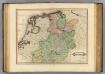
Westphalia.
1 : 1000000 Lizars, Daniel

Le cercle de Westphalie divisée en tous ses etats et principautés
1 : 700000 Vestfálsko (Německo)
Circuli Westphaliae quoad partem septentrionalem in suos status ecclesiasticos & seculares divisi
1 : 690000 Vestfálsko (Německo) edita sumtibus Hommanianorum Herredum
CIRCULI WESTPHALIAE quoad [sic] partem septentrionalem in suos Status ecclesiasticos & seculares divisi Tabula geographica
1 : 690000 Vestfálsko (Německo) edita sumtibus Hommanianorum Herredum
Nova et Exacta Mappa Geographica exhibens Circulum Westphalicum
1 : 700000 Mollova mapová sbírka Lotter, Tobias Conrad Lotter, Tobias Conrad
Circuli Westphaliae in omnes suos Status et Provincias accuratè divisi Nova et exacta Tabula
1 : 700000 Mollova mapová sbírka Homann, Johann Baptist Homann, Johann Baptista
S. R. I. Westphaliae Circulus, in omnes ejusdem subjacentes Provincias exactißimè distinctus.
1 : 690000 Mollova mapová sbírka Visscher, Nicolaes Jansz. Visscher, Nicolaus
S.R.I. Westphaliae circulus
1 : 687000 Vestfálsko (Německo) Visscher, Nicolaus Schenk, Pieter Pet Schenk Iunior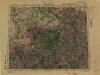
1:500,000 Europe (Air) G.S.G.S. No. 4072, Frankfurt
Sheet NE50-6 from the map series: 1:500,000 Europe (Air) G.S.G.S. No. 4072.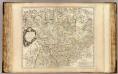
Westphalie, O. Frise, Oldenbourg.
1 : 620000 Robert de Vaugondy, Gilles, 1688-1766
Teutschlandes Westphaelischer Creiss samt dazu gehörigen Provintzien
1 : 2600000 Mollova mapová sbírka Weigel, Christoph Weigel, Christoph I.
Westfaliae Ordines secundum regiones suas distincti addita cursus publici permutatione curante
1 : 1100000 Mollova mapová sbírka Weigel, Christoph Kauffer, Michael Weigel, Christoph I.


