Maps of Balkan Pen.
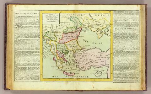
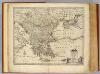
Turquie d'Europe.
1 : 6000000 Clouet, J. B. L. (Jean-Baptiste Louis), b. 1730
Turkey in Europe.
1 : 3450000 Cary, John, ca. 1754-1835
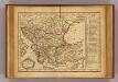
Turkey, in Europe and Hungary.
1 : 5800000 Carey, Mathew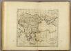
Turkey, in Europe and Hungary.
1 : 5900000 Carey, Mathew
Turkey, in Europe and Hungary.
1 : 5702400 Carey, Mathew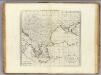
Turkey, in Europe and Hungary.
1 : 6336000 Carey, Mathew
Turkey, in Europe and Hungary.
1 : 6336000 Carey, Mathew
La Turchia d'Europa
1 : 10000000 Evropa jihovýchodní
Das Osmanische Reich in Europa
1 : 2960000 Kréta (Řecko) Walch, Johann Ioh. Walch
Turkey in Europe.
1 : 2900000 Faden, William, 1750?-1836
Schematičeska karta na M. Dehn
Balkanhalbinsel Grenze Balkankrieg <1912-1913> Kartogramm
Turkey in Europe.
1 : 2750000 Robert Laurie & James Whittle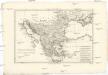
Turquie d'Europe
1 : 6960000 Balkánský poloostrov Bonne, Rigobert André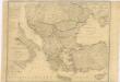
Karte von dem Osmanischen Reiche in Europa
Turky in Europe.
1 : 3900000 Bowen, Emanuel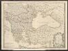
Turkey
A new general atlas of modern geography, consisting of a complete collection of maps of the four quarters of the globe Wyld, James James Wyld
Bez titulu: soubor map pag. 265

A General Map of Turky in Europe, Hungary etc
1 : 7000000 Mollova mapová sbírka Moll, Herman Moll, Hermann
Uebersichts Karte des Türkischen Reiches in Europa und Asien
1 : 4800000 Blízký východ Häussle, Joseph C.E. Rainold
Turquie.
1 : 9300000 Delamarche, Charles Francois; Lattre, Jean
Tabula Europae IX. [Karte], in: Claud. Ptolemaeus. Geographia lat. cum mappis [...], S. 278.
1 Karte aus Atlas Münster, Sebastian [und Ptolemaeus, Claudius]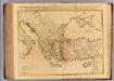
Orbis Romani descriptio.
1 : 3800000 L'Isle, Guillaume de, 1675-1726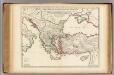
Orbis Romani descriptio.
1 : 3800000 L'Isle, Guillaume de, 1675-1726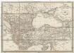
Karte des Ottomanischen Reiches in Europa und Asien
1 : 3230000 Asie Berthe, L. Artaria
[Turcia Evropaea] qua maxima pars Danubii et praesertim Hungaria
1 : 4000000 Achaia (Řecko) Seutter, Matthäus a Matthaeo Seutter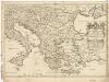
Estats de l'empire des Turqs en Europe
1 : 4270000 Evropa jihovýchodní Sanson, Guillaume Cordier, Louis chez H. Iaillot
Nr. 5. Rußland und Konstantinopel
Schwarzmeer-Gebiet
Totius Danubii
1 : 4000000 Mollova mapová sbírka Böhme, August Gottlob Dorn, Sebastian Homann, Johann Baptista - dědici