Maps of Pomeroon-Supenaam

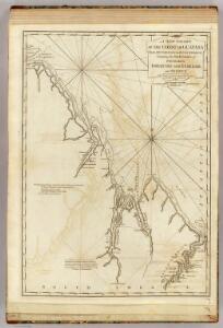
A new chart of the coast of Guyana from Rio Orinoco to River Berbice.
1 : 550000 Jefferys, Thomas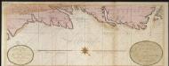
De kust van Guijana tussen R. Cupanama en Rio Oronoque
Guyana Gerard van Keulen
Facsimile: Part of the Great Colonial Map by Schomburgk.
1 : 1430000 Brown, Charles B.
Facsimile: Jesuit Missions of New Granada by Gumilla.
1 : 10300000 Gumilla, Joseph
Coast Region of the Essequibo Colony by Chollet(?).
Chollet, L.
Essequibo and Demerara by Heneman.
Heneman, J.C. v.
Facsimile: Chart of Guiana by Raleigh.
Raleigh, Walter
Essequibo by Storm Van's Gravesande.
Van's Gravesande, Storm
Facsimile: Part of Guiana by Bouchenroeder.
1 : 1500000 Bouchenroeder, F. Von
Early Spanish Map of Guiana.
1 : 5850000 Anonymous
Capuchin Missions of Guayana.
Anonymous
Facsimile: Part of Chart of the Guiana Coast by Jefferys.
1 : 560000 Jefferys, Thomas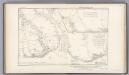
Essequibo and Demerara by Bouchenroeder.
Bouchenroeder, F. Von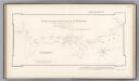
Essequibo by Siraut - Destouches.
Siraut - Destouches, A.
(Facsimile) Part of Chart of the Guiana Coast by Jefferys.
1 : 550000 Jefferys, Thomas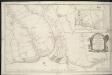
Carte generale et particulier de la colonie d'Essequebe & Demerarie situee dans la Guiane en Amerique
1 : 190080
Kaart van de kust van Guaiana tusschen de rivieren Essequebo en Oronoque beneffens de oosthoek der eylanden Trinidad en Tabago
1 : 500000 Amsterdam : G.H. van Keulen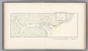
Essequibo by Siraut - Destouches.
Siraut - Destouches, A.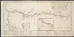
Caerte van de Rivier Demerary van ouds Immenary, geleger op Suyd Americaes Noordkust, op de Noorder Breedte van 6 Gr. 40
1 : 162400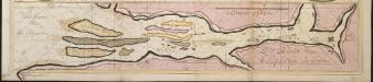
De Rivier van Esequeba int Groot
Guyana Gerard van Keulen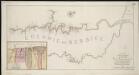
Nieuwe gameten Kaart van de Colonie de Berbice met der zelver Plantagien en de Namen der Bezitters
1 : 256000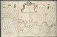
Nieuwe ez zeer accuraate generaale caart van de twee rievieren Berbice en Canja met alle desselts plantagien en gronden op ordre van de Edl. Agtere. Heeren Direceuren van de geoctroyeerde colonie
1 : 91870
[Carte de la riviere et de la colonie Demerari jusqu'a Mahayka Creek]
1 : 118800
Mouth of the Cuyuni by Heneman.
Heneman, J.C. v.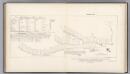
Pomeroon Coast Region by Chollet.
Chollet, L.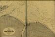
Georgetown and Mouths of Demerara and Essequibo Rivers
Georgetown and Mouths of Demerara and Éssequibo Rivers. Surveyed ... 1886-7. ... Scale, 1 : 48,375. [Admiralty Chart]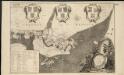
Naaukeurige platte grond van den staat loop van Rio de Berbice met derzelver plantagien in de geoctrojeerde colonie de Berbice
1 : 314957
British Guayana.
1 : 2800000 Tallis, J. & F.
Boundaries Claimed or Proposed.
1 : 2027520 Venezuela-British Guiana Boundary Commission