Maps of Saginaw County

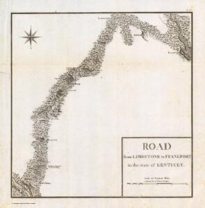
Road from Limestone to Frankfort in the state of Kentucky.
1 : 253440 Tardieu, P.F.
Butler, Clermont, Hamilton, Montgomery, Preble and Warren counties.
1 : 300000 Walling, H. F.
(Map of Cheboygan County, Michigan)
1 : 190080 Walling, H. F.
(Map of Saginaw County, Michigan)
1 : 190080 Walling, H. F.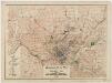
Regional plan map of Cincinnati, Ohio
1 : 62500 Technical Advisory Corporation (New York, N.Y.) Technical Advisory Corp.
(Map of Bay County, Michigan)
1 : 190080 Walling, H. F.
(Map of Lenawee County, Michigan)
1 : 190080 Walling, H. F.
(Map of Jackson County, Michigan)
1 : 190080 Walling, H. F.
Cincinnati, Covington, Newport.
1 : 45000 United States. War Department
(Map of Clinton County, Michigan)
1 : 190080 Walling, H. F.
(Map of Gratiot County, Michigan)
1 : 190080 Walling, H. F.
(Map of Roscommon County, Michigan)
1 : 190080 Walling, H. F.
(Map of Ogemaw County, Michigan)
1 : 190080 Walling, H. F.
(Map of Crawford County, Michigan)
1 : 190080 Walling, H. F.
(Map of Oscoda County, Michigan)
1 : 190080 Walling, H. F.
(Map of Montmorency County, Michigan)
1 : 190080 Walling, H. F.
(Map of Shiawassee County, Michigan)
1 : 190080 Walling, H. F.
(Map of Ingham County, Michigan)
1 : 190080 Walling, H. F.
(Map of Midland County, Michigan)
1 : 190080 Walling, H. F.
(Map of Gladwin County, Michigan)
1 : 190080 Walling, H. F.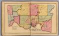
Hamilton County.
1 : 76032 Harrison, Robert H.; Titus, Clarence O.
(Map of Hillsdale County, Michigan)
1 : 190080 Walling, H. F.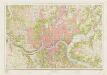
Cincinnati and vicinity : Ohio --Ky
1 : 24000 Geological Survey (U.S.) [Geological Survey]
(Map of Otsego County, Michigan)
1 : 190080 Walling, H. F.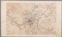
[Recto], uit: Ohio-Kentucky, Cincinnati quadrangle : topography / geo[graphy] T. Hawkins and W.J. Peters ; topography by Chas. E. Cooke
1 : 62500 Annotatie geografische gegevens: Opname: 1898 Hawkins, T.; Peters, W. J.; Cooke, Chas. E. [Washington, D.C. : U.S. Geological Survey]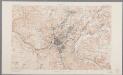
Ohio-Kentucky, Cincinnati quadrangle : topography / geo[graphy] T. Hawkins and W.J. Peters ; topography by Chas. E. Cooke
1 : 62500 Annotatie geografische gegevens: Opname: 1898, herzien in 1912 (bebouwing) Hawkins, T.; Peters, W. J.; Cooke, Chas. E. [Washington, D.C. : U.S. Geological Survey]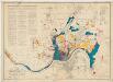
Official city plan map Cincinnati, Ohio
1 : 24000 Technical Advisory Corporation (New York, N.Y.) Technical Advisory Corp.
Bryan
1 : 62500
Bryan
1 : 62500
Lexington
1 : 62500
Lexington
1 : 62500
Lexington
1 : 48000
Georgetown
1 : 62500
Georgetown
1 : 62500