Maps of Mexico

United States Of Mexico.
1 : 12672000 Burr, David H., 1803-1875
Mexico, Texas, Californien, C. America.
1 : 6000000 Kiepert, Heinrich, 1818-1899
United States Of Mexico.
1 : 12700000 Greenleaf, Jeremiah
United States Of Mexico.
1 : 12800000 Greenleaf, Jeremiah
Mexico, California & Texas.
1 : 12300000 Hughes, William
Mexico.
1 : 16500000 Lucas, Fielding Jr.
Mexico.
1 : 6650000 Arrowsmith, John
Mexico & Guatemala.
1 : 11700000 Tanner, Henry S.
Mexico; Mexico to Vera-Cruz; The Isthmus of Tehuantepec
from New illustrated atlas of Dutchess County, New York. / Compiled & drawn from personal examinations, surveys etc. under the personal supervision of O.W. Gray & Son and F.A. Davis, and published under the superintendence of H. L. Kochersperger.
Mexico.
1 : 6969600 Arrowsmith, John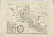
Carte du Méxique ou de la Nouvelle Espagne, où l'on peut suivre les mouvemens de Cortez
[S.l.] : [s.n.]
Mexico and Guatemala.
1 : 11800000 Tanner, Henry S.
Mexico.
1 : 11200000 Radefeld, Carl Christian Franz, 1788-1874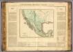
Mexique.
1 : 10000000 Buchon, J. A. C.; Carey, H. C.; Lea, I.
Neueste Karte von Mexico
Grosser Hand-Atlas über alle Theile der Erde in 170 Karten Meyer, J. Verlag des Bibliographischen Instituts
Composite: Mexico.
1 : 2500000 Humboldt, Alexander von, 1769-1859
Mexico and Adjacent Provinces.
1 : 2450000 Humboldt, Alexander von, 1769-1859
Map of Mexico : including Yucatan & Upper California, exhibiting the chief cities and towns, the principal travelling routes &c
1 : 7300000 Mitchell, S. Augustus (Samuel Augustus), 1792-1868 S. Augustus Mitchell
Map Of Mexico, Including Yucatan & Upper California.
1 : 7350000 Stealey, Geo.
Nouvelle Carte du Mexique, Du Texas.
1 : 4800000 Brue, Adrien Hubert, 1786-1832
Mexico & Guatemala.
1 : 11800000 Mitchell, Samuel Augustus
Mexico & Guatemala.
1 : 12000000 Tanner, Henry S.
Mexico & Guatemala.
1 : 12000000 Tanner, Henry S.
Mexico, Texas und Californien
1 : 6000000 bearb. und gezeichnet von H. Kiepert Situation und Schrift gestochen von K. Mädel ; Terrain von C. Jungmann Weimar : Verlag des Geographischen Institus
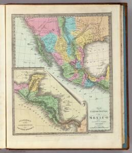
A Map Of The United States Of Mexico.
1 : 5195520 Tanner, Henry S.
Mexique.
1 : 8900000 Lapie, M. (Pierre), 1779-1850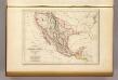
Etats-Unis du Mexique, 1835.
1 : 17000000 Malte-Brun, Conrad, 1775-1826
Etats-Unis Mexicains, Texas, Amerique Centrale.
1 : 9300000 Picquet, C.
Westliches-Nordamerica
Neuer Handatlas über alle Theile der Erde Kiepert, Heinrich Verlag von Dietrich Reimer