Maps of Pontic Steppe
Europe 4.
1 : 3850000 Brue, Adrien Hubert, 1786-1832
Karte von Europa, 4
4 Blätter : 52 x 70 cm Verlag der Königlich-Preussischen Academie-Kunst- und Buchhandlung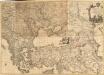
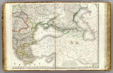
Le Theatre de la Guerre entre les deux puissans Empires de Russie et de Turquie, tant en Europe qu'en Asie :
1 : 2200000 Mollova mapová sbírka Jaeger, Johann Wilhelm Abraham Facius, Johann Gottlieb Jäger, Johann Wilhelm Abraham
[Ethnographische Karte von Europa]
Zweiter Band, enthaltend in vier Abtheilungen die Vertheilung der Organismen: 5. Pflanzen-Geographie, 6. Thier-Geographie, 7. Anthropographie, 8. Ethnographie Humboldt, Alexander von Verlag von Justus Perthes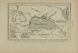
Pénétration et marche des Avars en Europe orientale
Osteuropa Avaren Völkerwanderungszeit
Europa befolkningskarta

Südeuropa
1 : 2500000 Blízký východ Gea Verlag
Het oorlogsterrein aan de Zwarte Zee : (vogelperspectief)
Annotatie: Onder de kaart: De toeschouwer stelle zich geplaatst te zijn 300 k.m. boven den Hellespont met het gezicht naar het Noord-Oosten Arnhem : Van Egmond & Heuvelink
Nr. 5. Rußland und Konstantinopel
Schwarzmeer-Gebiet
Balkánské státy a Turecko
1 : 3000000 Bospor (Turecko : průliv) Paulík, Ant. Klus, František Ústřední učitelské nakladatelství a knihkupectví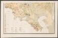
Carte des gîtes miniers de la Russie d'Europe
1 : 4200000 Süd-Blatt Möller, Valerian von Département des Mines de Russie
Grece. Caucase et Crimee.
1 : 2000000 Jouvet et Cie.
Partie orient.le de la mer Méditerranée
1 Karte : Kupferdruck ; 49 x 55 cm Robert de Vaugondy chés l'auteur quay de l'horloge du Palais près le pont neuf
Eastern part of the mediterranean sea with the coasts of Turky Anatolia Syria Egypt and Barbary
1 Blatt : 53 x 68 cm Sayer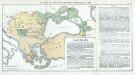
Nr. 12. Der Verfall der Türkei und die griechischen Freiheitskämpfe bis 1829
Osmanisches Reich Griechischer Unabhängigkeitskrieg
La mer Mediterranée vers l'orient
1 Karte : Kupferdruck ; 38 x 49 cm Duval P. Duval
Nr. 8. Der Verfall der Türkei und die griechischen Freiheitskämpfe bis 1829
Osmanisches Reich Griechischer Unabhängigkeitskrieg
Imperii Orientalis et Circumjacentium Regionum.
1 : 4500000 L'Isle, Guillaume de, 1675-1726
Imperii Orientalis et Circumjacentium Regionum.
1 : 4500000 L'Isle, Guillaume de, 1675-1726
Das Osmanische Reich nach seiner größten Ausdehnung im XVII. Jahrhundert.
osmanská říše Benecke Bormann, E. F. Tempsky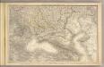
Das Russische Reich in Europa Sud.
1 : 4475000 Stein, Christ. Gottfr. Dan.
Oesterreichisch-russisch-türkischer Kriegsatlas
1 : 1500000 Evropa jižní Šimek, Maxmilian F. A. Schraembl
Empire Ottoman.
Andriveau-Goujon, J.
Das Osmanische Reich nach seiner grössten Ausdehnung im XVIIten Jahrhundert
1 : 12000000 Osmanisches Reich
Schauplatz des russisch-türkischen Krieges
1 : 2850000 Evropa východní Anville, Jean-Baptiste Bourguinon d' Schraembl, Franz Anton F. A. Schraembl
Schauplatz des Russisch Türkischen Krieges
1 : 2850000 Evropa východní Anville, Jean-Baptiste Bourguinon d' Schraembl, Franz Anton F. A. Schraembl
Schauplatz des Russisch Türkischen Krieges
1 : 2850000 Balkánský poloostrov Anville, Jean-Baptiste Bourguinon d' Schraembl, Franz Anton F.A. Schraembl
Schauplatz des russisch-türkischen Krieges
1 : 2850000 Evropa východní Anville, Jean-Baptiste Bourguinon d' Schraembl, Franz Anton F. A. Schraembl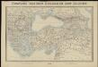
Tooneel van den oorlog in het Oosten
1 : 3000000 Top. Bureau, Min. van Oorlog ['s-Gravenhage] : Top. Bureau, Min. van Oorlog