Maps of Peloponnese, West Greece and Ionian Sea

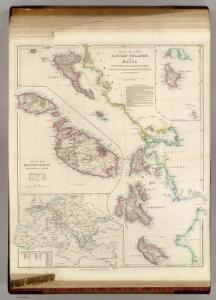
The Ionian Islands and Malta.
1 : 410000 Arrowsmith, John
[Die Balkan-Halbinsel, Blatt 3]
Adolf Stieler's Handatlas über alle Theile der Erde und über das Weltgebäude Stieler, Adolf Justus Perthes
Europ. Turkey III.
1 : 1740000 Grassl, J. (Joseph)
Königreich Hellas oder Griechenland
1 : 1000000 Athény (Řecko : oblast) Kiepert, Heinrich Dietrich Reimer
Graecia
Schul-Atlas der alten Welt bei Justus Perthes
Turkey in Europe, N. Greece.
1 : 1457280 Letts, Son & Co.
Greece and the Ionian Islands.
1 : 1584000 Arrowsmith, John
Greece and the Ionian Republic.
1 : 2000000 Colton, G.W.
Griechenland.
1 : 1400000 Flemming, Carl
Das Königreich Hellas
1 : 1000000 Řecko Bosse, P. Debes, E. Geograph. Anstalt von Wagner & Debes
[Griechenland]
1 : 1000000 Athény (Řecko : oblast)
Graeciae antiquae
1 : 1000000
Graecia, Epirus, post bella Persia.
1 : 1400000 Menke, Th.
Greece and the Ionian Republic.
1 : 2000000 Colton, G.W.
Graeciae antiquae specimen geographicum
1 : 1000000 Řecko Anville, Jean-Baptiste Bourguinon d' Berndt, Johann Christoph Officina Weigelio-Schneideriana
Greece and the Ionian Republic.
1 : 1500000 Colton, G.W.
Griechenland mit Beachtung der Klassischen Zeit
Stieler's Hand-Atlas Stieler, Adolf bei Justus Perthes
Carte particuliere des Iles Ioniennes et de la Morée
Jónské ostrovy (Řecko) Bocage, Jean-Denis Barbié du Luther, Th.
Greece and the Ionian Republic.
1 : 1500000 Colton, G.W.
Hellas, Ionischen Inseln.
1 : 800000 Kiepert, Heinrich, 1818-1899

Griechenland und die Jonischen Inseln mit Beachtung der Klassischen Zeit
Hand-Atlas über alle Theile der Erde nach dem neuesten Zustande und über das Weltgebäude Stieler, Adolf bei Justus Perthes
Das Königreich Hellas oder Griechenland und die Republik der Seiben Ionischen Inseln (Ephtánisos)
Řecko Kiepert, Heinrich Herzberg, H. Verlag des Geographischen Instituts
Morea
Řecko Müller, Jos. D. Šafařík, Pavel Josef
Peloponnesus; sive Morea. [Karte], in: Novus atlas absolutissimus, Bd. 10, S. 176.
1 Karte aus Atlas Janssonius Offizin
Řecko
starověké Řecko Bodenehr, Gabriel Sharland, William Karel André
Hellas
1 : 1680000 Athény (Řecko) Kiepert, Heinrich Kratz, W. Geographisches Institut
Graecia.
1 : 1250000 Kiepert, Heinrich, 1818-1899
Schul-Atlas für die alte Erdbeschreibung : zur allgemeinen Schul-encyclopädie gehörig
J. H. Campe Zusammensetzung und Zeichnung von [...] Dufour, unter Leitung von Heusinger ; gestochen von Frentzel. Braunschweig : Schulbuchhandlung