Maps of Argentina

Provinces of La Plata, The Banda Oriental del Uruguay and Chile.
1 : 4435200 Parish, Woodbine
Chili, La Plata, Uruguay.
1 : 7500000 Meyer, Joseph, 1796-1856
Dietrich Reimers Handkarte von Argentinien, Paraguay und Uruguay, sowie Teilen von Chile und Brasilien
1 : 5000000 Argentina Dietrich Reimer
Nuevo mapa de la Republica Argentina, Chile, Uruguay y Paraguay.
1 : 4000000 Ludwig, Pablo
Mapa orohidrografico de la Republica Argentina.
1 : 8500000 Paz Soldan, Mariano Felipe, 1821-1886
Mapa general de la Republica Argentina.
1 : 8500000 Paz Soldan, Mariano Felipe, 1821-1886
Mapa de la Republica Argentina
1 : 8500000 Oficina meteorologica nacional. Buenos Aires [Buenos Aires] : Tall. de la Officina Meteorologica
Ferro-carriles, correos y telegrafos, Republica Argentina.
1 : 6000000 Paz Soldan, Mariano Felipe, 1821-1886
Chili, Plata, et Patagonie.
1 : 15000000 Malte-Brun, Conrad, 1775-1826
Republica Argentina - Superficie, poblacion, ferrocarriles, cultivos y ganados
1 : 7400000 Argentine. Ministerio de agricultura [Buenos Aires] : Direccion de economia rural y estadistica
Typus Geographicus, CHILI PARAGUAY FRETI MAGELLANICI &c
1 : 1480000 Chile Delisle, Guillaume Beauchesne-Gouin de Homannianis Heredibus
159. Argentina e Cile.
1 : 10000000 Touring club italiano
A map of Chili, Patagonia, La Plata and ye south part of Brasil
1 : 18000000
Le Chili, avec les contrées voisines et le pays des Patagons
1 : 10700000 Chile Bonne, Rigobert André
Argentina Republic, Chili, Uruguay & Paraguay.
1 : 6000000 Colton, G.W.
Missioni Salesiane della Patagonia settentrionale
1 : 2000000 Falklandy Salesianische Buchdruckerei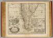
Chile, Terra del Fuego &c.
1 : 11000000 Bowen, Emanuel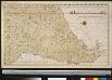
Het Zuijder gedeelt van America vertoonende Rio de la Plata met al sijn spruijte
South-America Gerard van Keulen
Mapa de los ferrocarriles en explotacion.
1 : 3400000 Argentina. Direccion General de Ferrocarriles.
Het Zuijdelijkste gedeelte van Brazieliea van Rio de La Plata tot de Straat van Magalani of C. de Hoorn
Argentina Gerard van Keulen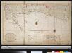
Het zuijdelijkste gedeelte van Brazilia van Rio de La Plata tot Caap de Hoorn of door de Straat van Magalanüs
Argentina Gerard van Keulen
Chile, La Plata And Montevideo.
1 : 7600000 Tanner, Henry S.
Chile La Plata And Montevideo.
1 : 7500000 Tanner, Henry S.
[Die Republiken Chili, La Plata und Uruguay]
Grosser Hand-Atlas über alle Theile der Erde in 170 Karten Meyer, J. Verlag des Bibliographischen Instituts
Chili, Argentine Republic, Paraguay, and Uruguay.
1 : 7350000 Mitchell, Samuel Augustus
Chili, Argentine Republic, Paraguay, and Uruguay.
1 : 7350000 Mitchell, Samuel Augustus
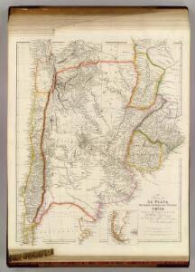
Chili, La Plata, and Uruguay.
1 : 7380000 Tanner, Henry S.
Paskaarte van't zuÿdelÿckste deel van America
1 Karte : Kupferdruck ; 43 x 53 cm Doncker bÿ Hendrick Doncker boeckverkoper en graad-boog-maker inde Nieuwe-brug-steeg
Repub. Argentine, Uruguay, Chili, Paraguay.
1 : 7200000 Garnier, F. A., 1803-1863