Maps of Sahara
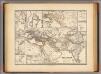
Monde Connu des Hebreux.
Levasseur, E.
Mohammedanischen Staaten-Systems.
1 : 25000000 Flemming, Carl
Carte de Premiers Ages de Monde ... 1825.
1 : 17500000 Delamarche, Felix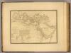
Monde connu des Hebreux.
1 : 14000000 Picquet, C.
Africa vetus florentibus Romanorum rebus
1 : 27429000 Afrika subsaharská Martin Gleditsch
Historische Weltkarte
Afrika severní Pařízek, Aleš Vincenc Niederhofer, Ondřej
Historische Weltkarte
Afrika severní Pařízek, Aleš Vincenc Niederhofer, Ondřej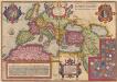
Romani Imperii Imago. [Karte], in: Theatrum orbis terrarum, S. 451.
1 Karte aus Atlas Ortelius, Abraham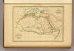
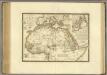
Afrique Ancienne.
1 : 27500000 Malte-Brun, Conrad, 1775-1826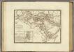
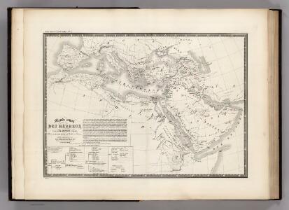
Geographie des Hebreux.
1 : 13000000 Brue, Adrien Hubert, 1786-1832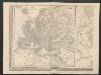
Europa
1 : 12000000 [Verlag nicht ermittelbar]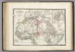
Afrique partie Nord.
1 : 16000000 Levasseur, E.
Carte mar.ne d'une partie de l'Europe, de l'Asie et de l'Afrique
1 Karte : Kupferdruck ; 41 x 49 cm Königliche Akademie der Wissenschaften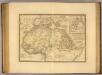
Afrique, septentrionale.
1 : 16000000 Picquet, C.
Carte détaillée (en deux feuilles) de l'Afrique et des îles qui en dépendent (partie septentrionale)
1 : 16323500 par A. Brué, d'après les observations astronomiques, les découvertes et les hypothèses les plus récentes Paris : chez l'auteur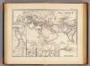
Orbis terrarum regni Assyrii tempore.
1 : 24500000 Menke, Th.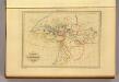
Geographie d'Herodote.
1 : 30000000 Malte-Brun, Conrad, 1775-1826
Übersichts Karte zu den Reisen in Europa, Asien und Afrika
1 : 11700000 Afrika severovýchodní Verlag der E. Schweizerbrat'schen Buchhandlung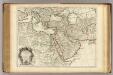
Turquie, Arabie, Perse.
1 : 10550000 L'Isle, Guillaume de, 1675-1726
Středomoří a Sev. Afrika
Afrique, septentrionale.
1 : 15000000 Brue, Adrien Hubert, 1786-1832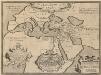
Geographia Sacra. [Karte] [Welt] [Nebenkarte], in: Theatrum orbis terrarum, S. 432.
1 Karte aus Atlas Ortelius, Abraham Vrients, Jan Baptista
Übersichts Karte zu den Reisen in Europa, Asien und Afrika unternommen von dem k. k. oesterreich. Bergrathe Joseph Russegger in den Jahren von 1835 bis 1841
1 : 11400000 Afrika E. Schweizerbart'schen Buchhandlung
Übersichts Karte zu den Reisen in Europa, Asien und Afrika unternommen von dem k. k. oesterreich. Bergrathe Joseph Russegger in den Jahren von 1835 bis 1841
1 : 11400000 Afrika
[Historisch-geographischer Atlas zu den allgemeinen Geschichtswerken von C. v. Rotteck, Pölitz u. Becker] : Übersichtskarte für die Geschichte der ältesten Zeit bis auf Cyrus
von Julius Loewenberg Lithographie von B. Herder in Freiburg im Breisgau [Freiburg im Breisgau] : [Herder]
Empire de la Porte ottomane en Europe, en Asie et en Afrique avec les pays qui lui sont tributaires
1 : 9000000 Lotter Family (Augsburg, Germany) Frères Lotter
Mare internum cum populis adiacentibus a bello Hannibalico usque ad Mithridatis M. tempus.
1 : 12000000 Menke, Th.
Romani Imperioo Imago. [Karte], in: Theatrum orbis terrarum, S. 450.
1 Karte aus Atlas Ortelius, Abraham Vrients, Jan Baptista
Orbis terrarum post proelium Corupediense 282-220 a. Ch.
1 : 2450000 Menke, Th.