Maps of Saint Kitts and Nevis

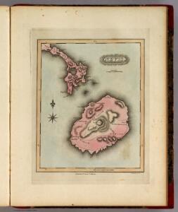
Nevis.
1 : 164736 Lucas, Fielding Jr.
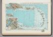
SAINT KITTS, Leeward Islands Island (1864).
Leeward Islands. St. Christopher and Nevis ... Eustatius and Saba. Surveyed ... 1850. Natural scale, 1 : 56,700 [Admiralty Chart]
SAINT KITTS, Leeward Islands Island (1899).
[Leeward Islands. St. Christopher and Nevis ... Eustatius and Saba. Surveyed ... 1850. Natural scale, 1 : 56,700 [Admiralty Chart]]
SAINT KITTS, Leeward Islands Island (1875).
St. Christophe, Nièves, St. Eustache et Saba. (Île St. Eustache. Orange Town). [Paris] : Dépôt des Cartes et Plans de la Marine
St. Christophers.
1 : 40392 Lucas, Fielding Jr.
St Kitts-Nevis (1920)
St. Christopher or St. Kitts, GSGS 2941. Great Britain. General Staff. Geographical Section. [London] : [GSGS, War Office].
The Dutch islands of St. Eustatia, Saba, and St. Martins ; the French island of St. Bartholomew ; the English islands of St. Christophers, Nevis, and Anguilla ; with the smaller islands and keys adjoining
1 : 430000
Virgin Islands & c.
1 : 511753 Lucas, Fielding Jr.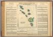
Leeward Islands.
1 : 1420000 Lea, I.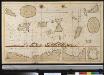
De Caribese eijlande tusschen St. Luzia en St. Christoffel
Lesser Antilles Gerard van Keulen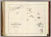
Map of The Leeward Islands.
1 : 950400 Arrowsmith, John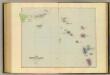
Leeward Islands.
1 : 887040 Stanford, Edward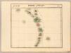
Petites Antilles. Amer. Sep. 75.
1 : 1641836 Vandermaelen, Philippe, 1795-1869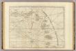
The Caribbee Islands, the Virgin Islands, and the Isle of Porto Rico.
1 : 1560000 Jefferys, Thomas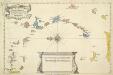
A New And Correct Map Of The Caribbean Islands From The Latest Observations
This map of the West Indies by Archebald Bontein was published in 1751. Bontein was the Chief Engineer in Jamaica and published a map of that island in 1763. A system of colour codes and letters, with the key in a panel at bottom centre, identifies the various European dominions in the region. Bontein, Archibald. Cartographer
A CHART OF THE ANTILLES, or, CHARIBBE, or, CARIBS ISLANDS, WITH THE VIRGIN ISLES
This chart by cartographer L. S. de la Rochette (1731 ? 1802) was engraved by William Palmer and published by 'geographer to the King' William Faden in 1784. There is a compass rose at the centre of a network of rhumb lines (for sailing directions) and a smaller scale map of the region is inset at top right showing distances between the islands, sailing routes and a table recording latitude and longitude of each island. Down the right side of the map are represented the profiles of the headlands of the different islands- this is as they would appear to sailors from the sea. La Rochette. Cartographer.
CANIBALES | INSVLÆ.
[Amsterdam : Joan Blaeu]
Carte des Antilles
1 : 2777775
Antilles, Charibbee Islands.
1 : 2700000 Faden, William, 1750?-1836
[Puerto Rico, Kleine Antillen, Trinidad]
1 Karte : Kupferdruck ; 44 x 55 cm Doncker bij Hendrick Doncker boeckverkooper en graadbooghmaeker inde Nieuwbrugh steegh in 't Stuurmans gereedtschap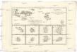
Cartes de supplément pour les isles Antilles
1 : 1330000 Antigua (Antigua a Barbuda) Bonne, Rigobert André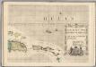
A Map of the British Empire in America. (Sheet 15).
1 : 2000000 Popple, Henry
Carte des iles Antilles. Par J.B. Poirson . Nivose An XI, 1803
1 : 3100000 Herbin de Halle, Etienne de.
Insula S. Iuan De Puerto Rico Caribes; Vel Canibalum Insulae. [Karte], in: Het vijfde Deel Des Grooten Atlas : Vervatende De Water-Weereld, S. 66.
1 Karte aus Atlas Jansson, Jan Jansson, Jan
Insula S.Iuan de Puerto Rico Caribes; Vel Canibalum Insulae. [Karte], in: Novus atlas absolutissimus, Bd. 9, S. 76.
1 Karte aus Atlas Janssonius Offizin
Nieuwe Carybsche Pascaart: The Carybes Ilands [Karte], in: De Nieuwe Groote Vermeerderde Zee-Atlas ofte Water-Werelt, S. 65.
1 Karte aus Atlas Doncker, Hendrick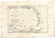
Les Petites Antilles ou les Isles du Vent avec celles de Sous le Vent
1 : 7320000 Malé Antily (souostroví) Bonne, Rigobert André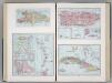
Island of Haiti. Lesser Antilles. Puerto Rico. Cuba.
1 : 3095000 Hammond, C.S.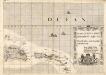
A Map of the British Empire in America. (Sheet 15).
1 : 2000000 Popple, Henry