Maps of England

England.
1 : 1760000 Tanner, Henry S.
Composite: England & Wales.
1 : 633600 Stanford, Edward
England.
1 : 1760000 Mitchell, Samuel Augustus
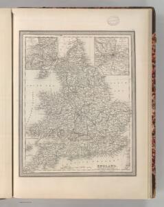
England.
1 : 1760000 Mitchell, Samuel Augustus
Charte von England
Anglie Streit, Friedrich Wilhelm
Smith's new map of England and Wales with parts of Scotland : including the turnpike, and principal crossroads ... / engraved by Edw[ar]d Jones & Benj[ami]n Smith
1 : 1275000 Jones, Edward (fl. 1806); Smith, Benjamin London : C. Smith
[Recto], uit: England and Wales
1 : 1108000 [London] : Philip [etc.]
England.
1 : 1220000 Playfair, Principal
Charte von England
Anglie
Charte von England
Anglie
Charte von England
Anglie
CHARTE von ENGLAND
Anglie
Geological map of England and Wales / publ. under the superintendence of the Society for the Diffusion of Useful Knowledge ; arr. by Roderick Impey Murchison ; S.P. Woodward del.; cold. by T. Malby; J. & C. Walker sculpt
1 : 1780000 Annotatie: Oorspr. uitg.: Strand : Chapman and Hall, 1843; Annotatie geografische gegevens: Met aanvullingen tot 1847 Roderick Impey Murchison 1792-1871; S.P. Woodward; T. Malby; Society for the Diffusion of Useful Knowledge London : Knight
England, Wales.
1 : 2400000 Mitchell, Samuel Augustus
Ireland, Scotland.
1 : 2400000 Mitchell, Samuel Augustus
England, Wales.
1 : 2400000 Mitchell, Samuel Augustus Jr.
England, Wales.
1 : 2400000 Mitchell, Samuel Augustus
England, Wales.
1 : 2400000 Mitchell, Samuel Augustus
Composite: England.
1 : 755000 Pinkerton, John, 1758-1826
Britanniae sive Angliae regnum
1 : 1300000 Anglie Lotter, Tobias Conrad sumtibus Tob. Conradi Lotter
England And Wales.
1 : 2850000 Finley, Anthony
A new and correct map of the roads in England and Wales wherein are contained all the road waies and the principal cross roads, with the computed distances [...] &c.
1 : 1300000 ingraven by Sutton Nicholls London : printed and sold by H. Overton at the White Horse without Newgate
England.
1 : 1760000 Tanner, Henry S.
England.
1 : 1760000 Tanner, Henry S.
England.
1 : 2800000 Tanner, Henry S.
[86][86] Anglia Regnum ..., uit: Atlas sive Descriptio terrarum orbis
Annotatie: Gedigitaliseerde versie. Amsterdam. Heiloo : Picturae (vervaardiger), 2015. tiff-bestand. Gedigitaliseerd: 07-01-2015; Origineel: Universiteitsbibliotheek Vrije Universiteit (XL.05127.-) ; Netherlands; Titelpagina ontbreekt Wit, Frederik de Amsterdam : Frederick de Wit
England and Wales.
1 : 2700000 Lucas, Fielding Jr.
Composite: (Cary's England, Wales, and Scotland).
1 : 360000 Cary, John, ca. 1754-1835
England and Wales.
1 : 1725000 Teesdale, Henry