Maps of United States
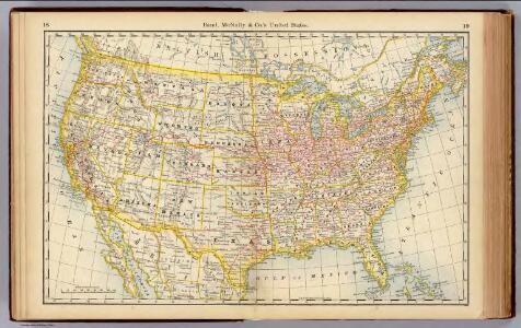
United States.
1 : 10560000 Rand McNally and Company
Vereinigte Staaten von Nord-America
1 : 13000000
Fredonia Or The United States of North America.
1 : 570000 Laurie, Richard Holmes
Vereinigte Staaten
1 : 10000000 Nové Skotsko Elfert, Paul Geogr. anstalt von Wagner & Debes
Routen der Missouri - Pacific, sowie der Wabash St. Louis und Pacific Eisenbahnen
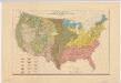
Distribution of the great soil groups (soil provinces)
1 : 8000000 Relief shown by spot heights. Appears in Washington: U.S. Dept. of Agriculture. Atlas of American agriculture, 1936. Soils, plate 2. Marbut, Curtis Fletcher, 1863-1935. Washington, D.C. : Bureau of Chemistry and Soils
Vereinigte Staaten Von Nordamerika

Map of the United States of America with its territories & districts : including also a part of upper & lower Canada and Mexico.
from Whole
Railroad map of the United States to accompany the "Commercial travellers guide book".
From Whole
[Vereinigte Staaten von Nord-America und Canada]
Schul-Atlas über alle Theile der Erde nach dem neuesten Zustande, und über das Weltgebäude Stieler, Adolf bei Justus Perthes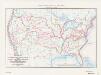
Map of the conterminous United States showing routes of the principal explorers from 1501 to 1844, whose work had an important bearing on the settlement of the country and the fixing of its successive boundaries
1 : 8500000 "Taken from Bulletin 1212, Plate 1." Original title: United States map showing routes of principal explorers and early roads and highways. Bond, Frank, 1856-1940 United States. General Land Office.; Geological Survey (U.S.); Reston, Virginia : U.S. Geological Survey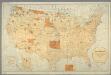
Map showing the location of the Indian reservations within the limits of the United States and territories / compiled from official and other authentic sources, under the direction of the Hon. John D.C. Atkins, Commissioner of Indian Affairs ; Paul Brodi
from Whole
Etats-Unis de l'Amerique en 1860.
1 : 12000000 Garnier, F. A., 1803-1863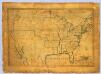
United States.
1 : 7700000 Symonds, Maria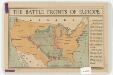
The battle fronts of Europe
1 : 2500000 Map of battle fronts drawn to scale upon a map of the United States showing relative distances of fronts. Roberts & Leete. London : Stanford's Geographical Establishment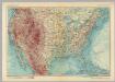
United States of America. Pergamon World Atlas.
1 : 10000000 Polish Army Topography Service
American Continent: United States, British Possessons, West Indies, Mexico, Central America
1 : 4435200 Rosa, R.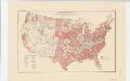
Areas covered by the soil survey, completed to January 1934
1 : 7900000 Includes numbered list of reconnaissance surveys. "Atlas of American Agriculture, Soils, Plate 1." United States. Bureau of Chemistry and Soils. [Washington, D.C.?] : The Bureau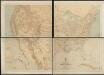
Military map of the United States
1 : 5000000 Freyhold, Edward United States. War Dept.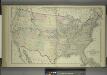
Map of the United States and Territories
from Combination atlas map of Broome County, New York; / compiled, drawn and published from personal examinations and surveys by Everts, Ensign & Everts.
United States / Geo. Boynton, sc., Boston.
from Whole
United States Of North America.
1 : 6336000 Stanford, Edward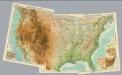
Composite: United States.
1 : 5000000 John Bartholomew & Co.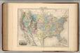
Etats-Unis.
1 : 11700000 Migeon, J.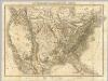
Die Vereinigten Staaten von Nord-America.
1 : 8000000 Bromme, Traugott
Hypsometric sketch US.
1 : 10400000 United States. Census Office
Vereinigte Staaten von Nord-America
Hand-Atlas über alle Theile der Erde nach dem neuesten Zustande und über das Weltgebäude Stieler, Adolf bei Justus Perthes
United States with the contiguous British & Spanish Possessions.
1 : 3801600 Melish, John
Composite: United States with the contiguous British & Spanish Possessions.
1 : 3801600 Melish, John