Maps of Al Bahr al Ahmar
Egypte geog. 2.
1 : 1000000 France. Armee. Genie; Jacotin, Pierre, 1765-1827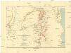
Die krystallinischen Küstengebirge am Roten Meer zwischen 26°40 ́ u[nd] 27°30 ́ n. Br
1 : 200000 Egypt Schweinfurth, Georg Geographische Verlagshandlung Dietrich Reimer
Die krystallinischen Küstengebirge am Roten Meer zwischen dem Uadi Qeneh und Gebel Set
1 : 200000 Egypt Schweinfurth, Georg Geographische Verlagshandlung Dietrich Reimer
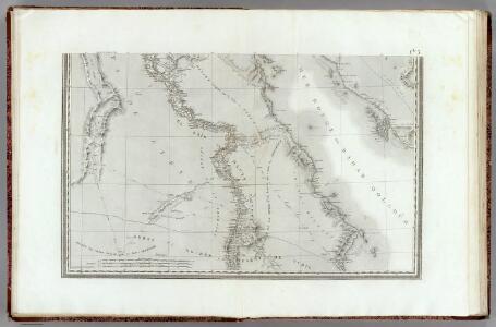
Aegyptus.
1 : 6500000 Fenner, Rest.
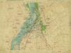
Land zwischen den kleinen und grossen Kataracten des Nil
1 : 288000 Egypt Prokesch, A. von Wöber, J.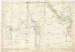
Kharga and Dakhla oases and their approaches
1 : 500000 War Office
Orographical map of south-eastern Egypt
1 : 750000 Egypt Ball, John Survey Dept.
Mudiria Assiut
1 : 10000 Egypt Survey department Egypt
Die Wüstenregion zwischen Nil und Uadi Kenet
1 : 200000 Egypt Schweinfurth, Georg Geographische Verlagshandlung Dietrich Reimer
Die Wüstenregion zwischen Nil und Uadi Kenet
1 : 200000 Egypt Schweinfurth, Georg Geographische Verlagshandlung Dietrich Reimer
6 Vallee de Qosier.
1 : 100000 Jacotin, Pierre, 1765-1827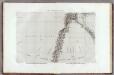
1 Cataractes, Syene.
1 : 100000 Jacotin, Pierre, 1765-1827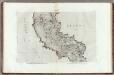
11 Tahtah.
1 : 100000 Jacotin, Pierre, 1765-1827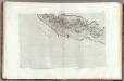
10 Girgeh.
1 : 100000 Jacotin, Pierre, 1765-1827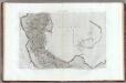
13 Manfalout.
1 : 100000 Jacotin, Pierre, 1765-1827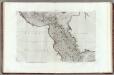
12 Siout.
1 : 100000 Jacotin, Pierre, 1765-1827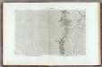
2 Koum Ommbous.
1 : 100000 Jacotin, Pierre, 1765-1827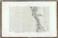
3 Edfou.
1 : 100000 Jacotin, Pierre, 1765-1827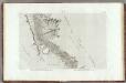
4 Esne.
1 : 100000 Jacotin, Pierre, 1765-1827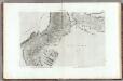
5 Thebes.
1 : 100000 Jacotin, Pierre, 1765-1827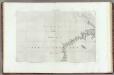
8 El Haweh.
1 : 100000 Jacotin, Pierre, 1765-1827
7 Qosier.
1 : 100000 Jacotin, Pierre, 1765-1827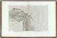
9 Qeneh.
1 : 100000 Jacotin, Pierre, 1765-1827
Geological map of desert south of Kharga oasis
1 : 250000 Green, F.W. Survey dept.
Karte der westlichen Umgebung von Luksor und Karnak (Theben)
1 : 25000 Luxor (Egypt) Schweinfurth, Georg Dietrich Reimer
Geological map of the first or Aswan cataract
1 : 20000 Survey dept.
First or Aswan cataract
1 : 20000 Survey dept.
Luxor & Karnak
1 : 10000 Luxor (Egypt) Survey of Egypt
El Qurna
1 : 10000 Survey of Egypt