Maps of Maryland

Central Virginia showing Lieut Gen'l U.S. Grant's Campaign and Marches.
1 : 350000 United States. War Dept. Engineer Bureau
Karte des Kriegs-Theaters in Virginien
1 : 890000 Virginie
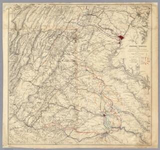
War Telegram Marking Map.
War Telegram Marking Map. Produced by Prang in 1862, this War Telegram Marking Map was published for sale with the intension that telegraph communications within what the map calls ‘Virginia Territory’, the area running from Baltimore to Petersburg across the Union and Confederate line, would me marked down. The explanation key on the map comments that red and blue pencils would be provided alongside the map so that Union telegraph communications could be marked in red and Confederate communications in blue. This map is unmarked. L. Prang & Co.
War Telegram Marking Map.
1 : 490000 Prang, L. & Co.
2d Corps A.N. Va., camps, pickets, routes.
Hotchkiss, Jed.
Der amerikanische Kriegsschauplatz zwischen Washington und Richmond
1 : 1000000 Richmond (Virginie) Petermann, August Debes, Ernst Justus Perthes
Seat of War in America
Seat of War in America. Published by Bacon & Co. in London, Seat of the War in America shows the region between Baltimore and Petersburg and the placement of troops and fortifications along the border between the Confederacy and the Union. It is notable how many batteries are placed around the Confederate capital of Richmond, as well as marking out the railway lines that connected the region. At the top of the map are publishing adverts for Colton productions, as well as a list of the Union and Confederate generals and a table detailing export amounts in 1860, with cotton being the largest figure. Bacon & Co.
Central Virginia 1864-1865.
1 : 650000 United States. War Department
Map of the Region between Gettysburg, Pa. and Appomattox Court House, Va.
1 : 285120 Weyss, John E.
Bird's-eye view of the Seat of War
Bird's-eye view of the Seat of War, arranged after the latest Surveys. This Bird’s Eye View of the Seat of War, published by Prang, displays the region around the Chesapeake Bay and Potomac River, showing Washington, D.C., Baltimore, Harper’s Ferry, Richmond, Manassas Junction (Bull Run), Fort Monroe and Norfolk Harbour. The map also details railroad lines. It is possible to see a drawing of the Capitol building where Washington, D.C. is labelled. L. Prang & Co.
(Seat of the Civil War - Virginia).
1 : 412000 Schonberg & Co.
Milford, Brock's Gap, Moorefield, New Creek, etc.
Hotchkiss, Jed.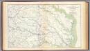
SE Virginia, Ft. Monroe.
1 : 316800 U.S. War Department, Topographical Engineers
Winchester, Cedar Run, Port Republic, Va.
Hotchkiss, Jed.
Map of the Shenandoah & Upper Potomac including portions of Virginia and Maryland
1 : 253440 Meigs, John Rodgers United States. Army. Office of the Chief of Engineers
Übersichts-Karte zum Feldzuge 1864 und 1865 in Virginien

Army Map Of The Seat Of War In Virginia.
1 : 190000 Disturnell, John
Hanover, Hanover C.H., New Bridge, Mechanicsville, New Market, Malvern Hill, Cross Keys.
United States. War Department
Composite: Staten Island.
1 : 253440 Dripps, Matthew
Proposed Shenandoah National Park, Virginia / engraved and printed by the U.S. Geological Survey
1 : 125000 Annotatie geografische gegevens: Opname: 1884-1891 United States Geological Survey [Washington, D.C. : U.S. Geological Survey]
E. & G.W. Blunt's corrected map of Washington and the seat of war on the Potomac
1 : 402500 E. & G.W. Blunt (Firm) E. & G.W. Blunt (Firm)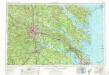
Richmond
1 : 250000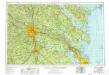
Richmond
1 : 250000
Richmond
1 : 250000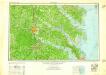
Richmond
1 : 250000
Richmond
1 : 250000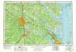
Richmond
1 : 250000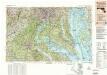
Washington
1 : 250000
Washington
1 : 250000
Washington
1 : 250000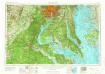
Washington
1 : 250000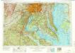
Washington
1 : 250000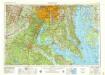
Washington
1 : 250000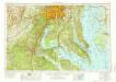
Washington
1 : 250000
Washington
1 : 250000
Washington
1 : 250000