Maps of Chubut
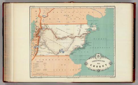
Gobernacion de Chubut.
1 : 3125000 Paz Soldan, Mariano Felipe, 1821-1886
Registro gráfico del territorio del Chubut
1 : 500000 Argentina Oficina cartografica Ludwig
Partie, la Patagonie. Amer. Merid. 39.
1 : 1641836 Vandermaelen, Philippe, 1795-1869
Acworth, Sullivan County.
1 : 39000 D.H. Hurd & Co.
Partie, la Patagonie. Amer. Merid. 38.
1 : 1641836 Vandermaelen, Philippe, 1795-1869
Mapa de la region patagonica entre los grados 41 y 47 sur
1 : 500000 Argentine. Oficina de Límites Internacionales [Buenos Aires ?] :
(Mapa de la Republica de Chile 9)
1 : 11000000 Pissis, Aime, 1812-1889
Patagonia, Feuerland, Falklands, Antarctische Continent.
1 : 7700000 Radefeld, Carl Christian Franz, 1788-1874
Patagonia ... South Orkney ... Falkland Islands ... South Georgia Island.
1 : 8236800 Colton, G.W.
Carte de la Patagonie et des Archipels de la Terre de Feu des Malounies et des Còtes Occidentales
1 : 2000000 Description géographique et statistique de la Confédération Argentine Martin de Moussy, Victor Librairie de Firmin Didot frères, fils et Cie
Esquisse de la Patagonie (République Argentine)
1 : 6000000 Paris : Erhard et fils
Patagonia. South Orkney or Powell's Group. Falkland Islands. South Georgia Island.
1 : 7600000 Colton, G.W.
Patagonia. South Orkney or Powell's Group. Falkland Islands. South Georgia Island.
1 : 7750000 Colton, G.W.
Amerique Merid., cotes.
1 : 5500000 Spain. Marina
Patagonie, Terre de Feu, Malouines.
1 : 3750000 Martin de Moussy, V. (Victor), 1810-1869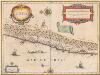
Chili [Karte], in: Novus Atlas, das ist, Weltbeschreibung, Bd. 2, S. 352.
1 Karte aus Atlas Blaeu, Joan Blaeu, Willem Janszoon
Chili.
1 : 4752000 Lucas, Fielding Jr.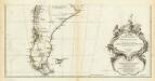
Amerique Meridionale. (Southern section)
1 : 6300000 Anville, Jean Baptiste Bourguignon d, 1697-1782
Chili [Karte], in: Le théâtre du monde, ou, Nouvel atlas contenant les chartes et descriptions de tous les païs de la terre, Bd. 2, S. 347.
1 Karte aus Atlas Blaeu, Willem Janszoon und Blaeu, Joan Blaeu, Willem Janszoon
Patagonia. South Orkney or Powell's Group. Falkland Islands. South Georgia Island.
Colton, G.W.
Le Chili
1 : 6400000
A new map of the southern parts of America taken from manuscript maps made in the country and a survey of the eastern coast maode by the order of the King of Spain
1 : 3168000
Chili. [Karte], in: Novus atlas absolutissimus, Bd. 6, S. 249.
1 Karte aus Atlas Janssonius Offizin
Chili [Karte], in: Theatrum orbis terrarum, sive, Atlas novus, Bd. 2, S. 362.
1 Karte aus Atlas Blaeu, Joan Blaeu, Willem Janszoon
Composite: (Mapa de la Republica de Chile 9-15)
1 : 11000000 Pissis, Aime, 1812-1889
South America 5.
1 : 2800000 Arrowsmith, Aaron
De kusten van Chili
Chile Gerard van Keulen
CHILI
[Amsterdam : Joan Blaeu]