Maps of Tasmania

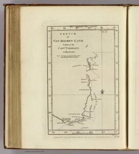
Van Diemen Land.
1 : 4400000 Furneaux, Tobias, 1735-1781
Tasmania
1 : 1100000 Tasmánie Bartholomew, John George Philip & son
Tasmania, Fiji.
1 : 1647360 Stanford, Edward
Carte de la Terre Van-Diemen
1 : 2240000 Tasmánie Bonne, Rigobert André
Tasmania
1 : 760000 Tasmánie Survey Office
Van-Diemens Land.
1 : 1010000 Teesdale, Henry
Van Diemen's Land.
1 : 850000 Hall, S. (Sidney)
Van Diemen's Island or Tasmania.
1 : 1457280 Tallis, J. & F.
Van Diemens Land.
1 : 650000 Arrowsmith, John
Van Diemens Land.
1 : 633600 Arrowsmith, John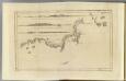
Van Diemen's Land.
1 : 740000 Cook, James, 1728-1779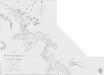
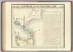
The River Tamar in Van Diemen’s Land (1831)
Head. The River Tamar in Van Diemen's Land. By J. Welsh. [Admiralty Chart] London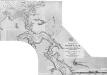
North Coast of Tasmania. River Tamar (from the Sea to Launceston.) 1897
[North Coast of Tasmania. River Tamar (from the Sea to Launceston.) The entrance of the River with Port Dalrymple and the approaches to Georgetown from a Survey by Staff Commr. Stanley, 1880. [Admiralty Chart]] London
Binginwarri
Austrálie Geological survey of Victoria
Maryvale
Austrálie Geological survey of Victoria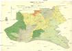
Waratah North
Austrálie Geological survey of Victoria
Tarwin South
Austrálie Geological survey of Victoria
Meeniyan
Austrálie Geological survey of Victoria
North Coast of Tasmania. River Tamar (from the Sea to Launceston.) 1898
[North Coast of Tasmania. River Tamar (from the Sea to Launceston.) The entrance of the River with Port Dalrymple and the approaches to Georgetown from a Survey by Staff Commr. Stanley, 1880. [Admiralty Chart]] London
The River Tamar in Van Diemen’s Land (1831)
Head. The River Tamar in Van Diemen's Land. By J. Welsh. [Admiralty Chart] London
Wonyip
Austrálie Geological survey of Victoria
Mirboo
Austrálie Geological survey of Victoria
Devon
Austrálie Geological survey of Victoria
Gunyah Gunyah
Austrálie Geological survey of Victoria
Narracan
Austrálie Geological survey of Victoria
Hazelwood
Austrálie Geological survey of Victoria
Welshpool
Austrálie Geological survey of Victoria
Narracan South
Austrálie Geological survey of Victoria
Budgerre
Austrálie Geological survey of Victoria