Maps of Baja California

U.S. West of Mississippi R. 4.
1 : 2000000 Freyhold, Edward; Warren, Gouverneur Kemble, 1830-1882; United States. Army. Corps of Engineers
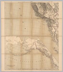
Cote NO, l'Amerique 1.
1 : 1500000 Vancouver, George, 1757-1798
The Coast of N.W. America.
1 : 1290000 Vancouver, George, 1757-1798
General Map of Explorations and Surveys in California.
1 : 600000 Williamson, R.S.
Partie, Nouvle. Californie. Amer. Sep. 52.
1 : 1641836 Vandermaelen, Philippe, 1795-1869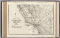
California. Nevada.
1 : 1341000 Rand McNally and Company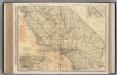
California (Southern Section).
1 : 1140000 Rand McNally and Company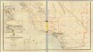
California, Nevada (lower)
1 : 696960 Von Haake, A.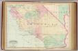
Calif., Nev. south.
1 : 1267200 Asher & Adams
73. Part Of Southern California.
1 : 506880 Wheeler, G.M.
Ventura, Los Angeles, San Bernardino, Orange, and San Diego Counties.
1 : 760320 Blum, George W.
Map showing a part of the Palomas Mining District and the Piru creek ditch, situated in Los Angles [sic] and Ventura Cs. California
1 : 147520 Shows mining claims including "Patented Gold Gravel" claim by Jenkins, townships and ranges, creeks and rivers, residences, and local features. De Laveaux, Gustave. Manuscript Map
Map and condensed profile showing Los Angeles Aqueduct, completed in 1913, and proposed extension to Mono Basin : also condensed profile of Colorado River Aqueduct now under construction by Metropolitan Water District.
1 : 1430000 One map shows southern portion of Los Angeles Aqueduct (to Fairmont Reservoir) and the route of the Colorado River Aqueduct; the other map shows the Los Angeles Aqueduct and proposed Mono Craters Tunnel. Photostat. Los Angeles Aqueduct hand colored in red and blue on one map. Los Angeles (Calif.). Bureau of Water Works & Supply. [Los Angeles, Calif.? : Bureau of Water Works and Supply?]
Topographic map of the Los Angeles Aqueduct and adjacent territory
1 : 1316800 Relief shown by contours and hachures. Blue line print. Includes "Key to index system." Map Library copy annotated in colored pen. [California? : s.n.]
San Benito, Fresno, Monterey, San Luis Obispo, Kings, Kern, and Santa Barbara Counties.
1 : 950400 Blum, George W.
Map of a part of Southern California, showing gaging stations
1 : 1250000 Relief shown by contours and spot heights. Map is plate 1 and 2 from the U.S. Geological Survey's Water- supply paper 447. Includes index. Geologic Survey (U.S.) [Washington, D.C.] : U.S. Geological Survey, 1920.
Existing airports & landing fields, County of Los Angeles
1 : 1250000 Includes inset of north part of Los Angeles County and index. Los Angeles County (Calif.). Regional Planning Commission [Los Angeles, Calif.] The Commission
Passes, Sierra Nevada, Walker's Pass-Coast Range.
1 : 240000 Williamson, R.S.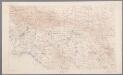
[Recto], uit: [Los Angeles-Riverside area] / R.U. Goode, geographer in charge ; comp. by J.E. Rockhold
1 : 250000 Annotatie geografische gegevens: Opname: 1893-1900 Goode, R. U.; Rockhold, J. E. [Washington, D.C. : U.S. Geological Survey]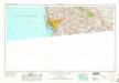
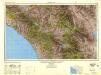
San Diego
1 : 250000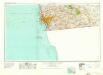
San Diego
1 : 250000
San Diego
1 : 250000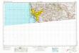
San Diego
1 : 250000
San Clemente Island
1 : 250000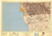
San Diego
1 : 250000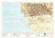
San Diego
1 : 250000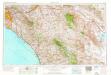
Santa Ana
1 : 250000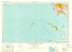
Long Beach
1 : 250000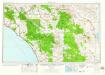
Santa Ana
1 : 250000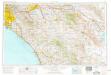
Santa Ana
1 : 250000
Santa Ana
1 : 250000
Santa Ana
1 : 250000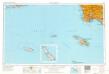
Long Beach
1 : 250000
Long Beach
1 : 250000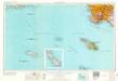
Long Beach
1 : 250000
Long Beach
1 : 250000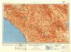
Santa Ana
1 : 250000
Long Beach
1 : 250000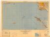
Long Beach
1 : 250000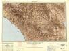
Santa Ana
1 : 250000