Maps of Kandiyohi County

Maps of Kandiyohi County

$title$

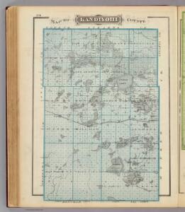
Map of Kandiyohi County.

1 : 160000 Andreas, A. T. (Alfred Theodore), 1839-1900
$title$

Atwater

1 : 62500
$title$

Atwater

1 : 62500
$title$

Little Kandiyohi Lake

1 : 24000
$title$

Raymond

1 : 24000
$title$

Willmar

1 : 24000
$title$

Willmar

1 : 24000
$title$

Willmar

1 : 24000
$title$

Spicer

1 : 24000
$title$

Pennock

1 : 24000
$title$

Solomon Lake

1 : 24000
$title$

Solomon Lake

1 : 24000
$title$

Pennock

1 : 24000
$title$

Solomon Lake

1 : 24000
$title$

Mount Tom

1 : 24000
$title$

Sunburg

1 : 24000
$title$

Mount Tom

1 : 24000
$title$

Lake Elizabeth

1 : 24000
$title$

Atwater

1 : 24000
$title$

Hawick

1 : 24000
$title$

Lake Lillian

1 : 24000
$title$

Blomkest

1 : 24000
$title$

Prinsburg

1 : 24000
$title$

Thorpe

1 : 24000
$title$

Olivia

1 : 62500
$title$

Lake Johanna

1 : 24000
$title$

Lake Johanna

1 : 24000
$title$

Belgrade

1 : 24000
$title$

Georgeville

1 : 24000
$title$

Lake Henry

1 : 24000
© MapTiler © OpenStreetMap contributors
How does it work?
These instructions will show you how to find historical maps online.
Getting started
Type the place name in the search box to find the exact location. You can further adjust the search by zooming in and out.
Zoom
Zoom in and out with the buttons or use your mouse or touchpad natively.
Exact Area tool
Click here and draw a rectangle over the map to precisely define the search area.
Set filters
Narrow your search with advanced settings, such as Years (from/to), Fulltext, Publisher, etc.
Results
See the results of your search on the right side. You can scroll down to find more maps of this location.
?

Download OldMapsOnline Mobile