Maps of Nova Scotia
A Map of the British Empire in America. (Sheet 7).
1 : 2000000 Popple, Henry
A Map of the British Empire in America. (Sheet 7).
1 : 2000000 Popple, Henry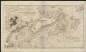
A new chart of the coast of New England, Nova Scotia, and the islands of St. Iohn, Cape Breton, Sable, the banks of St. Peters, Mizen, Banquereau, Porpoise, Middle, Sable Island, Browns, Cape Sable, Iefferys, and with part of St. Georges Bank
1 : 1200000 Keulen, Gerard Hulst van Keulen, Gerard Hulst van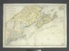
Carte réduite des côtes orientales de l'Amérique septentrionale: contenant celles des provinces de New-York et de la Nouvelle Angleterre, celles de l'Acadie ou Nouvelle Ecosse, de l'Île Royale de l'Île St. Jean, avec l'intérieur du pays dressée au Dépôt général des cartes, plans et journaux de la marine, pour le service des vaisseaux du roi, par ordre de M. de Sartine, conseiller d'Etat, ministre et secretaire d'Etat ayant le département de la marine / Petit, sculp.
from John H. Levine Collection M. de Sartine,
Quebec, New Brunswick, Nova Scotia, Prince Edward Id., Newfoundland.
1 : 2217600 Stanford, Edward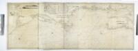
A new chart of the coast of America from Philadelphia to Halifax Harbor / by Wm. Heather, 1809; Stephenson, engraver.
from Whole William Heather,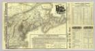
Map Boston & Maine Railroad.
1 : 2192000 Boston and Maine Railroad
Map Boston & Maine Railroad.
1 : 2471040 Boston and Maine Railroad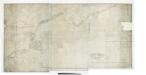
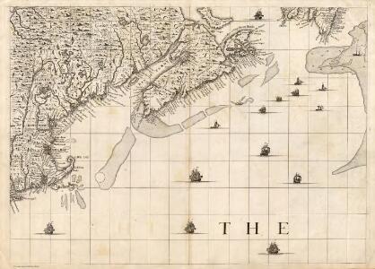
The north eastern coast of North America: from New York to Cape Canso, including Sable Island / by Edmunt Blunt, hydrographer; drawn & engraved by Charles Copley, N.Y.
from Parts Edmund Blunt; Charles Copley,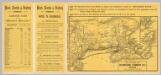
Intl. Steamship Co.'s routes.
1 : 3244000 International Steamship Company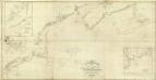
Composite: NE coast North America, N.Y. to Cape Canso.
1 : 910000 Wadsworth, A. S. (Alex. S.)
Carte réduite des côtes orientales de l'Amérique septentrionale: contenant celles des provinces de New-York et de la Nouvelle Angleterre, celles de l'Acadie ou Nouvelle Ecosse de l'Île Royale de l'Île St. Jean avec l'intérieur du pays / dressée au Dépôt général des cartes, plans et journaux de la marine, pour le service des vaisseaux du roi, par ordre de M. de Sartine, conseiller d'état, ministre et secrétaire d'état ayant le département de la marine; Petit, sculp.
from Parts M. de Sartine,
Lower Canada.
1 : 2200000 Arrowsmith, John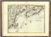
L'Acadia, le Provincie di Sagadahook e Main, la Nuova Hampshire.
1 : 2100000 Zatta, Antonio
Map, showing the commercial position of Portland
Map, showing the commercial position of Portland ... and its connection by lines of steamboat and railway with Europe, the British Provinces and the United States. Drawn and engraved for the State of Maine Newspaper. A.C. Morton, Engineer. (Map, showing the Plan for shortening the Transit between New York and London.) J.B. Cummings.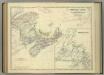
Eastern Canada.
1 : 2065500 Johnston, Alexander Keith
Maine Central Railroad.
1 : 4200000 New England Railway Publishing Co.
County map of Nova Scotia, New Brunswick, Cape Breton, and Prince Edward's Islands; City and harbor of Halifax [inset].
from Mitchell's new general atlas, containing maps of the various countries of the world, plans of cities, etc., embraced in fifty-three quarto maps., forming a series of eighty four maps and plans, together with valuable statistical tables.
Lower Canada ... and a large portion of the United States.
1 : 2154240 Arrowsmith, John
Carte réduite du Nord des Etat-Unis avec l'intérieur du pays, pour servirà l'intelligence de cette histoire.
from Histoire de la derniere guerre, entre la Grande-Bretagne, et les États-Unis de l'Amérique, la France, l'Espagne et la Hollande, depuis son commencement en 1775, jusqu'a sa fin en 1783 ...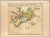
Nlle. Ecosse et Nouv. Brunswick. Amer. Sep. 44.
1 : 1641836 Vandermaelen, Philippe, 1795-1869
Canada, New Brunswick, Nova Scotia, &c., East Sheet.
1 : 2370000 Black, Adam & Charles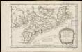
Carte de l'Acadie, Isle Royale, et Païs Voisins
1 : 2250000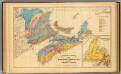
Geological map, Maritime Provinces.
1 : 1584000 Roe Brothers (Firm)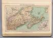
129. Maine, Nova Scotia, New Brunswick, Quebec.
1 : 3000000 Touring club italiano
Map of railways in the New England states : engraved expressly for Snow's pathfinder railway guide
Geo. K. Snow & Hapgood (Firm) Geo. K. Snow & Hapgood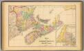
Maritime Provinces.
1 : 1584000 Roe Brothers (Firm)
Tierra nveva.
from Charts and maps
Map showing the Portland & Rochester railroad and its connections
1 : 900000 G.W. & C.B. Colton & Co G.W. & C.B. Colton & Co.