Maps of United States

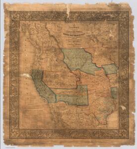
A New Map of The States Of Texas & California
1 : 6652800 Mitchell, Samuel Augustus
A New Map of Texas Oregon and California With The Regions Adjoining.
1 : 6652800 Mitchell, Samuel Augustus
A New Map of Texas Oregon and California With The Regions Adjoining.
1 : 6652800 Mitchell, Samuel Augustus
Louisiana.
1 : 23500000 Carey, Mathew
North America, 1782.
1 : 28000000 Jefferys, Thomas
United States.
1 : 21000000 Grigg, John
Facsimile: Walch's North America (portion).
1 : 13000000 Walch, Joh.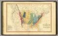
Geol. map US.
1 : 15000000 Simpkin & Marshall
A New Map of Texas Oregon and California With The Regions Adjoining.
1 : 6652800 Mitchell, Samuel Augustus
North America, 1710.
1 : 13500000 Senex, John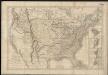
Carte générale des États-Unis de l'Amérique avec les plans des principales villes
1 : 7500000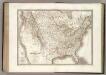
Etats-Unis d'Amerique.
1 : 9300000 Lapie, M. (Pierre), 1779-1850
Carte De La Cote De L'Amerique.
1 : 5555555 Duflot de Mofras, Eugene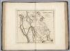
Missouri Territory formerly Louisiana.
1 : 9900000 Carey, Mathew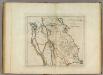
Missouri Territory formerly Louisiana.
1 : 10000000 Carey, Mathew
Die Atlantischen Staaten zwischen Washington & Boston, Blatt 1]
Adolf Stieler's Handatlas über alle Theile der Erde und über das Weltgebäude Stieler, Adolf Justus Perthes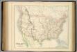
United States.
1 : 9504000 Fullarton, A. & Co.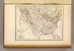
Etats-Unis d'Amerique, 1835.
1 : 16200000 Malte-Brun, Conrad, 1775-1826
[Neuer Atlas der ganzen Erde nach den neuesten Bestimmungen ... : XXIV.] Charte von dem Nordamericanischen Staatenbunde
Entworfen und gezeichnet von F.W. Streit H. Leutemann sc. Leipzig : J.C. Hinrichs'sche Buchhandlung
Hammond's comprehensive map of the United States with portions of Canada and Mexico
1 : 5000000 C.S. Hammond & Company C.S. Hammond & Company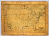
United States.
1 : 7700000 Symonds, Maria
Vereinigte Staaten von Nord-America
1 : 13000000
Composite: U.S. West of Mississippi R.
1 : 2000000 Freyhold, Edward; Warren, Gouverneur Kemble, 1830-1882; United States. Army. Corps of Engineers
Map Of The United States.
1 : 6000000 Emory, William H.
U.S. Western.
1 : 8870400 Letts, Son & Co.
Composite: Map of Louisiana and Mexico.
1 : 4300000 Tardieu, P.F.
West-Indien, Central-Amerika bis zum südlichen Canada in 4 Blättern
1 : 7500000 Nordwest-Blatt Petermann, August Heinrich ; Habenicht, H. Justus Perthes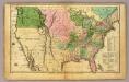
United States.
1 : 11300000 Huntington, Hezekiah, 1795-1865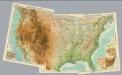
Composite: United States.
1 : 5000000 John Bartholomew & Co.