Maps of Appalachian Mountains
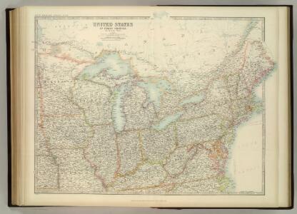
United States of North America (North East Sheet).
1 : 3984000 Johnston, W. & A.K.
Copy of a map attached to Govr. Colden's History of the Five Indian Natio[ns] : printed in London, A.D. MDCCXLVII.
from Parts
Distribution of the iron ores mined in the Lake Superior Region in year 1902
1 : 2500000 Birkinbine, John Geological Survey (U.S.)
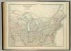
Etats Unis Flle. N.E.
1 : 5000000 Vivien St Martin, L.
British American, English, Welsh, Swedish, Norwegian population 1870.
1 : 14300000 United States. Census Office; Walker, Francis Amasa, 1840-1897
New Map of Upper & Lower Canada.
1 : 130000000 Morse, Jedidiah
Lake Shore and Michigan So. Railway.
1 : 3431200 Lake Shore & Michigan Southern Railway
A map of the United States of America, as settled by the peace of 1783.
from Whole Publish[e]d by I. Fielding, Pater-noster Row: [London],
A map of the United States of America, as settled by the peace of 1783.
from Whole Publish[e]d ... by I. Fielding, Pater-noster Row: [London]; Andrews, John,
United States.
1 : 11200000 Worcester, Joseph E.
CHARTE von den VEREINIGTEN STAATEN von NORD-AMERICA mit LUISIANA
Spojené státy americké-oblast východní
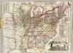
Map of the Northern and Middle States.
1 : 6950000 Morse, Jedidiah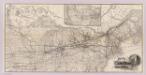
Grand Trunk Ry. of Canada.
1 : 3362700 Grand Trunk Railway Company of Canada
A New Map of the United States.
1 : 1520640 Carleton, Osgood
A new map of the United States including part of Louisiana

United States Of North America.
1 : 1550000 Arrowsmith, Aaron
An accurate map of the United States of America, with part of the surrounding provinces agreeable to the Treaty of Peace of 1783
1 : 1
Composite: United States of Nth. America.
1 : 1584000 Tardieu, P.F.
United States.
1 : 11800000 Bowen, Frances
States of America, drawn from the best authorities
Watson's new rail-road and distance map of the United States and Canada.
1 : 2344320 Watson, Gaylord
Population - United States census, 1870. Density, Foreign, Colored, British American, Swedish and Norwegian.
1 : 15000000 Baskin, Forster and Company
Population - United States census, 1870. Density, Foreign, Colored, British American, Swedish and Norwegian.
1 : 14000000 Andreas, A. T. (Alfred Theodore), 1839-1900
Population, United States Census, 1870: Density, foreign, colored, British American, Swedish and Norwegian.
Andreas, A. T. (Alfred Theodore), 1839-1900
United States of Nth. America.
1 : 1584000 Tardieu, P.F.
United States.
1 : 6200000 Hughes, William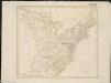
United States of America

United States
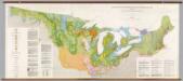
United States: East of the Rocky Mountains -- Glacial Deposits
1 : 1750000 The Geological Society of America