Maps of Central Lowland

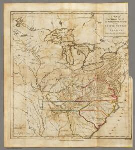
Western Part of the Territories.
1 : 6652800 Imlay, Gilbert
N.Y., Penn. and Ohio R.R.
1 : 6820000 New York, Pennsylvania and Ohio Railroad Company
A map of the United States of America, as settled by the peace of 1783.
from Whole Publish[e]d by I. Fielding, Pater-noster Row: [London],
A map of the United States of America, as settled by the peace of 1783.
from Whole Publish[e]d ... by I. Fielding, Pater-noster Row: [London]; Andrews, John,
United States of America.
1 : 1960000 Tanner, Henry S.
Lines And Metallic Circuit Connections.
1 : 2155000 American Telephone and Telegraph Company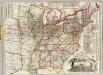
Watson's new rail-road and distance map of the United States and Canada.
1 : 2344320 Watson, Gaylord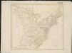
United States of America

An accurate map of the United States of America: according to the Treaty of Peace of 1783.
from Whole Published as the Act directs by H.D. (Henry Delahoy) Symonds: London; Russell, John,
G. Woolworth Colton's new guide map of the United States & Canada : with railroads, counties etc.
1 : 3168000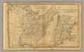
United States.
1 : 11700000 Adams, Daniel
Louisiana, Fla., Canada.
1 : 8000000 Bowen, Emanuel
A Connected View of The Whole Internal Navigation of the United States.
1 : 6082560 Tanner, Henry S.
Amplissimae regionis Mississipi seu provinciae Ludovicianae â R.P. Ludovico Hennepin Francisc. Miss. in America septentrionali anno 1687
1 : 6500000
3. Population 1800.
1 : 16500000 Gannett, Henry, 1846-1914; United States. Census Office
7. Population 1840.
1 : 16500000 Gannett, Henry, 1846-1914; United States. Census Office
4. Population 1810.
1 : 16500000 Gannett, Henry, 1846-1914; United States. Census Office
8. Population 1850.
1 : 16500000 Gannett, Henry, 1846-1914; United States. Census Office
9. Population 1860.
1 : 16500000 Gannett, Henry, 1846-1914; United States. Census Office
5. Population 1820.
1 : 16500000 Gannett, Henry, 1846-1914; United States. Census Office
6. Population 1830.
1 : 16500000 Gannett, Henry, 1846-1914; United States. Census Office
2. Population 1790.
1 : 16500000 Gannett, Henry, 1846-1914; United States. Census Office
United States.
1 : 8363520 Burr, David H., 1803-1875
United States / by David H. Burr, New-York.
from Whole David H. Burr,
Composite: United States of Nth. America.
1 : 1584000 Tardieu, P.F.
Etats Unis et Canada.
1 : 8400000 Montemont, A.
United States of America.
1 : 7603200 Melish, John
Amplissimae regionis Mississipi seu Provinciae Ludovicianae â R.P. Ludovico Hennepin Francisc Miss in America Septentrionali anno 1687
1 : 1
Map of the United States showing the land west of the Mississippi River still as Louisiana. Ohio is named as a state. Many Indian tribes and villages are named. A lead mine is located in today's northwestern Illinois. Florida is divided into the Spanish possessions of East and West Florida, Georgia extends to the Mississippi.