Maps of Balkan Pen.

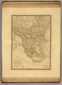
Turquie d'Europe.
1 : 3500000 Picquet, C.
Türkei und Griechenland
Neuer Handatlas über alle Theile der Erde Kiepert, Heinrich Verlag von Dietrich Reimer
Osman. Europa.
1 : 3000000 Weiland, C. F. (Carl Ferdinand), d. 1847
Turquie d'Europe, Grece.
1 : 3500000 Andriveau-Goujon, J.
Turquie d'Europe, Grece, Roumanie, Servie, Montenegro.
1 : 3600000 Levasseur, E.
Staaten der Balkan-Halbinsel
Volksschul-Atlas über alle Teile der Erde Lange, Henry Druck und Verlag von Georg Westermann
Balkanhalbinsel.
1 : 3000000 Andree, Richard
Turquie d'Europe, Grece &c.
1 : 3900000 Garnier, F. A., 1803-1863
Turchia Europea con i Principati di Servia, Valachia e Moldavia.
1 : 3540000 Picquet, C.
Turquie d'Europe, Grece.
1 : 3000000 Lapie, M. (Pierre), 1779-1850
Carte de la Turkie d'Europe
1 : 3600000 Evropa jihovýchodní Lapie, Pierre Arnoul Firmin Didot
Turkey in Europe.
1 : 6000000 Higgins, W.M.
Turkey in Europe.
1 : 3850000 Mitchell, Samuel Augustus
Karte des osmanischen Europa oder der europäischen Türkei
Originaltitel: Das osmanische Europa oder die europäische Türkei nebst dem Königreich Griechenland und den ionischen Inseln. Mit Erklärung der Zeichen, Legende der Farben sowie zwei Nebenkarten der Dardanellen und der Umgebung von Konstantinopel. Entwurf und Zeichnung: Weiland, C. F., in Weimar Verlag des geographischen Instituts
Libération et agrandissements successifs des états Balkaniques
1 : 14000000 Balkanhalbinsel Südosteuropa Unabhängigkeitsbewegung
75-76. Penisola balcanica.
1 : 3000000 Touring club italiano
La Turquie d'Europe, La Hongrie, La Transilvanie, La Croatie, La Morlaquie, La Sclavonie et La Dalmatie avec La Rép.que des Sept Iles
1 : 3700000 par J. B. Poirson gravé par Tardieu l'ainé [Paris] : [Mentelle etc.]
Türkisch-Griechische Halbinsel
Balkanhalbinsel
Türkei und Griechenland
1 : 6660000 Osmanisches Reich / Europäischer Teil, Griechenland
Die Europaeische Türkey und das Königreich Griechenland
Osmanisches Reich / Europäischer Teil, Griechenland
Karte von dem Türkischen Reiche in Europa
Neuester Schul-Atlas Walch, Johann im Verlag bei Joh. Walch
Die Staaten der Balkan-Halbinsel
1 : 3000000 Evropa jihovýchodní Kiepert, Heinrich Dietrich Reimer
Die europäische Türkey und Griechenland
1 : 4600000 Balkánský poloostrov geogr. lith. Anstalt von L. Holle
[Neuer Atlas der ganzen Erde nach den neuesten Bestimmungen ... : XXIII.] Griechenland, die Jonischen Inseln und das Osmanische Reich in Europa
Entworfen und gezeichnet von Dr. F.W. Streit H. Leutemann sc. Leipzig : J.C. Hinrichs'sche Buchhandlung
Die Balkan-Halbinsel
1 : 5500000 Balkanhalbinsel
Die Europäische Türkey, Griechenland, Dalmatien und die Republik Montenegro
Schul-Atlas in 36 Karten Völter, Daniel Verlag der J.M. Dannheimer'schen Buchhandlung
General-Karte der europäischen Türkey und des Königreichs Griechenland
1 : 1170000 Evropa jihovýchodní Schulz, R. A. Biller, Dominik Artaria
[Kaart], uit: Ethnographische Übersicht des Europäischen Orients / zsgest. von H. Kiepert
1 : 3000000 titelvariant: Ethnographische Übersichtskarte des Europäischen Orients; Annotatie: Omslagtitel: Ethnographische Übersichtskarte des Europäischen Orients : (untere Donauländer, Turkei und Griechenland); Met toelichting in de omslag (12 p.) Johann Samuel Heinrich Kiepert 1818-1899 Berlin : Reimer
Hungary, European Turkey.
1 : 3100000 Playfair, Principal