Maps of Carpathian Mountains
Empire d'Autriche.
1 : 2800000 Picquet, C.
Austria.
1 : 4700000 Tanner, Henry S.
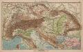
Alpen- und Karpatenländer
1 : 4000000 Alpenländer, Österreich-Ungarn
Austria.
1 : 5000000 Finley, Anthony
Rübenzucker-Fabriken der Österreichischen Monarchie
Rakousko (1804-1867)
Uibersichts-Karte der österreichischen Rübenzucker-Fabriken
1 : 206000 Rakousko-Uhersko Bělský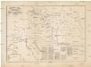
Uibersichts-Karte der österreichischen Rübenzucker-Fabriken
1 : 206000 Rakousko (1804-1867) Bělský Bělský
Uibersichts-Karte der oesterreichischen Rübenzucker-Fabriken
Rakousko (1804-1867)
Uibersichts-Karte der oesterreichischen Rübenzucker-Fabriken
Rakousko (1804-1867)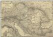
Oestreichs Laender unter den Roemern
1 : 2000000 Evropa jihovýchodní Renner, Emanuel von David, Johann J. G. Heubner
Oestreichs Laender unter den Roemern
1 : 2000000 Evropa jihovýchodní Renner, Emanuel von David, Johann J.G. Heubner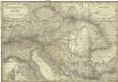
Oestreichs Laender unter den Roemern
1 : 2000000 Evropa jihovýchodní Renner, Emanuel von David, Johann J. G. Heubner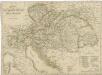
Charte der Oesterreichischen Monarchie

The European part of the Russian Empire, from the maps publishd by the Imperial Academy at St. Peter
1 : 8200000 1 Karte auf 2 Bl. : Kupferdruck ; 47 x 128 cm ; Einzelbl. 47 x 64 cm published 12th May 1794 by Lawrie & Whittle, No.53 Fleet Street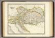
Austrian Empire.
1 : 2050000 Teesdale, Henry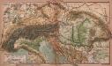
Alpen- und Karpatenländer
1 : 4000000 Alpenländer, Österreich-Ungarn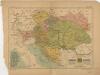
Mocnářství rakousko - uherské

Vývoj državy rakousko - uherské
Sibérie, avec L'Amérique russe / gravé par Chamouin ; ecrit par Giraldon
1 : 31000000 1 Karte : Kupferdruck ; 21 x 29 cm Chamouin, Jean Baptiste Marie [Verlag nicht ermittelbar]
Versuch einer Sprachenkarte der Österreichischen Monarchie
1 : 3000000 von J.V. Haeufler Pest : Emich
Kaiserthum Oesterreich...
Alpen- und Karpatenländer
1 : 4000000 Alpenländer, Österreich-Ungarn
Tabula Russiae / ex mandato Foedor Borissowits delineata, Magno studio plurimis in locis aucta, edit
1 : 7900000 1 Karte : Kupferdruck ; 41 x 52 cm Visscher, Claes Jansz. [Nicolas Visscher]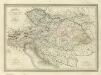
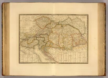
Composite: Carte Generale l'Empire d'Autriche.
1 : 2700000 Vivien de St Martin, L.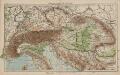
Österreich-Ungarn und Alpenländer
1 : 4000000 Österreich-Ungarn
Novissima Russiæ tabula / authore Isaaco Massa
1 : 840000 1 Karte : Kupferdruck ; 46 x 54 cm Massa, Isaac Abrahamsz Apud Janssonio-Waesbergios et Mosem Pitt
Austrian Dominions.
1 : 3750000 Hughes, William
Uhry
1 : 1850000 Uhersko Merklas, Václav W. Merklas
Rakauské mocnářstwí
1 : 4500000 Rakousko-Uhersko Merklas, Václav W. Merklas