Maps of Pontic Steppe
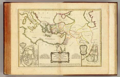
Nouveau Testament, regions, lieux.
1 : 10200000 Bonne, Rigobert, 1727-1794
Uebersichts-Karte des Russisch - Türkischen Kriegsschauplatzes

Osmanisches Reichs.
1 : 11800000 Radefeld, Carl Christian Franz, 1788-1874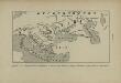
L’Europe Nord-Orientale au 5e siècle avant notre ère, d’après Hérodote
Europa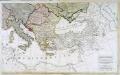
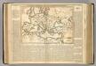
Carte generale de toute l'Europe, 3
2 Blätter : 56 x 90 cm J.M. Will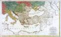
Carte générale de toute l'Europe, 2
2 Blätter : 57 x 93 cm T.C. Lotter
Carte de l’Empire des Goths, au 4e siècle de notre ère, à l’époque de l’arrivée des Huns et de leurs établissements entre l’Oural et le Don
Russland Ural Don Gotenreich Völkerwanderungszeit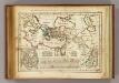
Regions, lieux dans le Nouveau Testament.
1 : 18000000 Delamarche, Charles Francois
Südeuropa
1 : 2500000 Blízký východ Gea Verlag
[Das Mittellaendische und Schwarze Meer. Auch als General Karte des Osmanischen Reichs]
Hand-Atlas über alle Theile der Erde nach dem neuesten Zustande und über das Weltgebäude Stieler, Adolf bei Justus Perthes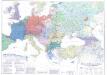
Länder- und Völkerkarte Europas
1 : 4000000 Europa Volk Staat Geschichte Schäfer, Dietrich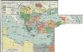
I. Osmanisches Reich bis 1683
1 : 28000000 Osmanisches Reich Expansion
Zuid-oostelijk oorlogsterrein
1 : 6000000 Annotatie geografische gegevens: Op de kaart zijn vestingen en forten aangegeven 's-Gravenhage : Smulders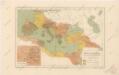
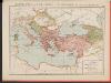
Říše římská ve své největší rozsáhlosti
Osmanisches Reich bis 1683
1 : 18000000 Osmanisches Reich Expansion
A map of the eastern part of the Roman empire
1 Karte : Kupferdruck ; 39 x 42 cm s.n.
Übersichts - Karte des Türkischen Reichs in Europa und Asien


Turkey, in Europe and Hungary, from the best authorities.
from Carey's general atlas, improved and enlarged : being a collection of maps of the world and quarters, their principal empires, kingdoms, &c.
Skandinavien und Rußland
1 : 18000000 Skandinavien, Osteuropa
Balkánské státy a Turecko
1 : 3000000 Bospor (Turecko : průliv) Paulík, Ant. Klus, František Ústřední učitelské nakladatelství a knihkupectví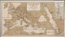
[Europa], uit: Routekaart van Nederland naar Ned. Indië en terug
1 : 8000000 Annotatie: Samengest. op uitnoodiging der Stoomvaart Maatschappij Nederland Groustra, J. Amsterdam : Seyffardt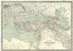
Carte générale de l'Empire Ottoman en Europe et en Asie
1 : 3000000 osmanská říše Kiepert, Heinrich D. Reimer
Střední Evropa a Přední Asie za časů III. války křížové
Map of the Incursions of the Barbarians.
1 : 13300000 Lavoisne, M.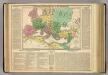
Roman Empire.
1 : 13400000 Lavoisne, M.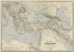
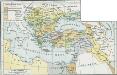
General-Karte des Türkischen Reiches in Europa und Asien nebst Ungarn, Südrussland, den kaukasischen Ländern und West-Persien
1 : 3000000 entworfen und bearb. von Heinrich Kiepert Stich und Druck der lithographischen Anstalt von L. Kraatz Berlin : Reimer
Europa befolkningskarta

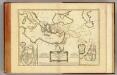
Gemaelde des Roemischen Reichs in seiner grösten Ausdehnung
Historisch-genealogisch-geographischer Atlas von Le Sage Las Cases, Emmanuel Auguste Dieudonné Marius Joseph de Johann Velten, Kunsthändler