Maps of New York
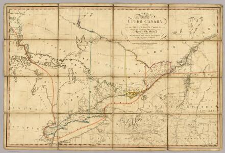
A Map of the Province of Upper Canada.
1 : 1420000 Smyth, David William
A Map of the Province of Upper Canada.
1 : 1420000 Smyth, David William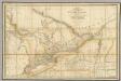
A Map of the Province of Upper Canada.
1 : 1420000 Wyld, James, 1812-1887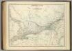
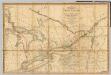
Central Canada.
1 : 2065500 Johnston, Alexander Keith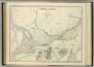
Central Canada.
1 : 2065500 Johnston, W. & A.K.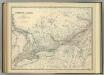
Central Canada.
1 : 2065500 Johnston, Alexander Keith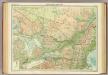
Ontario & Quebec.
1 : 2500000 John Bartholomew and Son
Carte pour servir à l'itinéraire pittoresque du fleuve Hudson et des parties latérales de l'Amerique du Nord
1 : 4200000 Milbert, Jacques Gérard Gaugain, Henri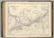
Canada W.
1 : 2065500 Johnston, Alexander Keith, 1804-1871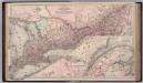
Canada. Provinces of Ontario and Quebec.
1 : 1550000 Colton, G.W.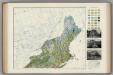
Soil Map of the United States, Section 1. Atlas of American Agriculture.
1 : 2500000 Marbut, Curtis F.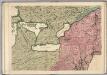
A Map of the British Empire in America. (Sheet 6).
1 : 2000000 Popple, Henry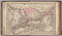
Canada West or Upper Canada.
1 : 1500000 Colton, G.W.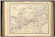
British North America. Sheet II, West.
1 : 2407680 Fullarton, A. & Co.
Upper Canada.
1 : 2200000 Arrowsmith, John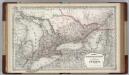
Canada. Ontario.
1 : 1500000 Colton, G.W.
Map of the Provinces of Lower & Upper Canada.
1 : 887040 Wyld, James, 1812-1887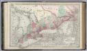
Canada West or Upper Canada.
1 : 1500000 Colton, G.W.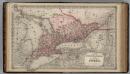
Dominion of Canada. Province of Ontario.
1 : 1550000 Colton, G.W.
Upper Canada &c.
1 : 2154240 Arrowsmith, John
Ontario, Quebec.
1 : 2217600 Stanford, Edward
Sheet 2: United States of Nth. America.
1 : 1584000 Tardieu, P.F.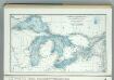
Great Lakes including Canals and Tributary Navigable Streams.
1 : 3353000 Hammond, C.S.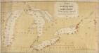
A Chart exhibiting the Light Houses, on the Lake Coasts of the United States of America
A Chart exhibiting the Light Houses, on the Lake Coasts of the United States of America.
Canada, West Sheet.
1 : 2370000 Black, Adam & Charles
Ontario.
1 : 1290000 Asher & Adams
Brooklyn V. 2, Double Page Plate No. 54 [Map bounded by Ryerson St., Myrtle Ave., Vanderbilt Ave., Flushing Ave.]
From Atlas 66. Vol. 2, 1887.
Ontario.
1 : 1350000 Johnson, A.J.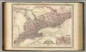
Ontario.
1 : 1350000 Johnson, A.J.