Maps of Africa

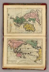
Pacific Ocean, British Islands.
Goodrich, S.G.
A generall chart from ENGLAND to cape Bona Espranca with the coast of BRASILE
from The sea-atlas : containing an hydrographical description of most of the sea-coasts of the known parts of the world.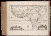
Nigritarvm regio
1 : 10000000 Annotatie: Origineel is Blad 207 in atlas factice; Annotatie geografische gegevens: Met schaalstok: 10 Milliaria Germanica Communia (=9,2 cm) Amstelaedami : Ioannes Blaeu excud
Carte de l'Afrique
1 : 50000000
A draught of the coast of AFRICA from the streights mouth to cape bona Esprance
from The sea-atlas : containing an hydrographical description of most of the sea-coasts of the known parts of the world.
Africa ; Delta of The Nile; Island of St.Helena
from New illustrated atlas of Dutchess County, New York. / Compiled & drawn from personal examinations, surveys etc. under the personal supervision of O.W. Gray & Son and F.A. Davis, and published under the superintendence of H. L. Kochersperger.
157. Africa, Communications. The World Atlas.
1 : 30000000 USSR (Union of Soviet Socialist Republics).
158-159. Africa, Political. The World Atlas.
1 : 20000000 USSR (Union of Soviet Socialist Republics).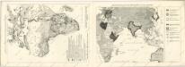
Meyers neuer Volksatlas

155-156. Africa, Physical. The World Atlas.
1 : 20000000 USSR (Union of Soviet Socialist Republics).
Africa - Physical. Pergamon World Atlas.
1 : 30000000 Polish Army Topography Service
Africa (political).
1 : 28990200 Fisher, Richard Swainson
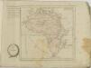
Africa.
1 : 22176000 Johnson, A.J.
Afrika
1 : 30000000 Kiepert, Richard Dietrich Reimer
Africa XXV. Nova Tabula. [Karte], in: Claud. Ptolemaeus. Geographia lat. cum mappis [...], S. 437.
1 Karte aus Atlas Münster, Sebastian [und Ptolemaeus, Claudius]
Ethnographische Karte von Afrika.
1 : 38000000 Berghaus, Heinrich
Africa - Political. Pergamon World Atlas.
1 : 30000000 Polish Army Topography Service
Afrika
1 : 40000000 Afrika Škorpil, František Bohumil Állami kiadóhivatal
107-08. Africa politica.
1 : 20000000 Touring club italiano
105-06. Africa fisica.
1 : 20000000 Touring club italiano
Africa.
1 : 44352000 Melish, John
Africa XVIII. Nova Tabula [Karte], in: Geographia universalis vetus et nova complectens Claudii Ptolemaei Alexandrini enarrationis libros VIII, S. 350.
1 Karte aus Atlas Münster, Sebastian [und Ptolemaeus, Claudius]
Afrika.
1 : 30000000 Berghaus, Hermann
Afrika
Atlas der Geologie Zittel, K.v. ; Berghaus, Hermann Justus Perthes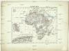
Afrika
1 : 30000000 Afrika Merklas, Václav W. Merklas
Afrika
1 : 30000000 Afrika Merklas, Václav W. Merklas
Africae Accurata Tabula [Karte], in: Novus atlas absolutissimus, Bd. 6, S. 159.
1 Karte aus Atlas Janssonius Offizin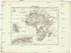
Afrika
1 : 30000000 Afrika Merklas, Václav W. Merklas